Dedham Village Historic District

Log in to your account

AroundUs is a community-driven map of interesting places, built by curious explorers like you. It grows with every review, story, and photo you share.
Connect to save your favorite spots, contribute locations, and create personalized routes.
Continue with Google
Continue with Apple
Continue with X
Continue with Facebook
Continue with email
By continuing, you accept our Terms and Conditions and our Privacy Policy
Create an account
Add to collection
Map
Suggest a change
Share

Dedham Village Historic District, Historic district in Dedham, Massachusetts, United States.

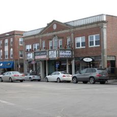
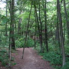
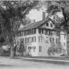
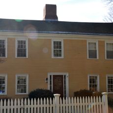
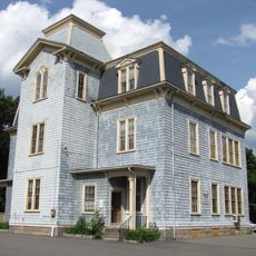
The Dedham Village Historic District is a 55-acre area along High Street containing buildings in Federal and Italianate styles built across different time periods. The district stretches across multiple streets, connecting the historic courthouse, residences, and other structures within its defined boundaries.

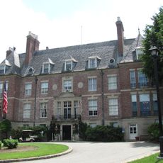
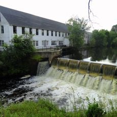
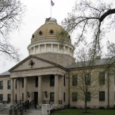
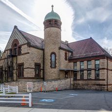
The district originated in 1636 as an agricultural community and gradually transformed into a regional administrative center over the following centuries. The courthouse and surrounding buildings were constructed starting in the late 1700s to meet the growing needs of local government.

The courthouse building stands at the center of community life and reflects how local government shaped the town's development. Walking through the district, you see where merchants, officials, and residents once gathered around this civic hub.

The district is walkable, with main buildings concentrated along High Street, making it simple to explore the historic structures on foot. There are sidewalks throughout the area, and the courthouse serves as a clear landmark to orient yourself as you move through the streets.

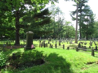
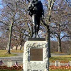
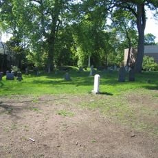
The Old Village Cemetery within the district holds graves and monuments belonging to Dedham's original settlers and offers a quiet glimpse into the region's early past. Walking among the stones, you encounter inscriptions and details that document the lives of those who founded this place.

Location: Dedham

GPS coordinates: 42.24833,-71.18028

Latest update: December 14, 2025 18:02

Photos
Around this place
Museum of Bad Art
United States of America

Museum of Bad Art

12.7 km
Fairbanks House
United States of America

Fairbanks House

1.2 km
West Roxbury
United States of America

West Roxbury

4.3 km
Endicott Estate
United States of America

Endicott Estate

1.6 km
United States of America

Camp Meigs

4.3 km
George Wright Golf Course
United States of America

George Wright Golf Course

4.5 km
Cutler Park
United States of America

Cutler Park

4.1 km
Stony Brook Reservation
United States of America

Stony Brook Reservation

3.9 km
Endicott House
United States of America

Endicott House

1.1 km
Wilson Mountain Reservation
United States of America

Wilson Mountain Reservation

1.9 km
United States of America

Millennium Park

3.7 km
Upper Charles River Reservation
United States of America

Upper Charles River Reservation

2.7 km
Bellevue Standpipe
United States of America

Bellevue Standpipe

4.2 km
Fairview Cemetery
United States of America

Fairview Cemetery

3.3 km
Norfolk County Courthouse
United States of America

Norfolk County Courthouse

299 m
Stony Brook Reservation Parkways
United States of America

Stony Brook Reservation Parkways

3.6 km
Westerly Burial Ground
United States of America

Westerly Burial Ground

4.1 km
United States of America

Dedham Public Library

340 m
Ames Schoolhouse
United States of America

Ames Schoolhouse

570 m
United States of America

Norfolk House

254 m
Brandeis University President's House
United States of America

Brandeis University President's House

1.9 km
First Church of Christ, Scientist
United States of America

First Church of Christ, Scientist

458 m
St. Mary's School and Asylum
United States of America

St. Mary's School and Asylum

254 m
City of Boston Archives
United States of America

City of Boston Archives

3.4 km
19 Court Street
United States of America

19 Court Street

254 m
Joshua Lewis House
United States of America

Joshua Lewis House

3 km
Colburn School-High Street Historic District
United States of America

Colburn School-High Street Historic District

3.5 km
Dedham Public Library
United States of America

Dedham Public Library

368 m
Show the full map
Reviews

Visited this place? Tap the stars to rate it and share your experience / photos with the community! Try now! You can cancel it anytime.

« Dedham Village Historic District - Historic district in Dedham, Massachusetts, United States » is provided by Around Us (aroundus.com). Images and texts are derived from Wikimedia project under a Creative Commons license. You are allowed to copy, distribute, and modify copies of this page, under the conditions set by the license, as long as this note is clearly visible.

Discover hidden gems everywhere you go!

From secret cafés to breathtaking viewpoints, skip the crowded tourist spots and find places that match your style. Our app makes it easy with voice search, smart filtering, route optimization, and insider tips from travelers worldwide. Download now for the complete mobile experience.

Around Us App Screenshot

A unique approach to discovering new places

Le Figaro

All the places worth exploring

France Info

A tailor-made excursion in just a few clicks

20 Minutes