Enable Location

We need your location to show you interesting places around you

Discover nearby places

Find interesting locations and hidden gems around you

Precise directions

Get accurate directions and distances to places

Your location is never shared with other users. It's only used when you tap the location button.

Upper Charles River Reservation

Log in to your account

Start exploring — it's free

Trusted by 62,937 travelers worldwide

Continue with Google
Continue with Apple
or

We will send you a code to connect

By continuing, you accept our Terms and Conditions and our Privacy Policy

Check your inbox

We've sent a pincode in your inbox. Please enter the code below.

Upper Charles River Reservation
Discussion Reviews 1 Photos
2.7k Popularity

Upper Charles River Reservation, Protected riverside area in Watertown, United States.

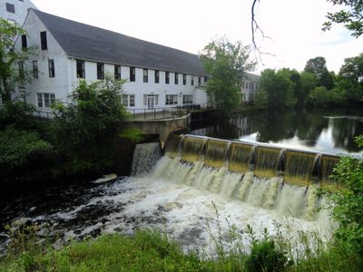
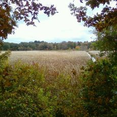
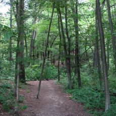
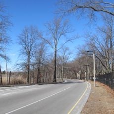
Upper Charles River Reservation stretches about 20 miles along the Charles River and connects multiple communities from Watertown Dam to Riverdale Park. The protected area consists of riverside parkland with parking areas, boat launches, playgrounds, and sports fields interspersed with natural sections of woods and open space.

The protection area was established in the 1890s by the Massachusetts Department of Conservation and Recreation to preserve natural spaces along the Charles River. Its creation came during a period when many river corridors in New England faced pressure from industrial use and rapid urban growth.

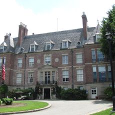
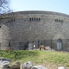
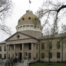
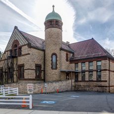
The Charles River Museum of Industry and Innovation within the reservation displays exhibits about the region's industrial past and technological developments. Visitors discover how local manufacturing shaped the communities along the river through artifacts and historical documentation.

The reservation is accessible from sunrise to sunset with parking areas available at multiple locations along the corridor. When planning a visit, keep in mind that accessibility varies by season and different sections are best reached by car, on foot, or by bicycle depending on your starting point.

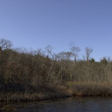
Native plant restoration projects along the riverbanks have created habitats for black-crowned night herons, muskrats, and snapping turtles. This restoration work demonstrates how river corridors can regain ecological productivity even in areas close to urban centers.

The community of curious travelers

AroundUs brings together thousands of curated places, local tips, and hidden gems, enriched daily by 60,000 contributors worldwide.

Start exploring
GPS coordinates
42.27220,-71.17440
Latest update
December 12, 2025 16:42
Around this place
Museum of Bad Art
United States of America

Museum of Bad Art

10.8 km
Brook Farm
United States of America

Brook Farm

2.1 km
Fairbanks House
United States of America

Fairbanks House

3.3 km
West Roxbury
United States of America

West Roxbury

2.2 km
Cutler Park
United States of America

Cutler Park

2.3 km
Endicott House
United States of America

Endicott House

2.5 km
Wilson Mountain Reservation
United States of America

Wilson Mountain Reservation

2.4 km
United States of America

Millennium Park

1.2 km
Holy Name Church
United States of America

Holy Name Church

2.9 km
Bellevue Standpipe
United States of America

Bellevue Standpipe

2.5 km
Veterans of Foreign Wars Parkway
United States of America

Veterans of Foreign Wars Parkway

2 km
Norfolk County Courthouse
United States of America

Norfolk County Courthouse

2.6 km
Stony Brook Reservation Parkways
United States of America

Stony Brook Reservation Parkways

2.6 km
Westerly Burial Ground
United States of America

Westerly Burial Ground

1.7 km
United States of America

Dedham Public Library

2.7 km
Ames Schoolhouse
United States of America

Ames Schoolhouse

3 km
United States of America

Norfolk House

2.6 km
Brandeis University President's House
United States of America

Brandeis University President's House

2.2 km
Dedham Village Historic District
United States of America

Dedham Village Historic District

2.7 km
Theodore Parker Unitarian Universalist Church
United States of America

Theodore Parker Unitarian Universalist Church

2.2 km
St. Mary's School and Asylum
United States of America

St. Mary's School and Asylum

2.6 km
First Church of Christ, Scientist
United States of America

First Church of Christ, Scientist

2.6 km
City of Boston Archives
United States of America

City of Boston Archives

890 m
19 Court Street
United States of America

19 Court Street

2.6 km
King House
United States of America

King House

3.2 km
Joshua Lewis House
United States of America

Joshua Lewis House

3 km
Dedham Public Library
United States of America

Dedham Public Library

2.7 km
West Roxbury Branch Library
United States of America

West Roxbury Branch Library

1.9 km
Show the full map
Reviews
Share your experience

No review yet

Discussions
Start a discussion...

No discussion yet

« Upper Charles River Reservation - Protected riverside area in Watertown, United States » is provided by Around Us (aroundus.com). Images and texts are derived from Wikimedia project under a Creative Commons license. You are allowed to copy, distribute, and modify copies of this page, under the conditions set by the license, as long as this note is clearly visible.

Discover hidden gems everywhere you go!

From secret cafés to breathtaking viewpoints, skip the crowded tourist spots and find places that match your style. Our app makes it easy with voice search, smart filtering, route optimization, and insider tips from travelers worldwide. Download now for the complete mobile experience.

Around Us App Screenshot

A unique approach to discovering new places

Le Figaro

All the places worth exploring

France Info

A tailor-made excursion in just a few clicks

20 Minutes

Around Us
Travel Guide & Maps
Download

Send to your phone

QR Code
1

Open the camera app on your mobile.

2

Point at the QR code with your camera. A notification will appear.

3

Tap the notification to open the link.