Enable Location

We need your location to show you interesting places around you

Discover nearby places

Find interesting locations and hidden gems around you

Precise directions

Get accurate directions and distances to places

Your location is never shared with other users. It's only used when you tap the location button.

Rutherfordton

Log in to your account

Start exploring — it's free

Trusted by 63,951 travelers worldwide

Continue with Google
Continue with Apple
or

We will send you a code to connect

By continuing, you accept our Terms and Conditions and our Privacy Policy

Check your inbox

We've sent a pincode in your inbox. Please enter the code below.

Discussion Reviews 1 Photos
18.4k Popularity

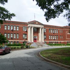
Rutherfordton, town in Rutherford County, North Carolina, United States

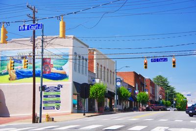
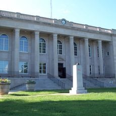
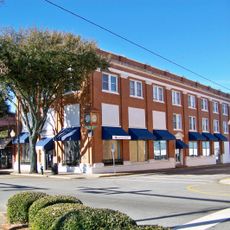
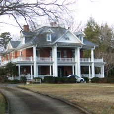
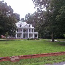
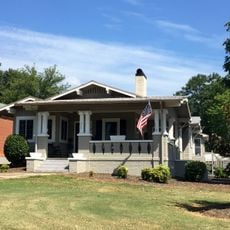
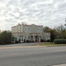
Rutherfordton is a small town in western North Carolina, established in 1787 in Rutherford County. Downtown features brick buildings, shops, and restaurants, with most historic structures clustered along Main Street where visitors can walk from one end to the other in a short time.

The town was founded in 1787 and grew during the early 1800s gold rush that brought miners and settlers to the region. Prosperity from gold extraction led to the construction of brick buildings that still line the streets today, shaping the character of downtown.

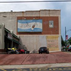
Rutherfordton's name honors Griffith Rutherford, an early settler and militia leader in the area. The community gathers regularly in shops, cafes, and at seasonal festivals, creating a tight-knit social fabric that visitors can observe while walking the streets.

The town is small enough to explore on foot, with flat, clean streets and clear signage throughout. Visitors find parking easily near downtown and can move between shops, restaurants, and historic sites without spending time navigating complicated routes.

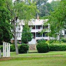
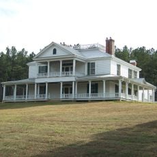
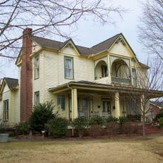
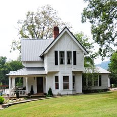
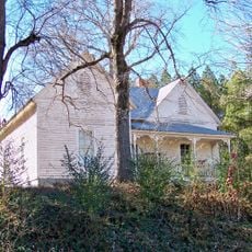
Christopher Bechtler created the first American one-dollar gold coin value here in the early 1800s in a private mint, decades before the federal government produced this denomination. The Bechtler House tells the story of how a local family inadvertently shaped early American coin history.

The community of curious travelers

AroundUs brings together thousands of curated places, local tips, and hidden gems, enriched daily by 60,000 contributors worldwide.

Start exploring
Inception
1787
Elevation above the sea
294 m
GPS coordinates
35.36639,-81.95889
Latest update
February 16, 2026 23:40
Around this place
Green River Plantation
United States of America

Green River Plantation

10.4 km
Gilbert Town Historic District
United States of America

Gilbert Town Historic District

4.7 km
Fox Haven Plantation
United States of America

Fox Haven Plantation

8.8 km
Rutherford County Courthouse
United States of America

Rutherford County Courthouse

160 m
Carson-Andrews Mill and Ben F.W. Andrews House
United States of America

Carson-Andrews Mill and Ben F.W. Andrews House

12.1 km
Forest City Baptist Church
United States of America

Forest City Baptist Church

8.9 km
Zeno Hicks House
United States of America

Zeno Hicks House

25.7 km
Main Street Historic District
United States of America

Main Street Historic District

9.3 km
Main Street Historic District
United States of America

Main Street Historic District

201 m
Cool Springs High School
United States of America

Cool Springs High School

9 km
Carrier Houses
United States of America

Carrier Houses

410 m
Washburn Historic District
United States of America

Washburn Historic District

13.3 km
Cliffside Public School
United States of America

Cliffside Public School

9 km
Trinity Lutheran Church
United States of America

Trinity Lutheran Church

755 m
James Dexter Ledbetter House
United States of America

James Dexter Ledbetter House

5.4 km
St. Luke's Chapel
United States of America

St. Luke's Chapel

822 m
Alexander Manufacturing Company Mill Village Historic District
United States of America

Alexander Manufacturing Company Mill Village Historic District

11.2 km
Polk County Courthouse
United States of America

Polk County Courthouse

25.2 km
George W. Logan House
United States of America

George W. Logan House

7.9 km
East Main Street Historic District
United States of America

East Main Street Historic District

10.2 km
T. Max Watson House
United States of America

T. Max Watson House

9.8 km
J. G. Hughes House
United States of America

J. G. Hughes House

25.2 km
Rev. Joshua D. Jones House
United States of America

Rev. Joshua D. Jones House

20.5 km
West Main Street Historic District
United States of America

West Main Street Historic District

8.5 km
Bostic Charge Parsonage
United States of America

Bostic Charge Parsonage

11.3 km
Albertus Ledbetter House
United States of America

Albertus Ledbetter House

23 km
Melton-Davis House
United States of America

Melton-Davis House

15 km
Carolina Arcade Museum
United States of America

Carolina Arcade Museum

9.4 km
Show the full map
Reviews
Share your experience

No review yet

Discussions
Start a discussion...

No discussion yet

« Rutherfordton - town in Rutherford County, North Carolina, United States » is provided by Around Us (aroundus.com). Images and texts are derived from Wikimedia project under a Creative Commons license. You are allowed to copy, distribute, and modify copies of this page, under the conditions set by the license, as long as this note is clearly visible.

Discover hidden gems everywhere you go!

From secret cafés to breathtaking viewpoints, skip the crowded tourist spots and find places that match your style. Our app makes it easy with voice search, smart filtering, route optimization, and insider tips from travelers worldwide. Download now for the complete mobile experience.

Around Us App Screenshot

A unique approach to discovering new places

Le Figaro

All the places worth exploring

France Info

A tailor-made excursion in just a few clicks

20 Minutes

Around Us
Travel Guide & Maps
Download

Send to your phone

QR Code
1

Open the camera app on your mobile.

2

Point at the QR code with your camera. A notification will appear.

3

Tap the notification to open the link.