Rutherford County

Log in to your account

AroundUs is a community-driven map of interesting places, built by curious explorers like you. It grows with every review, story, and photo you share.
Connect to save your favorite spots, contribute locations, and create personalized routes.
Continue with Google
Continue with Apple
Continue with X
Continue with Facebook
Continue with email
By continuing, you accept our Terms and Conditions and our Privacy Policy
Create an account
Add to collection
Map
Suggest a change
Share

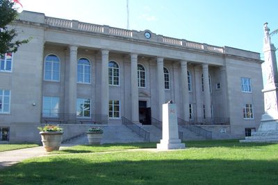
Rutherford County, County in southwestern North Carolina, United States.

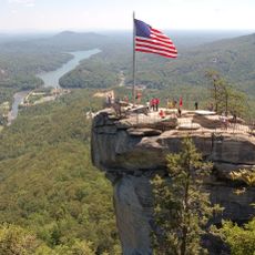
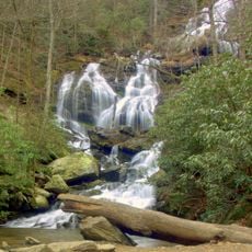
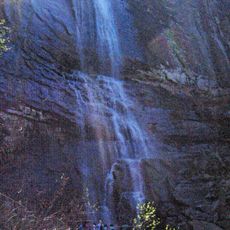
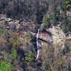
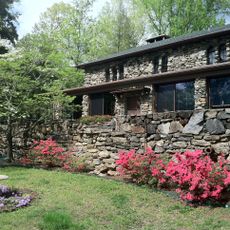
Rutherford County spans varied landscapes in southwestern North Carolina, featuring natural landmarks like Lake Lure and the distinctive Chimney Rock formations. The area combines rolling hills, river valleys, and rocky outcrops that define its terrain.

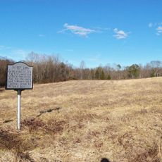
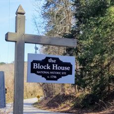
Established in 1779 and named after Griffith Rutherford, a leader during the American Revolution, the county rose to prominence in gold mining. Before the California Gold Rush, it was a major center of precious metal extraction that shaped the nation's early economy.

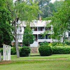
Music and craftsmanship run deep here, where regional gatherings celebrate Appalachian traditions and local artistry. Visitors can experience how these cultural practices continue to shape community identity and bring people together through performance and shared heritage.

The area offers access to natural attractions like the lake and rocky landmarks that invite outdoor activities. Visitors should prepare for varied weather and the hilly terrain, which enables hiking but requires physical effort.

Christopher Bechtler operated a private mint here and created the first gold dollar coin in the United States in 1831. This innovation made the region an early center of coin production and demonstrated the economic reach of local entrepreneurs.

Location: North Carolina

Inception: 1779

Capital city: Rutherfordton

Shares border with: McDowell County, Burke County, Cleveland County, Cherokee County, Spartanburg County, Polk County, Henderson County, Buncombe County

Website: http://rutherfordcountync.gov

GPS coordinates: 35.40000,-81.92000

Latest update: December 20, 2025 12:47

Photos
Around this place
Chimney Rock State Park
United States of America

Chimney Rock State Park

30.2 km
Catawba Falls
United States of America

Catawba Falls

37.2 km
Hickory Nut Falls
United States of America

Hickory Nut Falls

31 km
Green River Plantation
United States of America

Green River Plantation

15.5 km
Pine Gables
United States of America

Pine Gables

28.4 km
Rainbow Falls
United States of America

Rainbow Falls

31 km
Stone Hedge
United States of America

Stone Hedge

34.4 km
Gilbert Town Historic District
United States of America

Gilbert Town Historic District

2.3 km
Fox Haven Plantation
United States of America

Fox Haven Plantation

13.4 km
Rutherford County Courthouse
United States of America

Rutherford County Courthouse

5 km
Carson-Andrews Mill and Ben F.W. Andrews House
United States of America

Carson-Andrews Mill and Ben F.W. Andrews House

7.6 km
United States of America

Friendly Hills

36.1 km
Pine Crest Inn
United States of America

Pine Crest Inn

35.6 km
Forest City Baptist Church
United States of America

Forest City Baptist Church

8.7 km
Mills-Screven Plantation
United States of America

Mills-Screven Plantation

36 km
Main Street Historic District
United States of America

Main Street Historic District

9 km
Tryon Country Club
United States of America

Tryon Country Club

36.5 km
Main Street Historic District
United States of America

Main Street Historic District

4.9 km
Cool Springs High School
United States of America

Cool Springs High School

8.4 km
Carrier Houses
United States of America

Carrier Houses

4.8 km
Washburn Historic District
United States of America

Washburn Historic District

9.4 km
Cliffside Public School
United States of America

Cliffside Public School

8.4 km
Mill Farm Inn
United States of America

Mill Farm Inn

35.7 km
Trinity Lutheran Church
United States of America

Trinity Lutheran Church

4.4 km
James Dexter Ledbetter House
United States of America

James Dexter Ledbetter House

5.5 km
St. Luke's Chapel
United States of America

St. Luke's Chapel

6 km
Alexander Manufacturing Company Mill Village Historic District
United States of America

Alexander Manufacturing Company Mill Village Historic District

11.5 km
Blockhouse Site
United States of America

Blockhouse Site

35.3 km
Show the full map
Reviews

Visited this place? Tap the stars to rate it and share your experience / photos with the community! Try now! You can cancel it anytime.

Administrative divisions
« Rutherford County - County in southwestern North Carolina, United States » is provided by Around Us (aroundus.com). Images and texts are derived from Wikimedia project under a Creative Commons license. You are allowed to copy, distribute, and modify copies of this page, under the conditions set by the license, as long as this note is clearly visible.

Discover hidden gems everywhere you go!

From secret cafés to breathtaking viewpoints, skip the crowded tourist spots and find places that match your style. Our app makes it easy with voice search, smart filtering, route optimization, and insider tips from travelers worldwide. Download now for the complete mobile experience.

Around Us App Screenshot

A unique approach to discovering new places

Le Figaro

All the places worth exploring

France Info

A tailor-made excursion in just a few clicks

20 Minutes