Chest opened
+${chestReward.xp} XP
Explorer
NOUVEAU ×${chestReward.collectible.quantity}
tapez pour fermer
Chest locked

Open chests in the app

Around Us is built for your phone — chests unlock when you walk, explore and capture nearby places.

Enable Location

We need your location to show you interesting places around you

Discover nearby places

Find interesting locations and hidden gems around you

Precise directions

Get accurate directions and distances to places

Your location is never shared with other users. It's only used when you tap the location button.

Roslindale

Log in to your account

Start exploring — it's free

Trusted by 72,887 travelers worldwide

Continue with Google
Continue with Apple
or

We will send you a code to connect

By continuing, you accept our Terms and Conditions and our Privacy Policy

Check your inbox

We've sent a pincode in your inbox. Please enter the code below.

Discussion Reviews 1 Photos
28k Popularity

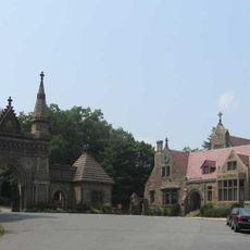
Roslindale, Residential neighborhood in Boston, US

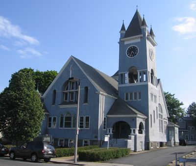
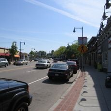
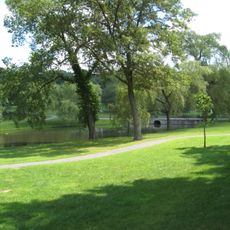
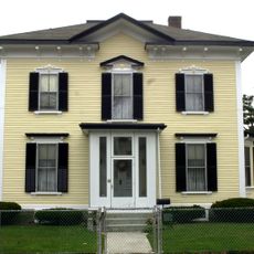
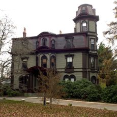
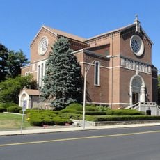
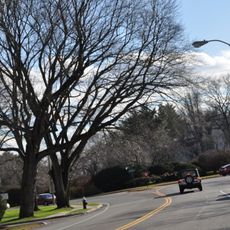
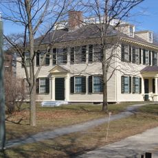
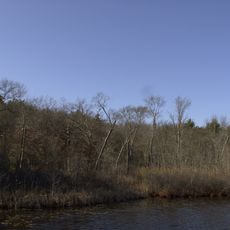
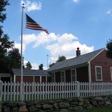
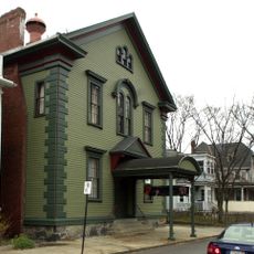
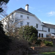
Roslindale is a residential neighborhood in Boston with tree-lined streets and colonial-style homes centered around the Roslindale Village commercial district. The area includes local shops and restaurants, with the Arnold Arboretum occupying its northern section and featuring extensive plantings.

The neighborhood separated from Roxbury in 1851 and incorporated into Boston in 1873. Its name comes from the Scottish town of Roslin and reflects early settler connections.

The Saturday farmers market in Adams Park brings together local food producers, artisans, and residents for weekly community gatherings. The event shapes neighborhood life and reflects local commitment to supporting regional products.

The neighborhood connects to downtown Boston through the MBTA Orange Line at Forest Hills station, with several bus routes also serving Roslindale Village. Visitors should allow time to explore the streets and visit the commercial core where most facilities are concentrated.

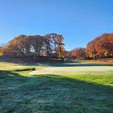
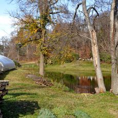
The Arnold Arboretum extends into Roslindale's northern section, offering residents and visitors walks through a curated collection of trees and shrubs. This makes the neighborhood a rare urban space with large-scale plantings situated within the city.

The community of curious travelers

AroundUs brings together thousands of curated places, local tips, and hidden gems, enriched daily by 60,000 contributors worldwide.

Start exploring
Location
GPS coordinates
42.28582,-71.12909
Latest update
December 20, 2025 13:01
Around this place
Arnold Arboretum
United States of America

Arnold Arboretum

1.4 km
West Roxbury
United States of America

West Roxbury

1.8 km
Forest Hills Cemetery
United States of America

Forest Hills Cemetery

2.2 km
Larz Anderson Park
United States of America

Larz Anderson Park

3 km
Larz Anderson Auto Museum
United States of America

Larz Anderson Auto Museum

2.8 km
Ellen Swallow Richards House
United States of America

Ellen Swallow Richards House

3 km
George Wright Golf Course
United States of America

George Wright Golf Course

2 km
Death and the Sculptor
United States of America

Death and the Sculptor

2.2 km
Adams-Nervine Asylum
United States of America

Adams-Nervine Asylum

2 km
Holy Name Church
United States of America

Holy Name Church

1.5 km
John Harris House and Farm
United States of America

John Harris House and Farm

2.2 km
Bellevue Standpipe
United States of America

Bellevue Standpipe

1.7 km
Mount Hope Cemetery
United States of America

Mount Hope Cemetery

2.2 km
Veterans of Foreign Wars Parkway
United States of America

Veterans of Foreign Wars Parkway

2.4 km
Firemen's Memorial
United States of America

Firemen's Memorial

1.8 km
Annunciation Melkite Catholic Cathedral
United States of America

Annunciation Melkite Catholic Cathedral

1.4 km
Walnut Hills Cemetery
United States of America

Walnut Hills Cemetery

2.4 km
West Roxbury Parkway
United States of America

West Roxbury Parkway

2.7 km
Loring-Greenough House
United States of America

Loring-Greenough House

2.9 km
Stony Brook Reservation Parkways
United States of America

Stony Brook Reservation Parkways

2.5 km
Westerly Burial Ground
United States of America

Westerly Burial Ground

2.5 km
Theodore Parker Unitarian Universalist Church
United States of America

Theodore Parker Unitarian Universalist Church

2.1 km
Putterham School
United States of America

Putterham School

3 km
Eliot Hall
United States of America

Eliot Hall

2.9 km
Roslindale Baptist Church
United States of America

Roslindale Baptist Church

104 m
Monument Square Historic District
United States of America

Monument Square Historic District

2.8 km
Isaac Child House
United States of America

Isaac Child House

3 km
Jamaica Plain Branch Library
United States of America

Jamaica Plain Branch Library

2.8 km
Show the full map
Reviews
Share your experience

No review yet

Discussions
Start a discussion...

No discussion yet

« Roslindale - Residential neighborhood in Boston, US » is provided by Around Us (aroundus.com). Images and texts are derived from Wikimedia project under a Creative Commons license. You are allowed to copy, distribute, and modify copies of this page, under the conditions set by the license, as long as this note is clearly visible.

Discover hidden gems everywhere you go!

From secret cafés to breathtaking viewpoints, skip the crowded tourist spots and find places that match your style. Our app makes it easy with voice search, smart filtering, route optimization, and insider tips from travelers worldwide. Download now for the complete mobile experience.

Around Us App Screenshot

A unique approach to discovering new places

Le Figaro

All the places worth exploring

France Info

A tailor-made excursion in just a few clicks

20 Minutes

Around Us
Travel Guide & Maps
Download

Send to your phone

QR Code
1

Open the camera app on your mobile.

2

Point at the QR code with your camera. A notification will appear.

3

Tap the notification to open the link.