Enable Location

We need your location to show you interesting places around you

Discover nearby places

Find interesting locations and hidden gems around you

Precise directions

Get accurate directions and distances to places

Your location is never shared with other users. It's only used when you tap the location button.

Aguas Buenas

Log in to your account

Start exploring — it's free

Trusted by 61,921 travelers worldwide

Continue with Google
Continue with Apple
or

We will send you a code to connect

By continuing, you accept our Terms and Conditions and our Privacy Policy

Check your inbox

We've sent a pincode in your inbox. Please enter the code below.

Aguas Buenas, Municipality in Central Mountain Range, Puerto Rico.

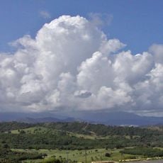
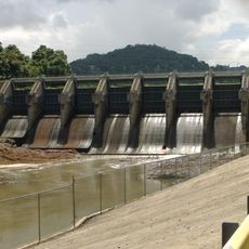
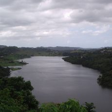
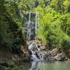
Aguas Buenas is a municipality in Puerto Rico's central mountain region organized into nine distinct barrios and a central downtown area. The territory is defined by numerous natural water springs that gave the place its name.

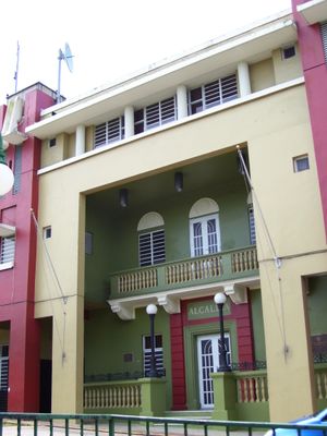
The area separated from Caguas in 1798 and gained official municipal status on May 25, 1838, under mayor Francisco de Salas Torres. This founding occurred during a period when Puerto Rico was reorganizing its administrative boundaries.

The annual Salsa, Bomba & Plena Festival each September brings the community together to celebrate Afro-Caribbean musical traditions alongside religious observances for Nuestra Señora de la Monserrate. These celebrations reflect how local identity remains rooted in the intersection of African heritage and Catholic faith.

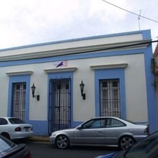
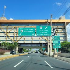
The postal code 00703 serves as the main reference point for the municipality, with most services concentrated in the downtown area. Visitors should expect that the mountainous terrain means roads are winding and getting around requires time.

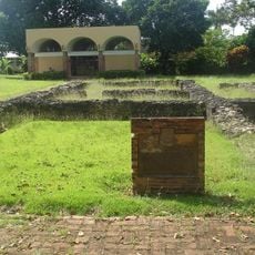
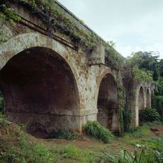
The underground cave system contains complex geological formations and serves as a regional center for geological research. These caverns often surprise visitors, as the agricultural landscape above gives no hint of their existence beneath.

The community of curious travelers

AroundUs brings together thousands of curated places, local tips, and hidden gems, enriched daily by 60,000 contributors worldwide.

Start exploring
GPS coordinates
18.25042,-66.13013
Latest update
December 7, 2025 20:24
Around this place
El Yunque National Forest
United States of America

El Yunque National Forest

37.4 km
Caparra Ruins
United States of America

Caparra Ruins

17.3 km
Carraízo Dam
United States of America

Carraízo Dam

14.8 km
La Plata Lake
United States of America

La Plata Lake

13.6 km
Bayamón Soccer Complex
United States of America

Bayamón Soccer Complex

13.5 km
Arenas Bridge
United States of America

Arenas Bridge

13 km
United States of America

Old Piedras River Aqueduct

17.2 km
Old Plata Bridge
United States of America

Old Plata Bridge

10.6 km
General Norzagaray Bridge
United States of America

General Norzagaray Bridge

12 km
Museum of Transportation of Puerto Rico
United States of America

Museum of Transportation of Puerto Rico

12.1 km
William Miranda Marín Botanical and Cultural Garden
United States of America

William Miranda Marín Botanical and Cultural Garden

9.8 km
Dr. Agustín Stahl Stamm House
United States of America

Dr. Agustín Stahl Stamm House

16.7 km
José Ignacio Quintón Center for Creole Music
United States of America

José Ignacio Quintón Center for Creole Music

10.3 km
Bayamón City Hall
United States of America

Bayamón City Hall

16.5 km
La Liendre Bridge
United States of America

La Liendre Bridge

12.9 km
José Celso Barbosa House Museum
United States of America

José Celso Barbosa House Museum

16.7 km
Caguas Museum of Art
United States of America

Caguas Museum of Art

10.1 km
Aguayo Aldea Vocational High School
United States of America

Aguayo Aldea Vocational High School

10.7 km
Caguas Museum of Folk Arts
United States of America

Caguas Museum of Folk Arts

10.1 km
Puente No. 6
United States of America

Puente No. 6

10 km
Caguas Museum of History
United States of America

Caguas Museum of History

10.1 km
Caguas Museum of Tobacco
United States of America

Caguas Museum of Tobacco

10 km
Río Hondo Bridge
United States of America

Río Hondo Bridge

12.8 km
Cascada Charco Prieto
Puerto Rico

Cascada Charco Prieto

6.8 km
Jesús Izcoa Moure Bridge
United States of America

Jesús Izcoa Moure Bridge

11.7 km
La Casa del Cuento y de la Historia Cayeyana Ramón "Moncho" Gómez
United States of America

La Casa del Cuento y de la Historia Cayeyana Ramón "Moncho" Gómez

15.7 km
La Casa de la Navidad
Puerto Rico

La Casa de la Navidad

12.3 km
Casa de la Cultura
Puerto Rico

Casa de la Cultura

17.4 km
Show the full map
« Aguas Buenas - Municipality in Central Mountain Range, Puerto Rico » is provided by Around Us (aroundus.com). Images and texts are derived from Wikimedia project under a Creative Commons license. You are allowed to copy, distribute, and modify copies of this page, under the conditions set by the license, as long as this note is clearly visible.

Discover hidden gems everywhere you go!

From secret cafés to breathtaking viewpoints, skip the crowded tourist spots and find places that match your style. Our app makes it easy with voice search, smart filtering, route optimization, and insider tips from travelers worldwide. Download now for the complete mobile experience.

Around Us App Screenshot

A unique approach to discovering new places

Le Figaro

All the places worth exploring

France Info

A tailor-made excursion in just a few clicks

20 Minutes

Around Us
Travel Guide & Maps
Download

Send to your phone

QR Code
1

Open the camera app on your mobile.

2

Point at the QR code with your camera. A notification will appear.

3

Tap the notification to open the link.