Enable Location

We need your location to show you interesting places around you

Discover nearby places

Find interesting locations and hidden gems around you

Precise directions

Get accurate directions and distances to places

Your location is never shared with other users. It's only used when you tap the location button.

Ciales

Log in to your account

Start exploring — it's free

Trusted by 61,921 travelers worldwide

Continue with Google
Continue with Apple
or

We will send you a code to connect

By continuing, you accept our Terms and Conditions and our Privacy Policy

Check your inbox

We've sent a pincode in your inbox. Please enter the code below.

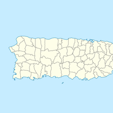
Ciales, Mountain municipality in northern Puerto Rico, United States

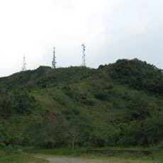
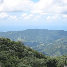
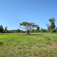
Ciales is a municipality in the central mountainous region of Puerto Rico that spans multiple elevation levels. The varying terrain creates different climate zones across the area, shaping both the landscape and how people live there.

The municipality was established in 1820, built on land where the Cibona indigenous people once lived. The native population left lasting marks on the region before Spanish colonization transformed it.

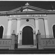
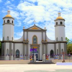
The yearly patron saint celebrations in Ciales honor Saint Joseph with traditional Puerto Rican music, local food dishes, and community gatherings. These events show how residents maintain their ties to religious tradition and express their local pride.

Local coffee farms offer tours and tastings throughout the year, with the chance to buy directly from growers. The mountainous terrain means visiting these locations requires good walking shoes and an early start is often needed.

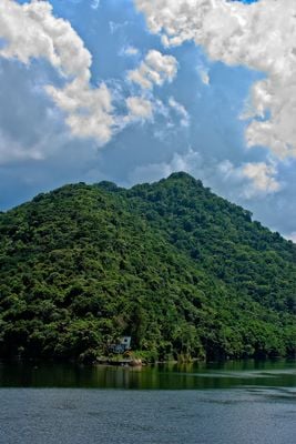
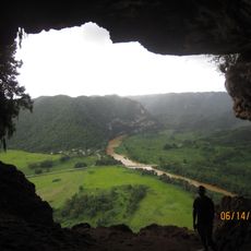
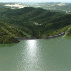
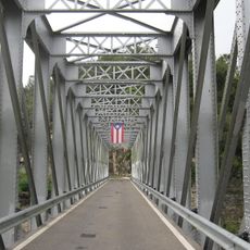
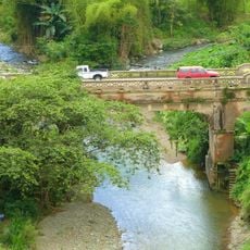
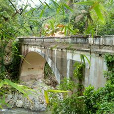
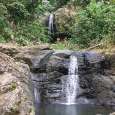
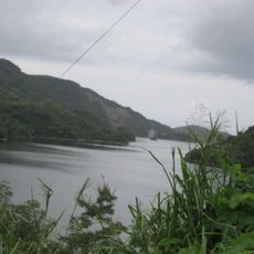
The municipality is crossed by several river systems that flow through its forests and valleys. These waterways create natural swimming spots and let visitors experience local water activities away from busy tourist areas.

The community of curious travelers

AroundUs brings together thousands of curated places, local tips, and hidden gems, enriched daily by 60,000 contributors worldwide.

Start exploring
GPS coordinates
18.26381,-66.50828
Latest update
December 7, 2025 20:47
Around this place
Arecibo Radio Telescope
Puerto Rico

Arecibo Radio Telescope

27.3 km
Cerro de Punta
United States of America

Cerro de Punta

13.5 km
Cueva Ventana
United States of America

Cueva Ventana

22.8 km
Toro Negro State Forest
United States of America

Toro Negro State Forest

12 km
Hacienda Buena Vista
United States of America

Hacienda Buena Vista

25.3 km
Portugués Dam
United States of America

Portugués Dam

26 km
Museo Hacienda Buena Vista
United States of America

Museo Hacienda Buena Vista

25.3 km
Luis A. Wito Morales Park
United States of America

Luis A. Wito Morales Park

22.5 km
United States of America

Monte Jayuya

12.9 km
Nuestra Señora de la Candelaria y San Matías Church
United States of America

Nuestra Señora de la Candelaria y San Matías Church

18.5 km
Cambalache State Forest
United States of America

Cambalache State Forest

22.1 km
San Ramón Nonato Church
United States of America

San Ramón Nonato Church

23.5 km
United States of America

Tres Picachos

6.5 km
United States of America

Los Tres Picachos State Forest

6.2 km
Museo de Vida Silvestre
United States of America

Museo de Vida Silvestre

512 m
Manatí Bridge at Mata de Plátano
United States of America

Manatí Bridge at Mata de Plátano

11.2 km
United States of America

Cerro El Bolo

10.8 km
Las Cabañas Bridge
United States of America

Las Cabañas Bridge

25.9 km
Casa Nemesio Canales
United States of America

Casa Nemesio Canales

8.2 km
Rafael Balseiro Maceira School
United States of America

Rafael Balseiro Maceira School

21.3 km
Blanco Bridge
United States of America

Blanco Bridge

22.4 km
Las Delicias Waterfall
Puerto Rico

Las Delicias Waterfall

5 km
Museo De Nuestros Martires
Puerto Rico

Museo De Nuestros Martires

8 km
Cemis of Taino Culture Statue Museos Casa Canales y El Cemi
Puerto Rico

Cemis of Taino Culture Statue Museos Casa Canales y El Cemi

8.3 km
Lago Guayabal
United States of America

Lago Guayabal

18.8 km
Lago Toa Vaca
United States of America

Lago Toa Vaca

18.5 km
Lake Cerrillos
United States of America

Lake Cerrillos

20.9 km
Place des Halles
United States of America

Place des Halles

21.7 km
Show the full map
« Ciales - Mountain municipality in northern Puerto Rico, United States » is provided by Around Us (aroundus.com). Images and texts are derived from Wikimedia project under a Creative Commons license. You are allowed to copy, distribute, and modify copies of this page, under the conditions set by the license, as long as this note is clearly visible.

Discover hidden gems everywhere you go!

From secret cafés to breathtaking viewpoints, skip the crowded tourist spots and find places that match your style. Our app makes it easy with voice search, smart filtering, route optimization, and insider tips from travelers worldwide. Download now for the complete mobile experience.

Around Us App Screenshot

A unique approach to discovering new places

Le Figaro

All the places worth exploring

France Info

A tailor-made excursion in just a few clicks

20 Minutes

Around Us
Travel Guide & Maps
Download

Send to your phone

QR Code
1

Open the camera app on your mobile.

2

Point at the QR code with your camera. A notification will appear.

3

Tap the notification to open the link.