Enable Location

We need your location to show you interesting places around you

Discover nearby places

Find interesting locations and hidden gems around you

Precise directions

Get accurate directions and distances to places

Your location is never shared with other users. It's only used when you tap the location button.

Brookville

Log in to your account

Start exploring — it's free

Trusted by 63,697 travelers worldwide

Continue with Google
Continue with Apple
or

We will send you a code to connect

By continuing, you accept our Terms and Conditions and our Privacy Policy

Check your inbox

We've sent a pincode in your inbox. Please enter the code below.

Discussion Reviews 1 Photos
15.7k Popularity

Brookville, town in Indiana, United States

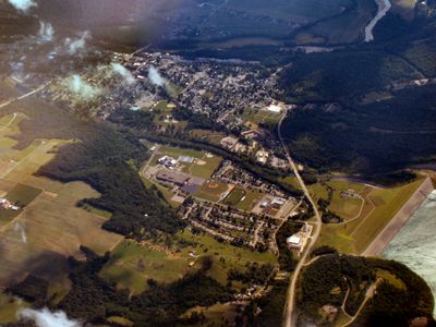
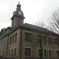
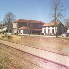
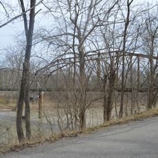
Brookville is a small town in Franklin County, Indiana, serving as the county seat and administrative center. The town sits where two branches of the Whitewater River meet and borders Brookville Lake, created in the 1970s.

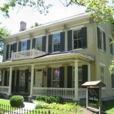
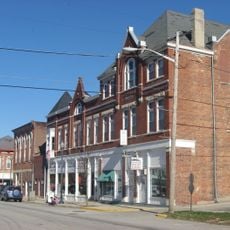
The town was founded in 1808 by Thomas Manwarring and laid out with a simple grid of streets. The area has roots in early American settlement and reflects over two centuries of community development and growth.

The town's name comes from a woman named Brooks, related to one of the early settlers. Local events, parades, and festivals bring residents together to celebrate their heritage and keep stories alive for coming generations.

The town is primarily accessed by car, with several main roads connecting it to surrounding areas. The flat terrain and tree-lined streets make walking around town comfortable and easy for exploring on foot.

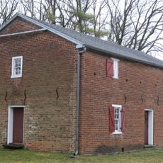
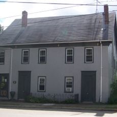
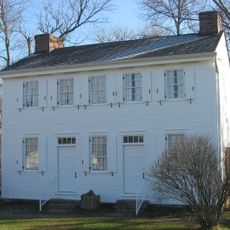
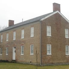
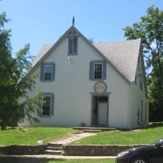
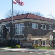
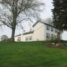
A historic site called The Hermitage is an old house that has stood for many years and welcomes visitors. Though Brookville College no longer operates, its history shaped the town, and local groups celebrate its legacy each year.

The community of curious travelers

AroundUs brings together thousands of curated places, local tips, and hidden gems, enriched daily by 60,000 contributors worldwide.

Start exploring
Location
Elevation above the sea
203 m
GPS coordinates
39.42220,-85.00940
Latest update
February 19, 2026 23:40
Around this place
Whitewater Canal
United States of America

Whitewater Canal

9.5 km
Goggin Ice Center
United States of America

Goggin Ice Center

25.1 km
Whitewater Memorial State Park
United States of America

Whitewater Memorial State Park

21.7 km
Duck Creek Aqueduct
United States of America

Duck Creek Aqueduct

10.7 km
Little Cedar Grove Baptist Church
United States of America

Little Cedar Grove Baptist Church

4.6 km
Alumni Library
United States of America

Alumni Library

25.2 km
McGuffey Hall
United States of America

McGuffey Hall

25.2 km
The Hermitage
United States of America

The Hermitage

404 m
Hall Auditorium
United States of America

Hall Auditorium

25.2 km
St. John the Baptist Harrison
United States of America

St. John the Baptist Harrison

24.5 km
Howe Tavern
United States of America

Howe Tavern

23.2 km
Othniel Looker House
United States of America

Othniel Looker House

24.7 km
Franklin County Seminary
United States of America

Franklin County Seminary

314 m
Dr. William S. Alexander House
United States of America

Dr. William S. Alexander House

24.7 km
Brookville Historic District
United States of America

Brookville Historic District

70 m
Metamora Historic District
United States of America

Metamora Historic District

11 km
Elias Kumler House
United States of America

Elias Kumler House

24.9 km
Oldenburg Historic District
United States of America

Oldenburg Historic District

18.9 km
James P. Hidley Cottage
United States of America

James P. Hidley Cottage

21.6 km
Union County Courthouse
United States of America

Union County Courthouse

24.6 km
Cedar Grove Bridge
United States of America

Cedar Grove Bridge

9.6 km
Liberty Courthouse Square Historic District
United States of America

Liberty Courthouse Square Historic District

24.7 km
Central Batesville Historic District
United States of America

Central Batesville Historic District

22.9 km
Liberty Residential Historic District
United States of America

Liberty Residential Historic District

24.8 km
Snow Hill Covered Bridge
United States of America

Snow Hill Covered Bridge

17.3 km
Salmon Turrell Farmstead
United States of America

Salmon Turrell Farmstead

16.6 km
United States of America

Bischoff Reservoir

22.8 km
Caroline Scott Harrison - Oxford Female Institute
United States of America

Caroline Scott Harrison - Oxford Female Institute

24.7 km
Show the full map
Reviews
Share your experience

No review yet

Discussions
Start a discussion...

No discussion yet

« Brookville - town in Indiana, United States » is provided by Around Us (aroundus.com). Images and texts are derived from Wikimedia project under a Creative Commons license. You are allowed to copy, distribute, and modify copies of this page, under the conditions set by the license, as long as this note is clearly visible.

Discover hidden gems everywhere you go!

From secret cafés to breathtaking viewpoints, skip the crowded tourist spots and find places that match your style. Our app makes it easy with voice search, smart filtering, route optimization, and insider tips from travelers worldwide. Download now for the complete mobile experience.

Around Us App Screenshot

A unique approach to discovering new places

Le Figaro

All the places worth exploring

France Info

A tailor-made excursion in just a few clicks

20 Minutes

Around Us
Travel Guide & Maps
Download

Send to your phone

QR Code
1

Open the camera app on your mobile.

2

Point at the QR code with your camera. A notification will appear.

3

Tap the notification to open the link.