Whitewater Canal

Log in to your account

AroundUs is a community-driven map of interesting places, built by curious explorers like you. It grows with every review, story, and photo you share.
Connect to save your favorite spots, contribute locations, and create personalized routes.
Continue with Google
Continue with Apple
Continue with X
Continue with Facebook
Continue with email
By continuing, you accept our Terms and Conditions and our Privacy Policy
Create an account
Add to collection
Map
Suggest a change
Share

Whitewater Canal, Historic transportation canal in Franklin County, United States.

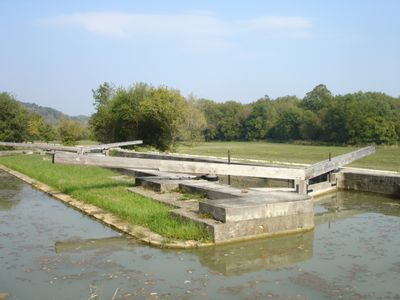
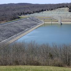
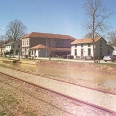
The Whitewater Canal is a historic waterway stretching from Lawrenceburg to Hagerstown through Indiana, designed to move goods by water rather than overland routes. The structure includes 56 locks and seven dams that controlled water levels for safe boat passage.

Construction started in 1836 as part of Indiana's ambitious internal improvement program to help farmers move their goods more easily. The project emerged from pressure to connect agricultural regions with the commercial centers downstream.

The canal system brought prosperity to farming communities by creating direct market access that hadn't existed before. Towns along the route grew as trading hubs where local products moved toward bigger cities.

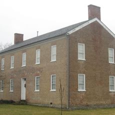
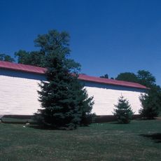
You can walk along preserved sections of the canal at various points along its path, with easy access from nearby parking areas. Several visitor centers offer exhibits and information about how the canal worked and what life was like during its operation.

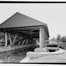
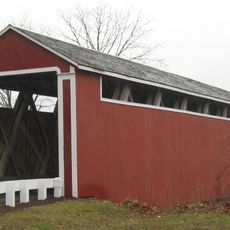
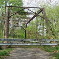
The Duck Creek Aqueduct earned national recognition as a historic engineering landmark, standing out for how it solved the problem of crossing the creek while maintaining water flow for boats. This structure showcases the problem-solving skills that went into building the entire system.

Location: Franklin County

GPS coordinates: 39.45190,-85.11280

Latest update: December 8, 2025 20:02

Photos
Around this place
Brookville Lake Dam
United States of America

Brookville Lake Dam

9.9 km
Whitewater Memorial State Park
United States of America

Whitewater Memorial State Park

22 km
Oxford Female Institute
United States of America

Oxford Female Institute

32.2 km
Elmhurst
United States of America

Elmhurst

20.2 km
Duck Creek Aqueduct
United States of America

Duck Creek Aqueduct

1.6 km
Little Cedar Grove Baptist Church
United States of America

Little Cedar Grove Baptist Church

13.4 km
Thomas Ranck Round Barn
United States of America

Thomas Ranck Round Barn

29.7 km
The Hermitage
United States of America

The Hermitage

9.9 km
Canal House
United States of America

Canal House

21.1 km
Howe Tavern
United States of America

Howe Tavern

28.6 km
Franklin County Seminary
United States of America

Franklin County Seminary

9.7 km
Dr. William S. Alexander House
United States of America

Dr. William S. Alexander House

32.2 km
Brookville Historic District
United States of America

Brookville Historic District

9.4 km
Stockheughter Covered Bridge
United States of America

Stockheughter Covered Bridge

19.6 km
Metamora Historic District
United States of America

Metamora Historic District

1.9 km
Oldenburg Historic District
United States of America

Oldenburg Historic District

14.6 km
James P. Hidley Cottage
United States of America

James P. Hidley Cottage

30.5 km
Union County Courthouse
United States of America

Union County Courthouse

25.7 km
Fayette County Courthouse
United States of America

Fayette County Courthouse

21.2 km
Cedar Grove Bridge
United States of America

Cedar Grove Bridge

18.3 km
Longwood Covered Bridge
United States of America

Longwood Covered Bridge

24.3 km
Liberty Courthouse Square Historic District
United States of America

Liberty Courthouse Square Historic District

25.8 km
Rush County Bridge No. 188
United States of America

Rush County Bridge No. 188

31 km
Central Batesville Historic District
United States of America

Central Batesville Historic District

19.6 km
Liberty Residential Historic District
United States of America

Liberty Residential Historic District

25.9 km
Snow Hill Covered Bridge
United States of America

Snow Hill Covered Bridge

26.5 km
Salmon Turrell Farmstead
United States of America

Salmon Turrell Farmstead

25.7 km
William Lowry House
United States of America

William Lowry House

31.7 km
Show the full map
Reviews

Visited this place? Tap the stars to rate it and share your experience / photos with the community! Try now! You can cancel it anytime.

« Whitewater Canal - Historic transportation canal in Franklin County, United States » is provided by Around Us (aroundus.com). Images and texts are derived from Wikimedia project under a Creative Commons license. You are allowed to copy, distribute, and modify copies of this page, under the conditions set by the license, as long as this note is clearly visible.

Discover hidden gems everywhere you go!

From secret cafés to breathtaking viewpoints, skip the crowded tourist spots and find places that match your style. Our app makes it easy with voice search, smart filtering, route optimization, and insider tips from travelers worldwide. Download now for the complete mobile experience.

Around Us App Screenshot

A unique approach to discovering new places

Le Figaro

All the places worth exploring

France Info

A tailor-made excursion in just a few clicks

20 Minutes