Enable Location

We need your location to show you interesting places around you

Discover nearby places

Find interesting locations and hidden gems around you

Precise directions

Get accurate directions and distances to places

Your location is never shared with other users. It's only used when you tap the location button.

Fontana Dam

Log in to your account

Start exploring — it's free

Trusted by 64,607 travelers worldwide

Continue with Google
Continue with Apple
or

We will send you a code to connect

By continuing, you accept our Terms and Conditions and our Privacy Policy

Check your inbox

We've sent a pincode in your inbox. Please enter the code below.

Discussion Reviews 1 Photos
30.4k Popularity

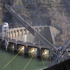
Fontana Dam, Hydroelectric dam in Great Smoky Mountains, North Carolina.

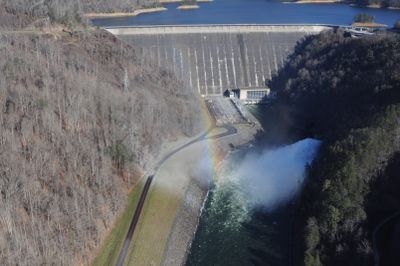
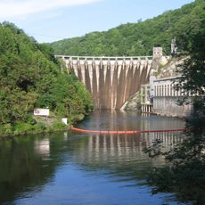
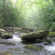
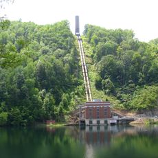
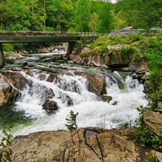
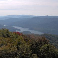
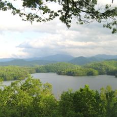
Fontana Dam is a 480-foot-tall concrete structure stretching 721 meters across the Little Tennessee River, forming a massive reservoir with 10,230 acres of water surface. The lake's shoreline creates numerous coves and peninsulas throughout the valley.

The Tennessee Valley Authority built this dam between 1942 and 1944 to supply electricity for aluminum production during World War II. The project was essential to wartime manufacturing and became part of a broader regional development effort.

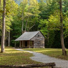
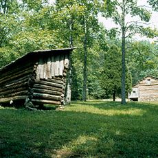
The dam's creation flooded Fontana, a town built on logging and copper mining, displacing over 1,000 families from their homes. The submerged community remains a memory tied to the landscape, shaping how locals view the reservoir.

A visitor center offers exhibits explaining how the facility generates power and shaped the region's development, helping guests understand the operation today. The site is accessible year-round with parking areas and walking paths around the structure.

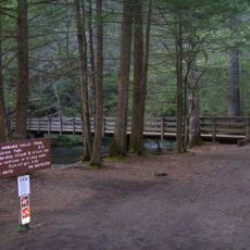
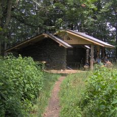
The Appalachian Trail crosses directly over the dam, and a nearby shelter provides hot showers that long-distance hikers affectionately call the Fontana Hilton. This surprising comfort stops hikers used to basic backcountry stays.

The community of curious travelers

AroundUs brings together thousands of curated places, local tips, and hidden gems, enriched daily by 60,000 contributors worldwide.

Start exploring
Location
Inception
1942
Length
721 m
GPS coordinates
35.45220,-83.80470
Latest update
December 20, 2025 02:20
Around this place
Fontana Lake
United States of America

Fontana Lake

1.3 km
Cheoah Dam
United States of America

Cheoah Dam

12 km
Joyce Kilmer Memorial Forest
United States of America

Joyce Kilmer Memorial Forest

17.8 km
Abrams Falls Trail
United States of America

Abrams Falls Trail

15.9 km
Tuckaleechee Caverns
United States of America

Tuckaleechee Caverns

23.1 km
Gregory Bald
United States of America

Gregory Bald

9.4 km
Joyce Kilmer-Slickrock Wilderness
United States of America

Joyce Kilmer-Slickrock Wilderness

17.8 km
Calderwood Dam
United States of America

Calderwood Dam

16.5 km
Silers Bald
United States of America

Silers Bald

25.1 km
Citico Creek Wilderness
United States of America

Citico Creek Wilderness

22.8 km
Santeetlah Dam
United States of America

Santeetlah Dam

10.6 km
The Sinks
United States of America

The Sinks

27.4 km
Shuckstack
United States of America

Shuckstack

3.8 km
Tapoco Lodge Historic District
United States of America

Tapoco Lodge Historic District

12.2 km
Hall Cabin
United States of America

Hall Cabin

13.6 km
Franklin Pierce Cover House
United States of America

Franklin Pierce Cover House

28 km
Graham County Courthouse
United States of America

Graham County Courthouse

14.4 km
Great Smoky Mountains Heritage Center
United States of America

Great Smoky Mountains Heritage Center

26 km
Charles Noden George House
United States of America

Charles Noden George House

21.1 km
Cades Cove Missionary Baptist Church
United States of America

Cades Cove Missionary Baptist Church

17.5 km
Look Rock Observation Tower
United States of America

Look Rock Observation Tower

23.7 km
Cades Cove Methodist Church
United States of America

Cades Cove Methodist Church

17.3 km
Cades Cove Primitive Baptist Church
United States of America

Cades Cove Primitive Baptist Church

16.7 km
Cades Cove Visitor Center
United States of America

Cades Cove Visitor Center

15.2 km
Carter Shields Cabin
United States of America

Carter Shields Cabin

15.3 km
Elijah Oliver Place
United States of America

Elijah Oliver Place

16.7 km
Derrick Knob Shelter
United States of America

Derrick Knob Shelter

19.5 km
Lake Santeetlah
United States of America

Lake Santeetlah

12 km
Show the full map
Reviews
Share your experience

No review yet

Discussions
Start a discussion...

No discussion yet

« Fontana Dam - Hydroelectric dam in Great Smoky Mountains, North Carolina » is provided by Around Us (aroundus.com). Images and texts are derived from Wikimedia project under a Creative Commons license. You are allowed to copy, distribute, and modify copies of this page, under the conditions set by the license, as long as this note is clearly visible.

Discover hidden gems everywhere you go!

From secret cafés to breathtaking viewpoints, skip the crowded tourist spots and find places that match your style. Our app makes it easy with voice search, smart filtering, route optimization, and insider tips from travelers worldwide. Download now for the complete mobile experience.

Around Us App Screenshot

A unique approach to discovering new places

Le Figaro

All the places worth exploring

France Info

A tailor-made excursion in just a few clicks

20 Minutes

Around Us
Travel Guide & Maps
Download

Send to your phone

QR Code
1

Open the camera app on your mobile.

2

Point at the QR code with your camera. A notification will appear.

3

Tap the notification to open the link.