Enable Location

We need your location to show you interesting places around you

Discover nearby places

Find interesting locations and hidden gems around you

Precise directions

Get accurate directions and distances to places

Your location is never shared with other users. It's only used when you tap the location button.

Log in to your account

Start exploring — it's free

Trusted by 64,533 travelers worldwide

Continue with Google
Continue with Apple
or

We will send you a code to connect

By continuing, you accept our Terms and Conditions and our Privacy Policy

Check your inbox

We've sent a pincode in your inbox. Please enter the code below.

Discussion Reviews Photo
17k Popularity

West Hempstead, Residential neighborhood in Nassau County, New York, United States

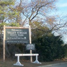
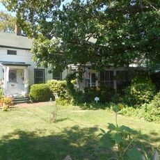
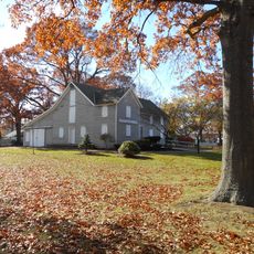
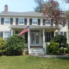
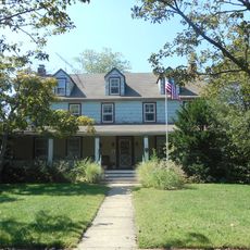
West Hempstead is a residential area in Nassau County on Long Island that includes schools, parks, and local shops spread throughout. The terrain is flat with typical suburban features that make daily life here straightforward and accessible.

The area was originally farmland until railroad development in the early 1900s sparked growth. This transportation connection transformed it into a residential community for commuters to New York City.

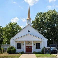
The community hosts seasonal events and concerts that draw residents together throughout the year. These gatherings shape local social life and offer chances for neighbors to connect.

The Long Island Rail Road station provides regular connections to downtown New York and surrounding areas. The Southern State Parkway also offers direct highway access for those driving to various destinations.

The West Hempstead Dog Park serves as a gathering spot where residents socialize while their pets play. This location plays a surprisingly important role in everyday neighborhood life here.

The community of curious travelers

AroundUs brings together thousands of curated places, local tips, and hidden gems, enriched daily by 60,000 contributors worldwide.

Start exploring
Location
Elevation above the sea
20 m
GPS coordinates
40.69640,-73.65250
Latest update
December 7, 2025 19:25
Around this place
Ohel
United States of America

Ohel

7.2 km
Cradle of Aviation Museum
United States of America

Cradle of Aviation Museum

5.8 km
Eisenhower Park
United States of America

Eisenhower Park

7.9 km
Denton House
United States of America

Denton House

4.8 km
St. Paul's School
United States of America

St. Paul's School

3.3 km
Cathedral of the Incarnation
United States of America

Cathedral of the Incarnation

2.9 km
Valley Stream State Park
United States of America

Valley Stream State Park

4 km
Brookholt
United States of America

Brookholt

6.7 km
Brooklyn Waterworks
United States of America

Brooklyn Waterworks

6.1 km
A. T. Stewart Era Buildings
United States of America

A. T. Stewart Era Buildings

3.1 km
St. Vincent de Paul Malankara Catholic Cathedral Parish
United States of America

St. Vincent de Paul Malankara Catholic Cathedral Parish

4 km
United States of America

Long Island Children's Museum

5.6 km
St. Joachim's Church
United States of America

St. Joachim's Church

7.1 km
House at 474 Ocean Avenue
United States of America

House at 474 Ocean Avenue

4.7 km
Pagan-Fletcher House
United States of America

Pagan-Fletcher House

4.5 km
House at 251 Rocklyn Avenue
United States of America

House at 251 Rocklyn Avenue

5.1 km
Haviland-Davison Grist Mill
United States of America

Haviland-Davison Grist Mill

5.6 km
Saint Mary's Chapel
United States of America

Saint Mary's Chapel

7.1 km
House at 73 Grove Street
United States of America

House at 73 Grove Street

3.7 km
Freeport Memorial Library
United States of America

Freeport Memorial Library

7.3 km
House at 18 Seventeenth Avenue
United States of America

House at 18 Seventeenth Avenue

5.8 km
House at 240 Sea Cliff Avenue
United States of America

House at 240 Sea Cliff Avenue

5.9 km
Bellerose Village Municipal Complex
United States of America

Bellerose Village Municipal Complex

6.1 km
Denton Homestead
United States of America

Denton Homestead

6.1 km
Church of St. Philip and St. James
United States of America

Church of St. Philip and St. James

7.9 km
African American Museum of Nassau County
United States of America

African American Museum of Nassau County

2.6 km
Old Nassau County Courthouse
United States of America

Old Nassau County Courthouse

4.7 km
Hofstra University Museum of Art
United States of America

Hofstra University Museum of Art

4.7 km
Show the full map
Reviews
Share your experience

No review yet

Discussions
Start a discussion...

No discussion yet

« West Hempstead - Residential neighborhood in Nassau County, New York, United States » is provided by Around Us (aroundus.com). Images and texts are derived from Wikimedia project under a Creative Commons license. You are allowed to copy, distribute, and modify copies of this page, under the conditions set by the license, as long as this note is clearly visible.

Discover hidden gems everywhere you go!

From secret cafés to breathtaking viewpoints, skip the crowded tourist spots and find places that match your style. Our app makes it easy with voice search, smart filtering, route optimization, and insider tips from travelers worldwide. Download now for the complete mobile experience.

Around Us App Screenshot

A unique approach to discovering new places

Le Figaro

All the places worth exploring

France Info

A tailor-made excursion in just a few clicks

20 Minutes

Around Us
Travel Guide & Maps
Download

Send to your phone

QR Code
1

Open the camera app on your mobile.

2

Point at the QR code with your camera. A notification will appear.

3

Tap the notification to open the link.