Enable Location

We need your location to show you interesting places around you

Discover nearby places

Find interesting locations and hidden gems around you

Precise directions

Get accurate directions and distances to places

Your location is never shared with other users. It's only used when you tap the location button.

Fowler Mountain

Log in to your account

Start exploring — it's free

Trusted by 61,862 travelers worldwide

Continue with Google
Continue with Apple
or

We will send you a code to connect

By continuing, you accept our Terms and Conditions and our Privacy Policy

Check your inbox

We've sent a pincode in your inbox. Please enter the code below.

Fowler Mountain

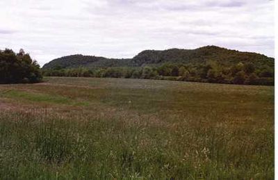
Fowler Mountain, Mountain summit in Connecticut, United States.

Description

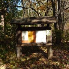
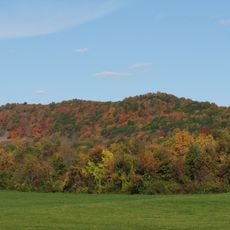
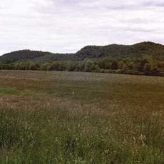
Fowler Mountain is a summit in Connecticut with steep slopes formed from basalt, rising to an elevation of 230 meters above sea level. The Mattabesett Trail crosses through the ridge, guiding hikers across exposed rock formations and forested sections.

History

This summit formed during the Triassic Period when continental rifting separated North America from Africa and Eurasia. The resulting geological upheaval created the basalt formations that define the mountain's character today.

Culture

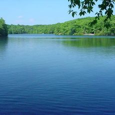
The mountain serves as a gathering place for outdoor enthusiasts who hike its trails throughout the year. These paths connect the surrounding communities and remain central to how locals experience the region's natural spaces.

Practical

Access to the mountain is provided through Trimountain State Park with marked hiking trails available year-round. Weather conditions can change quickly due to the elevation and exposed ridge sections, so visitors should come prepared for variable conditions.

Did you know?

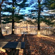
The mountain's elevation changes create distinct microclimates across its slopes, from dry upper sections to cool ravines below. These varying conditions support specialized plant communities adapted to their particular pockets of the landscape.

Location
Elevation above the sea
230 m
Made from material
igneous rock
Part of
Metacomet Ridge
GPS coordinates
41.44288,-72.74093
Latest update
December 14, 2025 15:02

AroundUs brings together thousands of curated places, local tips, and hidden gems, enriched daily by 60,000 contributors worldwide. Discover all places nearby (Connecticut).

Around this place
Millers Pond State Park
United States of America

Millers Pond State Park

9.7 km
Northford Center Historic District
United States of America

Northford Center Historic District

5.9 km
Nehemiah Royce House
United States of America

Nehemiah Royce House

6.6 km
Paul Mellon Arts Center
United States of America

Paul Mellon Arts Center

6 km
Wharton Brook State Park
United States of America

Wharton Brook State Park

8 km
Quinnipiac River State Park
United States of America

Quinnipiac River State Park

9.6 km
Trimountain
United States of America

Trimountain

1.9 km
Pistapaug Mountain
United States of America

Pistapaug Mountain

1.3 km
Tri-Mountain State Park
United States of America

Tri-Mountain State Park

359 m
Main Street Historic District
United States of America

Main Street Historic District

6.1 km
William Ward Jr. House
United States of America

William Ward Jr. House

6.8 km
Samuel Simpson House
United States of America

Samuel Simpson House

6.6 km
Curtis Memorial Library
United States of America

Curtis Memorial Library

11.4 km
David Lyman II House
United States of America

David Lyman II House

6.4 km
Thomas Lyman House
United States of America

Thomas Lyman House

6.5 km
Kohler Environmental Center
United States of America

Kohler Environmental Center

5 km
Meeting House Hill Historic District
United States of America

Meeting House Hill Historic District

8.4 km
John Barker House
United States of America

John Barker House

7.8 km
Franklin Johnson House
United States of America

Franklin Johnson House

6.7 km
Samuel Parsons House
United States of America

Samuel Parsons House

6.7 km
Howd-Linsley House
United States of America

Howd-Linsley House

4.4 km
Joseph Blakeslee House
United States of America

Joseph Blakeslee House

4.7 km
Theophilus Jones House
United States of America

Theophilus Jones House

9.3 km
Wallingford Center Historic District
United States of America

Wallingford Center Historic District

6.7 km
Fourth District School
United States of America

Fourth District School

6.8 km
Warham Williams House
United States of America

Warham Williams House

7 km
Dudley Farm
United States of America

Dudley Farm

10 km
Wallingford Center
United States of America

Wallingford Center

6.5 km
Show the full map
« Fowler Mountain - Mountain summit in Connecticut, United States » is provided by Around Us (aroundus.com). Images and texts are derived from Wikimedia project under a Creative Commons license. You are allowed to copy, distribute, and modify copies of this page, under the conditions set by the license, as long as this note is clearly visible.

Discover hidden gems everywhere you go!

From secret cafés to breathtaking viewpoints, skip the crowded tourist spots and find places that match your style. Our app makes it easy with voice search, smart filtering, route optimization, and insider tips from travelers worldwide. Download now for the complete mobile experience.

Around Us App Screenshot

A unique approach to discovering new places

Le Figaro

All the places worth exploring

France Info

A tailor-made excursion in just a few clicks

20 Minutes

Around Us
Travel Guide & Maps
Download

Send to your phone

QR Code
1

Open the camera app on your mobile.

2

Point at the QR code with your camera. A notification will appear.

3

Tap the notification to open the link.