Enable Location

We need your location to show you interesting places around you

Discover nearby places

Find interesting locations and hidden gems around you

Precise directions

Get accurate directions and distances to places

Your location is never shared with other users. It's only used when you tap the location button.

Perrot State Park

Log in to your account

Start exploring — it's free

Trusted by 62,422 travelers worldwide

Continue with Google
Continue with Apple
or

We will send you a code to connect

By continuing, you accept our Terms and Conditions and our Privacy Policy

Check your inbox

We've sent a pincode in your inbox. Please enter the code below.

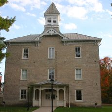
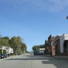
Perrot State Park, State park in Trempealeau County, United States.

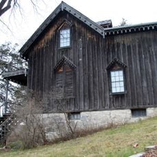
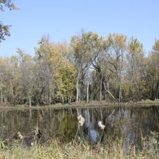
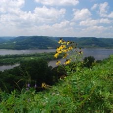
Perrot State Park sits where the Trempealeau and Mississippi rivers meet, encompassing roughly 1,270 acres of woodlands and river bluffs. The protected area provides hiking trails, camping spots, and viewing points for visitors exploring its natural landscape.

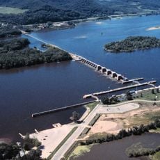
Wisconsin's Conservation Commission established the park in 1918, naming it after Nicolas Perrot, a 17th-century French explorer who traveled the region. The area served as a major trade and transport route for both Indigenous peoples and European traders.

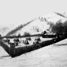
The park holds Native American mounds and settlement remains from before European contact, marking a significant presence along the river valley.

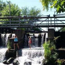
The park is accessible year-round with about 12 miles of trails, camping areas, and boat access points spread throughout the grounds. Visitors should prepare for wet conditions near the rivers and wear sturdy shoes, especially during rainy seasons.

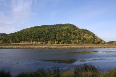
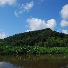
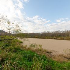
Trempealeau Mountain is a 425-foot limestone outcrop that sits completely isolated from the main bluffs, separated by the Mississippi River channel itself. This unusual geological formation draws visitors curious about how rivers shape the landscape over time.

The community of curious travelers

AroundUs brings together thousands of curated places, local tips, and hidden gems, enriched daily by 60,000 contributors worldwide.

Start exploring
Inception
1918
Operator
Wisconsin Department of Natural Resources
GPS coordinates
44.01861,-91.46750
Latest update
December 9, 2025 18:44
Around this place
Great River Bluffs State Park
United States of America

Great River Bluffs State Park

9.7 km
Basilica of Saint Stanislaus Kostka
United States of America

Basilica of Saint Stanislaus Kostka

12.8 km
Gale College
United States of America

Gale College

10.4 km
Willard Bunnell House
United States of America

Willard Bunnell House

7.4 km
Lock and Dam No. 6
United States of America

Lock and Dam No. 6

3.1 km
Trempealeau Mountain State Natural Area
United States of America

Trempealeau Mountain State Natural Area

2.2 km
Trempealeau National Wildlife Refuge
United States of America

Trempealeau National Wildlife Refuge

8.7 km
Watkins Manor House
United States of America

Watkins Manor House

13.8 km
Pickwick Mill
United States of America

Pickwick Mill

4.9 km
Winona Rail Bridge
United States of America

Winona Rail Bridge

11.2 km
Sacred Heart-Saint Wenceslaus Church
United States of America

Sacred Heart-Saint Wenceslaus Church

13.7 km
Tollef Jensen House
United States of America

Tollef Jensen House

11.2 km
Fort Trempealeau
United States of America

Fort Trempealeau

671 m
Latsch Building
United States of America

Latsch Building

13.8 km
Brady's Bluff Prairie State Natural Area
United States of America

Brady's Bluff Prairie State Natural Area

1.3 km
Bridge No. 4
United States of America

Bridge No. 4

11.8 km
Coman House
United States of America

Coman House

3.1 km
Winona City Hall
United States of America

Winona City Hall

14 km
Washington–Kosciusko Elementary School
United States of America

Washington–Kosciusko Elementary School

12.4 km
Downtown Historic District
United States of America

Downtown Historic District

11.9 km
Ridge Avenue Historic District
United States of America

Ridge Avenue Historic District

11.5 km
Polish Cultural Institute and Museum
United States of America

Polish Cultural Institute and Museum

13.3 km
Anger's Block
United States of America

Anger's Block

13.8 km
John F. Cance House
United States of America

John F. Cance House

12 km
Main Street Historic District
United States of America

Main Street Historic District

2.5 km
Pickwick Mill Inc
United States of America

Pickwick Mill Inc

4.9 km
Watkins Museum
United States of America

Watkins Museum

13.3 km
Van Loon Wildlife Area
United States of America

Van Loon Wildlife Area

11.5 km
Show the full map
« Perrot State Park - State park in Trempealeau County, United States » is provided by Around Us (aroundus.com). Images and texts are derived from Wikimedia project under a Creative Commons license. You are allowed to copy, distribute, and modify copies of this page, under the conditions set by the license, as long as this note is clearly visible.

Discover hidden gems everywhere you go!

From secret cafés to breathtaking viewpoints, skip the crowded tourist spots and find places that match your style. Our app makes it easy with voice search, smart filtering, route optimization, and insider tips from travelers worldwide. Download now for the complete mobile experience.

Around Us App Screenshot

A unique approach to discovering new places

Le Figaro

All the places worth exploring

France Info

A tailor-made excursion in just a few clicks

20 Minutes

Around Us
Travel Guide & Maps
Download

Send to your phone

QR Code
1

Open the camera app on your mobile.

2

Point at the QR code with your camera. A notification will appear.

3

Tap the notification to open the link.