Enable Location

We need your location to show you interesting places around you

Discover nearby places

Find interesting locations and hidden gems around you

Precise directions

Get accurate directions and distances to places

Your location is never shared with other users. It's only used when you tap the location button.

Banning State Park

Log in to your account

Start exploring — it's free

Trusted by 61,904 travelers worldwide

Continue with Google
Continue with Apple
or

We will send you a code to connect

By continuing, you accept our Terms and Conditions and our Privacy Policy

Check your inbox

We've sent a pincode in your inbox. Please enter the code below.

Banning State Park

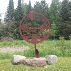
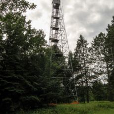
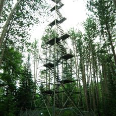
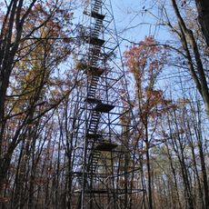
Banning State Park, Minnesota state park in Pine County, United States

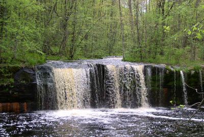
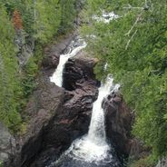
Banning State Park is a Minnesota state park where a river cuts through sandstone cliffs and creates whitewater rapids. The landscape features steep rocky banks, dense forests, and multiple waterfalls shaped by the flowing water.

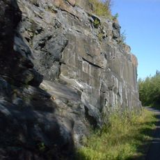
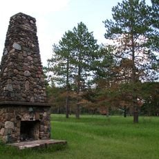
In the late 1800s, a sandstone quarry operated in this area and supplied stone for building across the region before shutting down. This early industrial activity eventually gave way to the site becoming protected parkland.

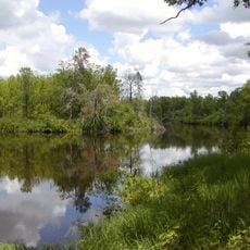
The river and forests held deep meaning for people who hunted and fished here long ago. Visitors today can feel this connection to the land as they move through the park.

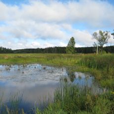
The park offers trails for hiking and a campground with spaces for overnight stays. Plan for uneven ground, wet areas near the river, and bring sturdy footwear if you explore the rocky terrain.

One waterfall here drops over layers of stone in steps, resembling a natural staircase that shifts with the seasons. The river has carved this formation gradually over time.

The community of curious travelers

AroundUs brings together thousands of curated places, local tips, and hidden gems, enriched daily by 60,000 contributors worldwide.

Start exploring
Location
Inception
1963
GPS coordinates
46.16470,-92.85440
Latest update
December 6, 2025 16:04
Minnesota secret locations and unusual places

Minnesota contains numerous locations away from the main tourist circuits. The state stretches from the shores of Lake Superior to the southern prairies, encompassing historic lighthouses, underground mines, waterfalls, and Japanese gardens. Visitors find both natural landscapes and cultural sites...

Around this place
St. Croix State Park
United States of America

St. Croix State Park

29.8 km
Father Hennepin State Park
United States of America

Father Hennepin State Park

48.9 km
Willard Munger State Trail
United States of America

Willard Munger State Trail

32.6 km
Moose Lake State Park
United States of America

Moose Lake State Park

32.1 km
Mille Lacs National Wildlife Refuge
United States of America

Mille Lacs National Wildlife Refuge

55.7 km
Rice Lake National Wildlife Refuge
United States of America

Rice Lake National Wildlife Refuge

55.1 km
Fond du Lac State Forest
United States of America

Fond du Lac State Forest

57.2 km
Svenska Mission Kyrka I Sodre Maple Ridge
United States of America

Svenska Mission Kyrka I Sodre Maple Ridge

66.5 km
Church of Sts. Joseph and Mary-Catholic
United States of America

Church of Sts. Joseph and Mary-Catholic

60.2 km
Carlton County Courthouse
United States of America

Carlton County Courthouse

64.7 km
Ogilvie Watertower
United States of America

Ogilvie Watertower

57.9 km
Kanabec County Courthouse
United States of America

Kanabec County Courthouse

46.6 km
Snake River Fur Post
United States of America

Snake River Fur Post

41.8 km
Goose Creek
United States of America

Goose Creek

63.5 km
Arthyde Stone House
United States of America

Arthyde Stone House

27.8 km
Daniels Town Hall
United States of America

Daniels Town Hall

52.8 km
Hinckley Fire Museum
United States of America

Hinckley Fire Museum

18 km
Solana State Forest
United States of America

Solana State Forest

31.7 km
Snake River Fur Post State Historic Site
United States of America

Snake River Fur Post State Historic Site

40.3 km
St. Croix Recreational Demonstration Area
United States of America

St. Croix Recreational Demonstration Area

31.4 km
St. Croix State Park Fire Tower
United States of America

St. Croix State Park Fire Tower

25.9 km
Rush City Aquatic Center
United States of America

Rush City Aquatic Center

54 km
Cromwell Lookout Tower
United States of America

Cromwell Lookout Tower

60.5 km
Mille Lacs Kathio Observation Tower
United States of America

Mille Lacs Kathio Observation Tower

68.1 km
Nickerson Lookout Tower
United States of America

Nickerson Lookout Tower

36.3 km
White Pine Lookout Tower
United States of America

White Pine Lookout Tower

34 km
Cloquet Lookout Tower
United States of America

Cloquet Lookout Tower

63.5 km
Pomroy Lookout Tower
United States of America

Pomroy Lookout Tower

31.9 km
Show the full map
« Banning State Park - Minnesota state park in Pine County, United States » is provided by Around Us (aroundus.com). Images and texts are derived from Wikimedia project under a Creative Commons license. You are allowed to copy, distribute, and modify copies of this page, under the conditions set by the license, as long as this note is clearly visible.

Discover hidden gems everywhere you go!

From secret cafés to breathtaking viewpoints, skip the crowded tourist spots and find places that match your style. Our app makes it easy with voice search, smart filtering, route optimization, and insider tips from travelers worldwide. Download now for the complete mobile experience.

Around Us App Screenshot

A unique approach to discovering new places

Le Figaro

All the places worth exploring

France Info

A tailor-made excursion in just a few clicks

20 Minutes

Around Us
Travel Guide & Maps
Download

Send to your phone

QR Code
1

Open the camera app on your mobile.

2

Point at the QR code with your camera. A notification will appear.

3

Tap the notification to open the link.