Enable Location

We need your location to show you interesting places around you

Discover nearby places

Find interesting locations and hidden gems around you

Precise directions

Get accurate directions and distances to places

Your location is never shared with other users. It's only used when you tap the location button.

Willard Munger State Trail

Log in to your account

Start exploring — it's free

Trusted by 62,546 travelers worldwide

Continue with Google
Continue with Apple
or

We will send you a code to connect

By continuing, you accept our Terms and Conditions and our Privacy Policy

Check your inbox

We've sent a pincode in your inbox. Please enter the code below.

Willard Munger State Trail

Willard Munger State Trail, Weg in den Vereinigten Staaten

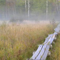
The Willard Munger State Trail is a paved path in Minnesota that runs from Hinckley to Duluth, passing through forests, farmland, and small towns along the way. The trail follows an old railroad route, providing a flat surface suitable for walking, biking, and snowmobiling in winter months.

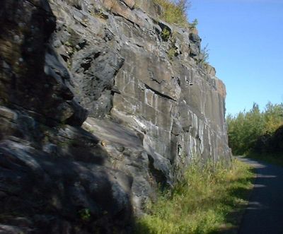
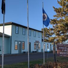
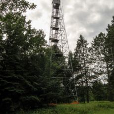
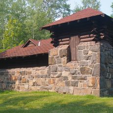
The trail follows the route of an old railroad that played a key role during the fires in Hinckley in 1894 and Cloquet in 1918, helping rescue efforts and moving supplies. A section called the Hinkley Fire Trail, about 23 miles long, marks this historical path and honors the region's past.

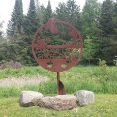
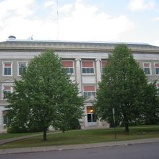
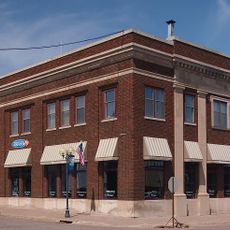
The trail is named after Willard Munger, a Minnesota lawmaker who supported environmental protection and the building of paths for walking and biking. It connects nine communities across northeastern Minnesota and serves the local area as a place for outdoor activity and recreation.

The trail is open year-round with parking available in towns like Hinckley, Finlayson, Willow River, and Duluth, though some locations require a vehicle permit. Restrooms are available at many points along the route, especially in state parks and public areas.

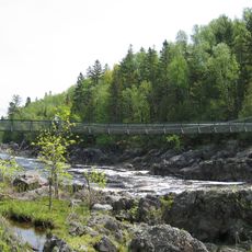
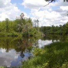
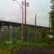
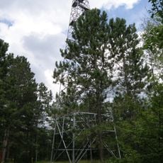
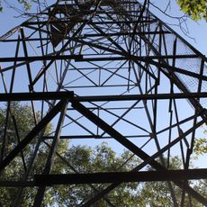
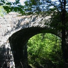
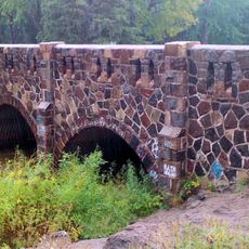
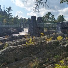
The Thomson trestle bridge is an old railroad span offering wide views of the St. Louis River where visitors can stop and look out, while kayakers paddle through rapids below. Along the route, hemlock trees stand as remnants of natural forest, adding to the sense of walking through a wooded landscape.

The community of curious travelers

AroundUs brings together thousands of curated places, local tips, and hidden gems, enriched daily by 60,000 contributors worldwide.

Start exploring
Location
GPS coordinates
46.45140,-92.76810
Latest update
February 9, 2026 08:23
Around this place
Jay Cooke State Park
United States of America

Jay Cooke State Park

40.1 km
Banning State Park
United States of America

Banning State Park

32.6 km
Pattison State Park
United States of America

Pattison State Park

50.2 km
St. Croix State Park
United States of America

St. Croix State Park

55 km
Big Manitou Falls
United States of America

Big Manitou Falls

50.5 km
Savanna Portage State Park
United States of America

Savanna Portage State Park

52.2 km
Moose Lake State Park
United States of America

Moose Lake State Park

2.7 km
Rice Lake National Wildlife Refuge
United States of America

Rice Lake National Wildlife Refuge

44.5 km
Oliver Bridge
United States of America

Oliver Bridge

49 km
Fond du Lac State Forest
United States of America

Fond du Lac State Forest

25.2 km
Savanna State Forest
United States of America

Savanna State Forest

51.8 km
Church of Sts. Joseph and Mary-Catholic
United States of America

Church of Sts. Joseph and Mary-Catholic

27.8 km
Carlton County Courthouse
United States of America

Carlton County Courthouse

35.5 km
Bridge No. L6007
United States of America

Bridge No. L6007

50 km
Bridge No. 5757
United States of America

Bridge No. 5757

44.3 km
Cloquet City Hall
United States of America

Cloquet City Hall

38.1 km
Arthyde Stone House
United States of America

Arthyde Stone House

26.9 km
Cloquet-Northern Office Building
United States of America

Cloquet-Northern Office Building

38.1 km
Hinckley Fire Museum
United States of America

Hinckley Fire Museum

50.4 km
Solana State Forest
United States of America

Solana State Forest

35 km
Swinging Bridge, Minnesota
United States of America

Swinging Bridge, Minnesota

37.9 km
Nickerson Lookout Tower
United States of America

Nickerson Lookout Tower

20 km
White Pine Lookout Tower
United States of America

White Pine Lookout Tower

37.3 km
Jay Cooke State Park CCC/Rustic Style Historic District‎
United States of America

Jay Cooke State Park CCC/Rustic Style Historic District‎

37.9 km
Cromwell Lookout Tower
United States of America

Cromwell Lookout Tower

29 km
Floodwood Lookout Tower
United States of America

Floodwood Lookout Tower

54.4 km
Jay Cooke State Park CCC/WPA/Rustic Style Picnic Grounds
United States of America

Jay Cooke State Park CCC/WPA/Rustic Style Picnic Grounds

39.1 km
Cloquet Lookout Tower
United States of America

Cloquet Lookout Tower

32.2 km
Show the full map
« Willard Munger State Trail - Weg in den Vereinigten Staaten » is provided by Around Us (aroundus.com). Images and texts are derived from Wikimedia project under a Creative Commons license. You are allowed to copy, distribute, and modify copies of this page, under the conditions set by the license, as long as this note is clearly visible.

Discover hidden gems everywhere you go!

From secret cafés to breathtaking viewpoints, skip the crowded tourist spots and find places that match your style. Our app makes it easy with voice search, smart filtering, route optimization, and insider tips from travelers worldwide. Download now for the complete mobile experience.

Around Us App Screenshot

A unique approach to discovering new places

Le Figaro

All the places worth exploring

France Info

A tailor-made excursion in just a few clicks

20 Minutes

Around Us
Travel Guide & Maps
Download

Send to your phone

QR Code
1

Open the camera app on your mobile.

2

Point at the QR code with your camera. A notification will appear.

3

Tap the notification to open the link.