Mount Holyoke, Mountain summit in western Massachusetts, US.
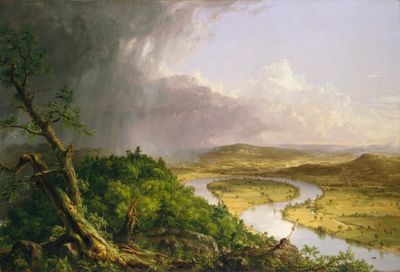
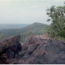
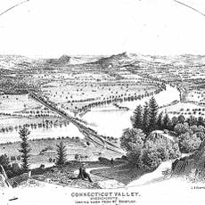
Mount Holyoke is a summit made of igneous rock in western Massachusetts, sitting at the westernmost point of the Metacomet Ridge along the Connecticut River Valley. The peak rises clearly above the surrounding lowlands, with the river valley visible on both sides from the top.
The mountain takes its name from Elizur Holyoke, an early English explorer who mapped the region during the first decades of European settlement in Massachusetts. His surveys gave names to several features in the area that have remained in use ever since.
Mount Holyoke College, a few miles from the summit, has kept a hiking tradition alive since the 1800s, with chapel bells calling students to climb on a set day each year. The tradition is still observed today and gives the mountain a presence in campus life beyond its role as a natural landmark.
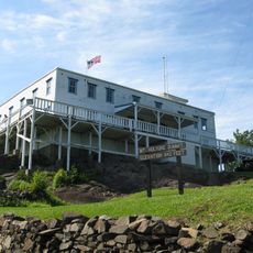
A road to the top is open from spring through late autumn, so the summit is reachable by car as well as on foot. A building at the top is staffed on weekends and holidays in summer and can offer shelter if the weather changes quickly.
The building at the top began as a modest guest shelter in 1821 and was rebuilt as a two-story structure by 1851. A covered tramway was later added to help visitors manage the steepest part of the ascent, which was an unusual feature for a mountain facility of that era.
The community of curious travelers
AroundUs brings together thousands of curated places, local tips, and hidden gems, enriched daily by 60,000 contributors worldwide.