Log in to your account

AroundUs is a community-driven map of interesting places, built by curious explorers like you. It grows with every review, story, and photo you share.
Connect to save your favorite spots, contribute locations, and create personalized routes.
Continue with Google
Continue with Apple
Continue with X
Continue with Facebook
Continue with email
By continuing, you accept our Terms and Conditions and our Privacy Policy
Create an account

Anacostia Tributary Trail System

Add to collection
Map
Suggest a change
Share

Anacostia Tributary Trail System, Recreational trail network in Prince George's and Montgomery Counties, Maryland.

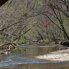
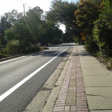
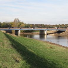
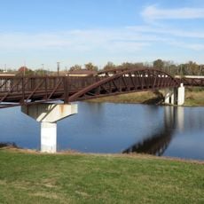
The Anacostia Tributary Trail System is a network of paved and natural paths that follow several streams feeding into the Anacostia River, extending across multiple miles through both counties. The trails connect parks and green spaces, offering different sections for various types of outdoor activities.

The network was created in the 1970s as part of drainage and sewage projects managed by regional parks authorities. The first sections opened to the public in 1977.

Local people use these paths for gatherings and activities that bring residents from both counties together. You will see cyclists and walkers enjoying the trails, making it a space where the community naturally meets outdoors.

You can enter the trails at multiple locations with parking available at different access points and clear signs showing directions and distances. It helps to check a map beforehand since the paths have different starting and ending points throughout the two counties.

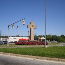
The zero milepost located in Hyattsville serves as the central meeting point where several trail branches converge to form the hub of the network. Many visitors use this junction naturally as a starting reference, even though it is not always formally marked as the official center.

Location: Prince George's County

Location: Montgomery County

GPS coordinates: 38.96140,-76.92530

Latest update: December 13, 2025 17:06

Photos
Around this place
DeMatha Catholic High School
United States of America

DeMatha Catholic High School

1.5 km
Peace Cross
United States of America

Peace Cross

2.8 km
Riversdale
United States of America

Riversdale

584 m
Northwest Branch Anacostia River
United States of America

Northwest Branch Anacostia River

2.6 km
Adele H. Stamp Student Union
United States of America

Adele H. Stamp Student Union

3.4 km
The Rossborough Inn
United States of America

The Rossborough Inn

2.9 km
Northwest Branch Trail
United States of America

Northwest Branch Trail

2.3 km
Bostwick
United States of America

Bostwick

2.8 km
University of Maryland Art Gallery
United States of America

University of Maryland Art Gallery

3.3 km
George Washington House
United States of America

George Washington House

2.7 km
University of Maryland Arboretum & Botanical Garden
United States of America

University of Maryland Arboretum & Botanical Garden

2.9 km
William Hilleary House
United States of America

William Hilleary House

2.7 km
Old Town College Park
United States of America

Old Town College Park

1.1 km
Calvert Hills Historic District
United States of America

Calvert Hills Historic District

1.7 km
Market Master's House
United States of America

Market Master's House

2.7 km
Hyattsville Historic District
United States of America

Hyattsville Historic District

2 km
Library of American Broadcasting
United States of America

Library of American Broadcasting

3.3 km
Hilltop Manor
United States of America

Hilltop Manor

2.1 km
Harry Smith House
United States of America

Harry Smith House

722 m
Cory House
United States of America

Cory House

2.2 km
Bladensburg Road Bridge
United States of America

Bladensburg Road Bridge

3 km
United States Post Office–Hyattsville Main
United States of America

United States Post Office–Hyattsville Main

1.7 km
College Heights Estates Historic District
United States of America

College Heights Estates Historic District

2.8 km
Marenka House
United States of America

Marenka House

1.9 km
North Brentwood Historic District
United States of America

North Brentwood Historic District

3 km
Bladensburg Park Pedestrian Bridge
United States of America

Bladensburg Park Pedestrian Bridge

3.1 km
Tydings Hall
United States of America

Tydings Hall

3.1 km
Lake Artemesia
United States of America

Lake Artemesia

2.8 km
Show the full map
Reviews

Visited this place? Tap the stars to rate it and share your experience / photos with the community! Try now! You can cancel it anytime.

« Anacostia Tributary Trail System - Recreational trail network in Prince George's and Montgomery Counties, Maryland » is provided by Around Us (aroundus.com). Images and texts are derived from Wikimedia project under a Creative Commons license. You are allowed to copy, distribute, and modify copies of this page, under the conditions set by the license, as long as this note is clearly visible.

Discover hidden gems everywhere you go!

From secret cafés to breathtaking viewpoints, skip the crowded tourist spots and find places that match your style. Our app makes it easy with voice search, smart filtering, route optimization, and insider tips from travelers worldwide. Download now for the complete mobile experience.

Around Us App Screenshot

A unique approach to discovering new places

Le Figaro

All the places worth exploring

France Info

A tailor-made excursion in just a few clicks

20 Minutes