Ashmore Estates

Log in to your account

AroundUs is a community-driven map of interesting places, built by curious explorers like you. It grows with every review, story, and photo you share.
Connect to save your favorite spots, contribute locations, and create personalized routes.
Continue with Google
Continue with Apple
Continue with X
Continue with Facebook
Continue with email
By continuing, you accept our Terms and Conditions and our Privacy Policy
Create an account
Add to collection
Map
Suggest a change
Share

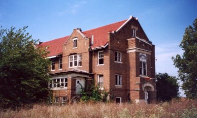
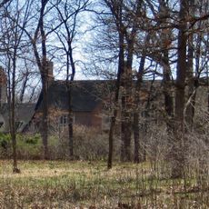
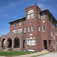
Ashmore Estates, Former psychiatric facility in Ashmore, Illinois.

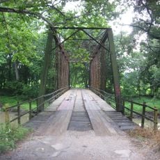
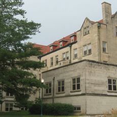
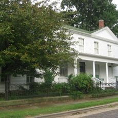
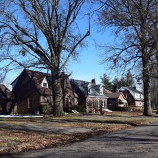
Ashmore Estates is a two-story brick building with Neo-Georgian architectural features, situated near a historic railroad crossing in rural Illinois. The structure displays early 20th-century construction methods and materials characteristic of institutional buildings from that era.

The facility was constructed in 1916 as a successor to the original Coles County Poor Farm and provided care for those in need until 1959. It represents a chapter in the region's approach to social support that spanned nearly half a century.

The property maintains records of 250 former residents from its early period, with a cemetery containing between 60 and 100 unmarked graves.

The property is privately owned and visitors should obtain permission from the current owners before visiting. Daytime visits work best for viewing the building's features and exploring the surrounding grounds safely.

A winter windstorm in January 2013 caused severe damage to the roof, prompting extensive restoration by later owners. The property also preserves records of roughly 250 former residents from its early years and maintains a cemetery with dozens of unmarked graves that speak to its long history.

Location: Illinois

Inception: September 1, 1916

GPS coordinates: 39.52900,-88.04980

Latest update: December 7, 2025 19:31

Photos
Around this place
Lincoln Log Cabin State Historic Site
United States of America

Lincoln Log Cabin State Historic Site

21.2 km
Airtight Bridge
United States of America

Airtight Bridge

4.5 km
Pemberton Hall
United States of America

Pemberton Hall

12 km
Old Main
United States of America

Old Main

11.9 km
Health Education Building
United States of America

Health Education Building

12.1 km
Edgar County Courthouse
United States of America

Edgar County Courthouse

31.9 km
Stone Quarry Bridge
United States of America

Stone Quarry Bridge

5.2 km
Coles County Courthouse
United States of America

Coles County Courthouse

11.4 km
Alexander Briggs House
United States of America

Alexander Briggs House

11.8 km
Arcola Carnegie Public Library
United States of America

Arcola Carnegie Public Library

27.9 km
Philip D. Armour III House
United States of America

Philip D. Armour III House

20.8 km
Dr. Hiram Rutherford House and Office
United States of America

Dr. Hiram Rutherford House and Office

14.1 km
Unity Church
United States of America

Unity Church

29 km
Harrison Street Bridge
United States of America

Harrison Street Bridge

7 km
United States Post Office (Mattoon, Illinois)
United States of America

United States Post Office (Mattoon, Illinois)

28.5 km
Richland County Courthouse
United States of America

Richland County Courthouse

22.7 km
Will Rogers Theatre
United States of America

Will Rogers Theatre

11.3 km
McFarland House
United States of America

McFarland House

11.5 km
Greenup Commercial Historic District
United States of America

Greenup Commercial Historic District

32.8 km
Burgess-Osborne Memorial Auditorium
United States of America

Burgess-Osborne Memorial Auditorium

28.5 km
Pine Grove Community Club
United States of America

Pine Grove Community Club

31.9 km
Paris Elks Lodge No. 812 Building
United States of America

Paris Elks Lodge No. 812 Building

31.9 km
Blakeman Bridge
United States of America

Blakeman Bridge

11.6 km
Richard Roytek House
United States of America

Richard Roytek House

30.5 km
Shaw-Van Gilder House
United States of America

Shaw-Van Gilder House

32 km
Henry Clay Moss House
United States of America

Henry Clay Moss House

31.9 km
Sixth, Seventh, and Tenth Street Stone Arch Bridges
United States of America

Sixth, Seventh, and Tenth Street Stone Arch Bridges

11.4 km
Lumpkin Heights and Elm Ridge Subdivision Historic District
United States of America

Lumpkin Heights and Elm Ridge Subdivision Historic District

26.9 km
Show the full map
Reviews

Visited this place? Tap the stars to rate it and share your experience / photos with the community! Try now! You can cancel it anytime.

« Ashmore Estates - Former psychiatric facility in Ashmore, Illinois » is provided by Around Us (aroundus.com). Images and texts are derived from Wikimedia project under a Creative Commons license. You are allowed to copy, distribute, and modify copies of this page, under the conditions set by the license, as long as this note is clearly visible.

Discover hidden gems everywhere you go!

From secret cafés to breathtaking viewpoints, skip the crowded tourist spots and find places that match your style. Our app makes it easy with voice search, smart filtering, route optimization, and insider tips from travelers worldwide. Download now for the complete mobile experience.

Around Us App Screenshot

A unique approach to discovering new places

Le Figaro

All the places worth exploring

France Info

A tailor-made excursion in just a few clicks

20 Minutes