Enable Location

We need your location to show you interesting places around you

Discover nearby places

Find interesting locations and hidden gems around you

Precise directions

Get accurate directions and distances to places

Your location is never shared with other users. It's only used when you tap the location button.

Bayard Park Neighborhood

Log in to your account

Join the adventure

Create your free account and start exploring (like 60k+ others)

We will send you a code to connect

or
Continue with Google
Continue with Apple
By continuing, you accept our Terms and Conditions and our Privacy Policy

Check your inbox

We've sent a pincode in your inbox. Please enter the code below.

Bayard Park Neighborhood, Historic residential district in Evansville, Indiana, US.

Description

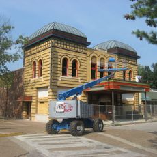
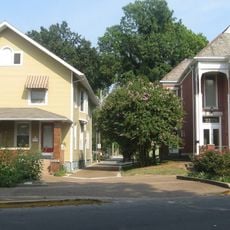
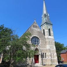
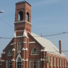
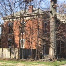
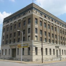
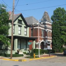
Bayard Park is a residential district in Evansville containing about 335 buildings spread across 87 acres that show different building styles from the late 1800s onward. The neighborhood holds Queen Anne houses, small bungalows, and American Foursquare residences standing side by side and forming a unified residential area.

History

The district came about in the late 1800s when Evansville grew eastward and created its first planned neighborhood in 1893 with strict rules against businesses. This early planning allowed the area to grow as a coherent residential community rather than developing randomly.

Culture

Residents and visitors pass through the park regularly for walks and quiet moments, while the mixture of homes from different decades shows how local families chose to live. This neighborhood keeps alive the memory of how Evansville grew into a more prosperous city.

Practical

The neighborhood stretches from Lincoln Avenue to Washington Avenue and from US Highway 41 to Garvin Street, making it easy to walk through. The central park serves as a good landmark and offers a place to rest while exploring the streets.

Did you know?

Martha Orr Bayard donated ten acres in 1901 for the park on the condition that it would bear her husband's name and that she would design the landscaping herself. Her hand in shaping the park's layout remains visible to visitors today.

Location
GPS coordinates
37.96580,-87.55000
Latest update
December 14, 2025 12:24

AroundUs brings together thousands of curated places, local tips, and hidden gems, enriched daily by 60,000 contributors worldwide. Discover all places nearby (Indiana).

Around this place
Victory Theatre
United States of America

Victory Theatre

1.8 km
Children's Museum of Evansville
United States of America

Children's Museum of Evansville

1.8 km
St. Benedict Cathedral
United States of America

St. Benedict Cathedral

958 m
United States of America

Haynies Corner Arts District

1.5 km
Riverside Historic District
United States of America

Riverside Historic District

1.7 km
Alhambra Theatorium
United States of America

Alhambra Theatorium

1.4 km
Washington Avenue Historic District
United States of America

Washington Avenue Historic District

683 m
St. Paul's Episcopal Church
United States of America

St. Paul's Episcopal Church

1.7 km
Liberty Baptist Church
United States of America

Liberty Baptist Church

1.3 km
Trinity United Methodist Church
United States of America

Trinity United Methodist Church

1.8 km
Independence Historic District
United States of America

Independence Historic District

683 m
Auto Hotel Building
United States of America

Auto Hotel Building

1.9 km
John W. Boehne House
United States of America

John W. Boehne House

676 m
Huber Motor Sales Building
United States of America

Huber Motor Sales Building

1.8 km
Conner's Bookstore
United States of America

Conner's Bookstore

1.8 km
Firestone Tire and Rubber Store
United States of America

Firestone Tire and Rubber Store

1.7 km
Peter Augustus Maier House
United States of America

Peter Augustus Maier House

1.2 km
M.G. Newman Building
United States of America

M.G. Newman Building

1.8 km
William Bedford Sr. House
United States of America

William Bedford Sr. House

254 m
Barrett's Britz Building
United States of America

Barrett's Britz Building

1.9 km
Michael Schaeffer House
United States of America

Michael Schaeffer House

1.1 km
Harding and Miller Music Company
United States of America

Harding and Miller Music Company

1.8 km
Parson and Scoville Building
United States of America

Parson and Scoville Building

1.6 km
O'Donnell Building
United States of America

O'Donnell Building

1.9 km
Gemcraft-Wittmer Building
United States of America

Gemcraft-Wittmer Building

1.8 km
Masonic Temple
United States of America

Masonic Temple

1.8 km
Lincolnshire Historic District
United States of America

Lincolnshire Historic District

1.9 km
Riverside Historic District
United States of America

Riverside Historic District

1.9 km
Show the full map
« Bayard Park Neighborhood - Historic residential district in Evansville, Indiana, US » is provided by Around Us (aroundus.com). Images and texts are derived from Wikimedia project under a Creative Commons license. You are allowed to copy, distribute, and modify copies of this page, under the conditions set by the license, as long as this note is clearly visible.

Discover hidden gems everywhere you go!

From secret cafés to breathtaking viewpoints, skip the crowded tourist spots and find places that match your style. Our app makes it easy with voice search, smart filtering, route optimization, and insider tips from travelers worldwide. Download now for the complete mobile experience.

Around Us App Screenshot

A unique approach to discovering new places

Le Figaro

All the places worth exploring

France Info

A tailor-made excursion in just a few clicks

20 Minutes

Around Us
Travel Guide & Maps
Download

Send to your phone

QR Code
1

Open the camera app on your mobile.

2

Point at the QR code with your camera. A notification will appear.

3

Tap the notification to open the link.