Blairstown Historic District

Log in to your account

AroundUs is a community-driven map of interesting places, built by curious explorers like you. It grows with every review, story, and photo you share.
Connect to save your favorite spots, contribute locations, and create personalized routes.
Continue with Google
Continue with Apple
Continue with X
Continue with Facebook
Continue with email
By continuing, you accept our Terms and Conditions and our Privacy Policy
Create an account
Add to collection
Map
Suggest a change
Share

Blairstown Historic District, Historic district in Blairstown, New Jersey, US.

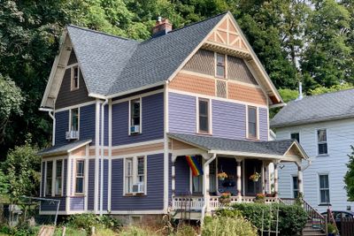
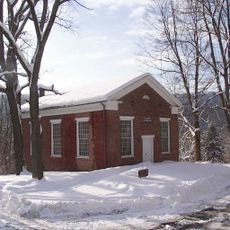
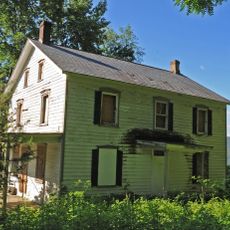
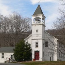
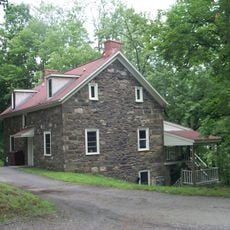
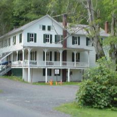
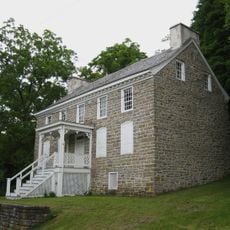
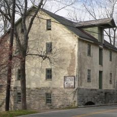
Blairstown Historic District is a collection of Renaissance Revival buildings spread across several streets in Warren County, dating from 1880 to 1900. The area includes residential homes, commercial structures, and public buildings designed by prominent architects of the period.

The district developed after the railroad arrived in the 1830s and was named in 1839 for railroad industrialist John I. Blair. The building boom in the following decades created the collection of structures visible today, reflecting the railroad's importance to the town's growth.

The district served as a center for education and local enterprise, with its buildings reflecting how residents lived and worked during the late 1800s. The structures show the community's connection to the railroad industry and its role in shaping daily life.

The best way to explore the area is on foot along the main streets and side roads to see all the buildings in detail. Local information sources have maps and details that help you understand the architecture and history more deeply.

Two renowned architects, Charles Graham and Addison Hutton, shaped the district's appearance with their different design approaches, creating a mix of Italianate and Queen Anne styles. This architectural variety shows the taste and ambitions of the local elite during that era.

Location: Blairstown

Architectural style: Renaissance Revival architecture

GPS coordinates: 40.98306,-74.95972

Latest update: December 14, 2025 18:15

Photos
Around this place
United States of America

Land of Make Believe

9 km
Jenny Jump State Forest
United States of America

Jenny Jump State Forest

7.4 km
Paulinskill Viaduct
United States of America

Paulinskill Viaduct

9.4 km
Sunfish Pond
United States of America

Sunfish Pond

9.8 km
Worthington State Forest
United States of America

Worthington State Forest

10.6 km
Siddhachalam
United States of America

Siddhachalam

3.2 km
Pahaquarry Copper Mine
United States of America

Pahaquarry Copper Mine

8.4 km
Minisink Archaeological Site
United States of America

Minisink Archaeological Site

12.6 km
Cold Spring Farm Springhouse
United States of America

Cold Spring Farm Springhouse

10.1 km
St. Luke's Episcopal Church
United States of America

St. Luke's Episcopal Church

8.1 km
Zion Lutheran Church
United States of America

Zion Lutheran Church

9.2 km
Spring Valley Christian Church Site
United States of America

Spring Valley Christian Church Site

3 km
John Michael Farm
United States of America

John Michael Farm

10 km
Harmony Hill United Methodist Church
United States of America

Harmony Hill United Methodist Church

9.3 km
Happiness is Camping
United States of America

Happiness is Camping

4.6 km
Capt. Jacob Shoemaker House
United States of America

Capt. Jacob Shoemaker House

12.5 km
Schoonover Mountain House
United States of America

Schoonover Mountain House

11.6 km
Old Mine Road Historic District
United States of America

Old Mine Road Historic District

11.8 km
Casper and Abraham Shafer Grist Mill Complex
United States of America

Casper and Abraham Shafer Grist Mill Complex

9.1 km
Warrington Stone Bridge
United States of America

Warrington Stone Bridge

11.2 km
Fairview Schoolhouse
United States of America

Fairview Schoolhouse

8.3 km
Johnsonburg Historic District
United States of America

Johnsonburg Historic District

7.2 km
Abraham Van Campen House
United States of America

Abraham Van Campen House

10 km
Moravian Cemetery
United States of America

Moravian Cemetery

8.2 km
Roy's Hall
United States of America

Roy's Hall

135 m
Colonel Abraham Van Campen House
United States of America

Colonel Abraham Van Campen House

9 km
Moses Van Campen House
United States of America

Moses Van Campen House

8.8 km
Decker Ferry House
United States of America

Decker Ferry House

12.7 km
Show the full map
Reviews

Visited this place? Tap the stars to rate it and share your experience / photos with the community! Try now! You can cancel it anytime.

« Blairstown Historic District - Historic district in Blairstown, New Jersey, US » is provided by Around Us (aroundus.com). Images and texts are derived from Wikimedia project under a Creative Commons license. You are allowed to copy, distribute, and modify copies of this page, under the conditions set by the license, as long as this note is clearly visible.

Discover hidden gems everywhere you go!

From secret cafés to breathtaking viewpoints, skip the crowded tourist spots and find places that match your style. Our app makes it easy with voice search, smart filtering, route optimization, and insider tips from travelers worldwide. Download now for the complete mobile experience.

Around Us App Screenshot

A unique approach to discovering new places

Le Figaro

All the places worth exploring

France Info

A tailor-made excursion in just a few clicks

20 Minutes