Enable Location

We need your location to show you interesting places around you

Discover nearby places

Find interesting locations and hidden gems around you

Precise directions

Get accurate directions and distances to places

Your location is never shared with other users. It's only used when you tap the location button.

Jenny Jump State Forest

Log in to your account

Start exploring — it's free

Trusted by 62,331 travelers worldwide

Continue with Google
Continue with Apple
or

We will send you a code to connect

By continuing, you accept our Terms and Conditions and our Privacy Policy

Check your inbox

We've sent a pincode in your inbox. Please enter the code below.

Jenny Jump State Forest, Mountain state forest in Warren County, New Jersey.

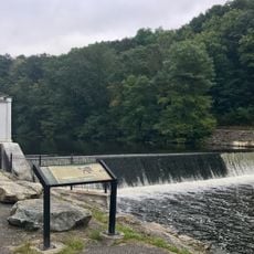
Jenny Jump State Forest is a protected woodland of approximately 4,466 acres in Warren County that stretches along a mountain ridge with rocky slopes and glacial boulders scattered throughout. The terrain features elevation changes that create varied landscapes across the property.

The forest area contains traces from the Wisconsin glaciation period roughly 21,000 years ago, when thick ice sheets from Canada shaped the landscape and left behind the rocky terrain we see today. These glacial influences are visible in the stone formations found throughout the property.

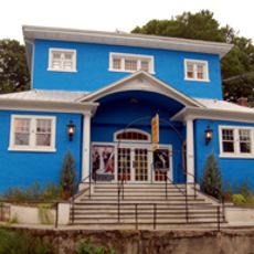
The Greenwood Observatory, built in 1995 by the United Astronomy Clubs of New Jersey, hosts public stargazing sessions throughout the year. Visitors can observe the night sky and learn about astronomy in a setting dedicated to these activities.

The forest has 14 trails for hiking, 22 camping spots, and several shelters where visitors can stay overnight or rest during the day. Ghost Lake is available for fishing while Mountain Lake is suitable for swimming.

The forest sits in one of the darkest zones in New Jersey, making the night sky far more visible than in most surrounding areas. This quality draws photographers and astronomers seeking to capture and study the stars without light interference.

The community of curious travelers

AroundUs brings together thousands of curated places, local tips, and hidden gems, enriched daily by 60,000 contributors worldwide.

Start exploring
Location
Inception
1931
GPS coordinates
40.92203,-74.92558
Latest update
December 8, 2025 19:55
Around this place
Blair Academy
United States of America

Blair Academy

7.7 km
Centenary University
United States of America

Centenary University

11.3 km
Paulinskill Viaduct
United States of America

Paulinskill Viaduct

11.8 km
Rutherfurd Hall
United States of America

Rutherfurd Hall

9.5 km
Siddhachalam
United States of America

Siddhachalam

4.3 km
Shippen Manor
United States of America

Shippen Manor

14.3 km
Darlington's Bridge at Delaware Station
United States of America

Darlington's Bridge at Delaware Station

12.8 km
Stephens State Park
United States of America

Stephens State Park

11.4 km
Oxford Furnace
United States of America

Oxford Furnace

14.5 km
Jacob C. Allen House
United States of America

Jacob C. Allen House

11.2 km
St. Luke's Episcopal Church
United States of America

St. Luke's Episcopal Church

3.9 km
United States of America

Danville Mountain

5.9 km
Blairstown Historic District
United States of America

Blairstown Historic District

7.4 km
Allamuchy Freight House
United States of America

Allamuchy Freight House

8.9 km
Spring Valley Christian Church Site
United States of America

Spring Valley Christian Church Site

9.4 km
Port Murray Historic District
United States of America

Port Murray Historic District

14.5 km
Warren County Courthouse
United States of America

Warren County Courthouse

16.5 km
Beattystown Historic District
United States of America

Beattystown Historic District

13.9 km
Belvidere Historic District
United States of America

Belvidere Historic District

16.4 km
Miller Farmstead
United States of America

Miller Farmstead

15.4 km
Mount Bethel Methodist Church
United States of America

Mount Bethel Methodist Church

10.9 km
Warrington Stone Bridge
United States of America

Warrington Stone Bridge

12.6 km
Oxford Industrial Historic District
United States of America

Oxford Industrial Historic District

14.9 km
Fairview Schoolhouse
United States of America

Fairview Schoolhouse

7.5 km
Johnsonburg Historic District
United States of America

Johnsonburg Historic District

6.4 km
Moravian Cemetery
United States of America

Moravian Cemetery

4 km
Saxton Falls Dam
United States of America

Saxton Falls Dam

11.4 km
Roy's Hall
United States of America

Roy's Hall

7.4 km
Show the full map
« Jenny Jump State Forest - Mountain state forest in Warren County, New Jersey » is provided by Around Us (aroundus.com). Images and texts are derived from Wikimedia project under a Creative Commons license. You are allowed to copy, distribute, and modify copies of this page, under the conditions set by the license, as long as this note is clearly visible.

Discover hidden gems everywhere you go!

From secret cafés to breathtaking viewpoints, skip the crowded tourist spots and find places that match your style. Our app makes it easy with voice search, smart filtering, route optimization, and insider tips from travelers worldwide. Download now for the complete mobile experience.

Around Us App Screenshot

A unique approach to discovering new places

Le Figaro

All the places worth exploring

France Info

A tailor-made excursion in just a few clicks

20 Minutes

Around Us
Travel Guide & Maps
Download

Send to your phone

QR Code
1

Open the camera app on your mobile.

2

Point at the QR code with your camera. A notification will appear.

3

Tap the notification to open the link.