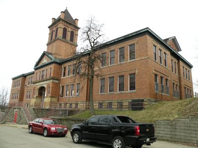
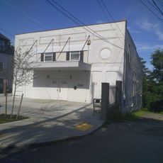
Beltzhoover Elementary School
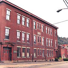
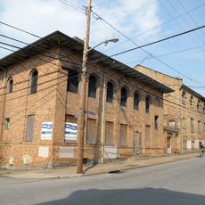
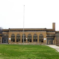
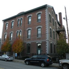
Beltzhoover Elementary School is a school building in Pittsburgh constructed in 1909 by architects William J. Shaw and Thomas Lloyd in the Classical Revival style. Located at the intersection of Cedarhurst and Estella Streets, it features formal symmetrical shapes and columns typical of that architectural period.
The building was constructed in 1909 and served the community as a school for over a century, welcoming students from different backgrounds. It was added to the National Register of Historic Places in 1986 and recognized as a historic structure by the Pittsburgh History & Landmarks Foundation in 2001.
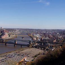
The school bears the name of the Beltzhoover neighborhood, which has provided homes for different communities since the early 20th century. The building displays the classical architecture of that period and serves as a visible symbol of the neighborhood's past for residents today.
The building stands at a clearly visible location at the intersection of Cedarhurst and Estella Streets in the Beltzhoover neighborhood. Visitors can easily view the exterior facade and early 20th-century classical architecture, as it is a distinguishing landmark in the residential area.
The building was overlooked by local architecture discourse for years, despite being officially recognized as historically significant in 1986. Its solid construction and original design have remained surprisingly well preserved through decades of urban change surrounding it.
The community of curious travelers
AroundUs brings together thousands of curated places, local tips, and hidden gems, enriched daily by 60,000 contributors worldwide.