Enable Location

We need your location to show you interesting places around you

Discover nearby places

Find interesting locations and hidden gems around you

Precise directions

Get accurate directions and distances to places

Your location is never shared with other users. It's only used when you tap the location button.

Blackhand Gorge State Nature Preserve

Log in to your account

Start exploring — it's free

Trusted by 63,512 travelers worldwide

Continue with Google
Continue with Apple
or

We will send you a code to connect

By continuing, you accept our Terms and Conditions and our Privacy Policy

Check your inbox

We've sent a pincode in your inbox. Please enter the code below.

Blackhand Gorge State Nature Preserve
Discussion 5.0 1 Reviews 1 Photos
8.4k Popularity

Blackhand Gorge State Nature Preserve, Nature preserve in Licking County, Ohio, United States.

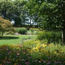
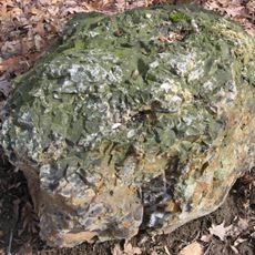
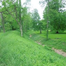
Blackhand Gorge State Nature Preserve is a nature reserve along the Licking River featuring dramatic sandstone cliffs and varied rock formations. The protected land spans several miles and supports a range of plants and wildlife throughout its landscape.

The gorge took its name from a prehistoric petroglyph showing a black hand that was destroyed during 19th-century canal construction. This carved marking had once served as a significant landmark in the ancient landscape.

Native American tribes used the gorge as a passage to reach flint deposits, establishing an agreement that all groups must travel through the area peacefully.

A paved trail runs along the river connecting both entrances and allows visitors to start from either end. The path is easy to walk and lets you explore at your own pace.

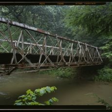
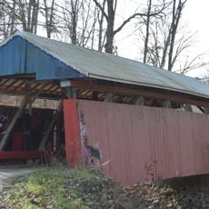
The area was once crossed by different forms of transportation including canal boats and railroads before becoming a protected nature reserve. These layers of human use are still visible in the landscape today, though now only hiking paths remain active.

The community of curious travelers

AroundUs brings together thousands of curated places, local tips, and hidden gems, enriched daily by 60,000 contributors worldwide.

Start exploring
Location
Inception
1975
GPS coordinates
40.05600,-82.24850
Latest update
December 8, 2025 19:57
Around this place
Prospect Place
United States of America

Prospect Place

22 km
Alligator Effigy Mound
United States of America

Alligator Effigy Mound

21.6 km
Y-Bridge
United States of America

Y-Bridge

23.8 km
Dawes Arboretum
United States of America

Dawes Arboretum

16.7 km
Flint Ridge State Memorial
United States of America

Flint Ridge State Memorial

7.4 km
Bryn Du Mansion
United States of America

Bryn Du Mansion

21 km
St. Thomas Aquinas Church
United States of America

St. Thomas Aquinas Church

24.1 km
Masonic Temple Building
United States of America

Masonic Temple Building

24.3 km
Muskingum County Courthouse
United States of America

Muskingum County Courthouse

24.3 km
Midland Theatre
United States of America

Midland Theatre

13 km
St. James Episcopal Church
United States of America

St. James Episcopal Church

24.2 km
Alameda Apartments
United States of America

Alameda Apartments

24.3 km
St. Luke's Episcopal Church
United States of America

St. Luke's Episcopal Church

23.1 km
James Boggs Tannehill House
United States of America

James Boggs Tannehill House

23 km
Glenford Bank
United States of America

Glenford Bank

19.6 km
Avery-Hunter House
United States of America

Avery-Hunter House

23 km
Adena Court Apartments
United States of America

Adena Court Apartments

24.3 km
West View
United States of America

West View

23 km
Lafayette Lodge No. 79
United States of America

Lafayette Lodge No. 79

24.1 km
Parks Covered Bridge
United States of America

Parks Covered Bridge

22.8 km
Newark Earthworks
United States of America

Newark Earthworks

15.6 km
National Heisey Glass Museum
United States of America

National Heisey Glass Museum

13.8 km
Home Building Association Bank
United States of America

Home Building Association Bank

13.1 km
Longaberger Homestead
United States of America

Longaberger Homestead

21.5 km
Daweswood House Museum
United States of America

Daweswood House Museum

16.2 km
Dresden Suspension Bridge
United States of America

Dresden Suspension Bridge

22.4 km
Falling Rock Camp Bridge
United States of America

Falling Rock Camp Bridge

14.2 km
Jacks Hollow Covered Bridge
United States of America

Jacks Hollow Covered Bridge

17.9 km
Show the full map
Reviews

Real people, real opinions — but not verified.

Share your experience
michael_w
michael_w · May 1, 2025
Discussions
Start a discussion...

No discussion yet

« Blackhand Gorge State Nature Preserve - Nature preserve in Licking County, Ohio, United States » is provided by Around Us (aroundus.com). Images and texts are derived from Wikimedia project under a Creative Commons license. You are allowed to copy, distribute, and modify copies of this page, under the conditions set by the license, as long as this note is clearly visible.

Discover hidden gems everywhere you go!

From secret cafés to breathtaking viewpoints, skip the crowded tourist spots and find places that match your style. Our app makes it easy with voice search, smart filtering, route optimization, and insider tips from travelers worldwide. Download now for the complete mobile experience.

Around Us App Screenshot

A unique approach to discovering new places

Le Figaro

All the places worth exploring

France Info

A tailor-made excursion in just a few clicks

20 Minutes

Around Us
Travel Guide & Maps
Download

Send to your phone

QR Code
1

Open the camera app on your mobile.

2

Point at the QR code with your camera. A notification will appear.

3

Tap the notification to open the link.