Chest opened
+${chestReward.xp} XP
Explorer
NOUVEAU ×${chestReward.collectible.quantity}
tapez pour fermer
Chest locked

Open chests in the app

Around Us is built for your phone — chests unlock when you walk, explore and capture nearby places.

Enable Location

We need your location to show you interesting places around you

Discover nearby places

Find interesting locations and hidden gems around you

Precise directions

Get accurate directions and distances to places

Your location is never shared with other users. It's only used when you tap the location button.

Log in to your account

Start exploring — it's free

Trusted by 72,880 travelers worldwide

Continue with Google
Continue with Apple
or

We will send you a code to connect

By continuing, you accept our Terms and Conditions and our Privacy Policy

Check your inbox

We've sent a pincode in your inbox. Please enter the code below.

Lake Byllesby Dam
Discussion Reviews Photo
1.3k Popularity

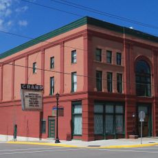
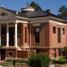
Lake Byllesby Dam, Gravity dam in Randolph and Stanton Townships, Minnesota, United States.

Lake Byllesby Dam is a concrete gravity dam on the Cannon River that creates a large reservoir used for both power generation and water management in the region. The structure has a solid design typical of early hydroelectric facilities, with spillways and control systems that regulate water flow downstream.

Construction began in 1910 under the direction of the Henry M. Byllesby Company to generate hydroelectric power for the region. The facility became one of the early hydroelectric projects in Minnesota and played a role in the area's industrial development.

The dam and its reservoir evolved from an industrial facility to a recreational center where local residents participate in water activities and community gatherings.

The dam is managed by Dakota County and accessible from several public viewing areas where visitors can observe the structure and explore the surrounding area. The reservoir and nearby parks offer different ways to experience the location depending on your interests.

The dam supplies electricity to thousands of homes in the area, making it a significant part of the region's power infrastructure. The site stands as a reminder of how early hydroelectric projects transformed energy access in rural areas.

The community of curious travelers

AroundUs brings together thousands of curated places, local tips, and hidden gems, enriched daily by 60,000 contributors worldwide.

Start exploring
Location
GPS coordinates
44.51180,-92.94000
Latest update
December 14, 2025 17:43
Around this place
Pachyderm Studio
United States of America

Pachyderm Studio

5.7 km
Thorstein Veblen Farmstead
United States of America

Thorstein Veblen Farmstead

20.1 km
Goodsell Observatory
United States of America

Goodsell Observatory

17.8 km
The Cave
United States of America

The Cave

17.6 km
O. E. Rolvaag House
United States of America

O. E. Rolvaag House

19.2 km
Northfield Public Library
United States of America

Northfield Public Library

18.4 km
Valley Grove
United States of America

Valley Grove

21 km
Chimney Rock Scientific and Natural Area
United States of America

Chimney Rock Scientific and Natural Area

14.5 km
United States of America

Miesville Ravine Park Reserve

11.3 km
Exchange Bank Building
United States of America

Exchange Bank Building

21.6 km
Church of the Advent
United States of America

Church of the Advent

21.4 km
Waterford Bridge
United States of America

Waterford Bridge

15.2 km
Willis Hall
United States of America

Willis Hall

18.1 km
Holden Lutheran Church Parsonage
United States of America

Holden Lutheran Church Parsonage

21.5 km
Cross of Christ Lutheran Church
United States of America

Cross of Christ Lutheran Church

19.4 km
Jo Ryo En Japanese Garden
United States of America

Jo Ryo En Japanese Garden

17.7 km
Bonde Farmhouse
United States of America

Bonde Farmhouse

21.6 km
Scoville Memorial Library
United States of America

Scoville Memorial Library

18.1 km
District No. 72 School
United States of America

District No. 72 School

16.5 km
Third Street Bridge
United States of America

Third Street Bridge

2.9 km
Nerstrand City Hall
United States of America

Nerstrand City Hall

21.5 km
All Saints Church-Episcopal
United States of America

All Saints Church-Episcopal

18.4 km
Osmund Osmundson House
United States of America

Osmund Osmundson House

21.2 km
Northfield Historical Society
United States of America

Northfield Historical Society

18.6 km
Old Main, St. Olaf College
United States of America

Old Main, St. Olaf College

20 km
Grand Theatre
United States of America

Grand Theatre

18.4 km
Steensland Library-Saint Olaf College
United States of America

Steensland Library-Saint Olaf College

20 km
Lake Byllesby Regional Park
United States of America

Lake Byllesby Regional Park

841 m
Show the full map
Reviews
Share your experience

No review yet

Discussions
Start a discussion...

No discussion yet

« Lake Byllesby Dam - Gravity dam in Randolph and Stanton Townships, Minnesota, United States » is provided by Around Us (aroundus.com). Images and texts are derived from Wikimedia project under a Creative Commons license. You are allowed to copy, distribute, and modify copies of this page, under the conditions set by the license, as long as this note is clearly visible.

Discover hidden gems everywhere you go!

From secret cafés to breathtaking viewpoints, skip the crowded tourist spots and find places that match your style. Our app makes it easy with voice search, smart filtering, route optimization, and insider tips from travelers worldwide. Download now for the complete mobile experience.

Around Us App Screenshot

A unique approach to discovering new places

Le Figaro

All the places worth exploring

France Info

A tailor-made excursion in just a few clicks

20 Minutes

Around Us
Travel Guide & Maps
Download

Send to your phone

QR Code
1

Open the camera app on your mobile.

2

Point at the QR code with your camera. A notification will appear.

3

Tap the notification to open the link.