Enable Location

We need your location to show you interesting places around you

Discover nearby places

Find interesting locations and hidden gems around you

Precise directions

Get accurate directions and distances to places

Your location is never shared with other users. It's only used when you tap the location button.

Log in to your account

Start exploring — it's free

Trusted by 61,996 travelers worldwide

Continue with Google
Continue with Apple
or

We will send you a code to connect

By continuing, you accept our Terms and Conditions and our Privacy Policy

Check your inbox

We've sent a pincode in your inbox. Please enter the code below.

Castle Mountain

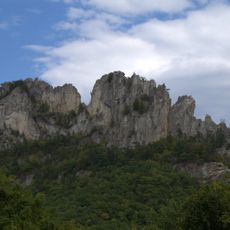
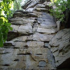
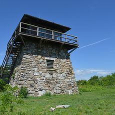
Castle Mountain, Mountain summit in Pendleton County, United States

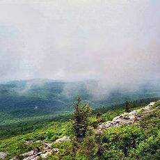
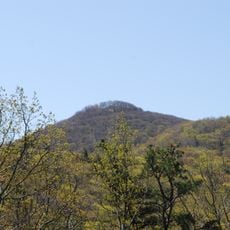
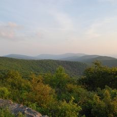
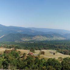
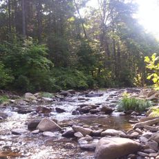
Castle Mountain is a summit in Pendleton County that rises to about 3,400 feet and is covered by dense forest throughout. The terrain offers multiple hiking trails, particularly along the northeastern ridge where various forest types and habitats exist.

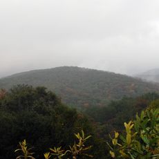
The mountain is part of the Ridge-and-Valley Appalachian formation that developed through tectonic activity over 300 million years ago. This extensive mountain chain continues to define the landscape of the Appalachian region today.

Local people use the mountain regularly for traditional hiking and observe native wildlife as seasons change throughout the year.

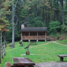
Hikers reach the mountain via marked trails, with main access points near forest service roads in the area. Wear comfortable shoes and prepare for wet conditions and changing weather, especially at higher elevations.

The mountain's location creates specific weather patterns and microclimates that support different plant communities at various elevations. This variety of habitats in a small area makes observing local plants particularly interesting.

The community of curious travelers

AroundUs brings together thousands of curated places, local tips, and hidden gems, enriched daily by 60,000 contributors worldwide.

Start exploring
Location
Part of
Ridge-and-Valley Appalachians
GPS coordinates
38.64595,-79.41810
Latest update
December 14, 2025 20:32
Around this place
United States National Radio Quiet Zone
United States of America

United States National Radio Quiet Zone

31 km
Spruce Knob
United States of America

Spruce Knob

11.6 km
United States of America

Sugar Grove, West Virginia

18.7 km
Shenandoah Mountain
United States of America

Shenandoah Mountain

25.4 km
Smoke Hole Canyon
United States of America

Smoke Hole Canyon

26.5 km
Reddish Knob
United States of America

Reddish Knob

25.5 km
Germany Valley
United States of America

Germany Valley

13.5 km
Seneca Caverns
United States of America

Seneca Caverns

13.3 km
Spruce Knob-Seneca Rocks National Recreation Area
United States of America

Spruce Knob-Seneca Rocks National Recreation Area

21.4 km
Wild Oak Trail
United States of America

Wild Oak Trail

31.2 km
Laurel Fork North Wilderness
United States of America

Laurel Fork North Wilderness

25.4 km
Sites Homestead
United States of America

Sites Homestead

21.5 km
Middle Mountain Cabins
United States of America

Middle Mountain Cabins

27.9 km
Laurel Fork South Wilderness
United States of America

Laurel Fork South Wilderness

27.1 km
Old Probst Church
United States of America

Old Probst Church

15 km
Pendleton County Poor Farm
United States of America

Pendleton County Poor Farm

16.2 km
Monterey High School
United States of America

Monterey High School

30.1 km
Bowers House
United States of America

Bowers House

17.6 km
Ananias Pitsenbarger Farm
United States of America

Ananias Pitsenbarger Farm

11.5 km
Franklin Gorge
United States of America

Franklin Gorge

8.7 km
Old Judy Church
United States of America

Old Judy Church

30.1 km
Circleville School
United States of America

Circleville School

6.6 km
Priest Mill
United States of America

Priest Mill

7.6 km
McCoy House
United States of America

McCoy House

7.6 km
Franklin Historic District
United States of America

Franklin Historic District

7.4 km
C.P. Jones House and Law Office
United States of America

C.P. Jones House and Law Office

29.6 km
High Knob Fire Tower
United States of America

High Knob Fire Tower

23.2 km
McCoy Mill
United States of America

McCoy Mill

7.1 km
Show the full map
« Castle Mountain - Mountain summit in Pendleton County, United States » is provided by Around Us (aroundus.com). Images and texts are derived from Wikimedia project under a Creative Commons license. You are allowed to copy, distribute, and modify copies of this page, under the conditions set by the license, as long as this note is clearly visible.

Discover hidden gems everywhere you go!

From secret cafés to breathtaking viewpoints, skip the crowded tourist spots and find places that match your style. Our app makes it easy with voice search, smart filtering, route optimization, and insider tips from travelers worldwide. Download now for the complete mobile experience.

Around Us App Screenshot

A unique approach to discovering new places

Le Figaro

All the places worth exploring

France Info

A tailor-made excursion in just a few clicks

20 Minutes

Around Us
Travel Guide & Maps
Download

Send to your phone

QR Code
1

Open the camera app on your mobile.

2

Point at the QR code with your camera. A notification will appear.

3

Tap the notification to open the link.