Chest opened
+${chestReward.xp} XP
Explorer
NOUVEAU ×${chestReward.collectible.quantity}
tapez pour fermer
Chest locked

Open chests in the app

Around Us is built for your phone — chests unlock when you walk, explore and capture nearby places.

Enable Location

We need your location to show you interesting places around you

Discover nearby places

Find interesting locations and hidden gems around you

Precise directions

Get accurate directions and distances to places

Your location is never shared with other users. It's only used when you tap the location button.

Log in to your account

Start exploring — it's free

Trusted by 72,977 travelers worldwide

Continue with Google
Continue with Apple
or

We will send you a code to connect

By continuing, you accept our Terms and Conditions and our Privacy Policy

Check your inbox

We've sent a pincode in your inbox. Please enter the code below.

Central Bucks High School West
Discussion Reviews Photo
17k Popularity

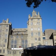
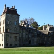
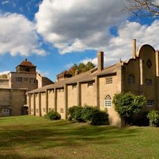
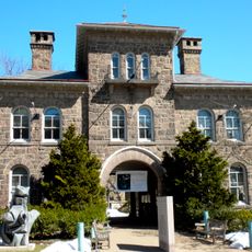
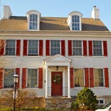
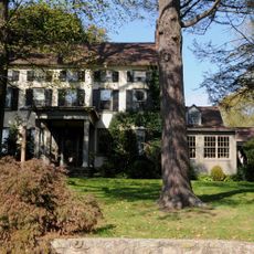
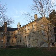
Central Bucks High School West, Public high school in Doylestown, Pennsylvania.

Central Bucks High School West is a public secondary school located in Doylestown that serves students across the region. The campus includes classroom buildings, specialty labs, a library, and athletic facilities for sports and other student activities.

The school opened in the early 1950s as Doylestown High School to serve the expanding population in the area. It was later enlarged and renamed to reflect the growth of the school district and meet increasing enrollment demands.

The school community gathers for sports, clubs, and performances throughout the year, creating traditions that bring together students, families, and neighbors. These activities shape how students spend their time and build connections within the wider area.

The school is accessible by car and has parking available on campus. It is best to contact the school beforehand if you need to visit specific areas or attend events.

Students and staff produce podcasts where they share stories and experiences from the school community. This digital work shows how the school uses modern technology in everyday learning.

The community of curious travelers

AroundUs brings together thousands of curated places, local tips, and hidden gems, enriched daily by 60,000 contributors worldwide.

Start exploring
Location
Inception
1952
GPS coordinates
40.30500,-75.13800
Latest update
December 7, 2025 19:25
Around this place
Mercer Museum
United States of America

Mercer Museum

966 m
Fonthill
United States of America

Fonthill

2.2 km
Moravian Pottery and Tile Works
United States of America

Moravian Pottery and Tile Works

2.4 km
Peace Valley Park
United States of America

Peace Valley Park

4.9 km
James A. Michener Art Museum
United States of America

James A. Michener Art Museum

1.1 km
Oscar Hammerstein II Farm
United States of America

Oscar Hammerstein II Farm

2.2 km
Fordhook Farm
United States of America

Fordhook Farm

1.3 km
The Fountain House
United States of America

The Fountain House

825 m
Kids Castle
United States of America

Kids Castle

2.1 km
Fonthill, Mercer Museum and Moravian Pottery and Tile Works
United States of America

Fonthill, Mercer Museum and Moravian Pottery and Tile Works

1.7 km
Pugh Dungan House
United States of America

Pugh Dungan House

796 m
Bridge Valley Bridge
United States of America

Bridge Valley Bridge

5.6 km
Longland
United States of America

Longland

8.1 km
Doylestown Historic District
United States of America

Doylestown Historic District

528 m
Tabor Home for Needy and Destitute Children
United States of America

Tabor Home for Needy and Destitute Children

1.6 km
Cabin Run Covered Bridge
United States of America

Cabin Run Covered Bridge

7.3 km
Pine Valley Covered Bridge
United States of America

Pine Valley Covered Bridge

4.2 km
Henry Schmieder Arboretum
United States of America

Henry Schmieder Arboretum

1.9 km
Thomas and Lydia Gilbert Farm
United States of America

Thomas and Lydia Gilbert Farm

7.5 km
Chalfont Historic District
United States of America

Chalfont Historic District

6.4 km
Forest Grove Historic District
United States of America

Forest Grove Historic District

6.7 km
Mechanicsville Village Historic District
United States of America

Mechanicsville Village Historic District

6.8 km
Morgan James Homestead
United States of America

Morgan James Homestead

5.4 km
Fretz Farm
United States of America

Fretz Farm

3.9 km
Spring Valley Historic District
United States of America

Spring Valley Historic District

4.9 km
Dyerstown Historic District
United States of America

Dyerstown Historic District

4.1 km
Gardenville-North Branch Rural Historic District
United States of America

Gardenville-North Branch Rural Historic District

8.2 km
Shaw Historic District
United States of America

Shaw Historic District

528 m
Show the full map
Reviews
Share your experience

No review yet

Discussions
Start a discussion...

No discussion yet

« Central Bucks High School West - Public high school in Doylestown, Pennsylvania » is provided by Around Us (aroundus.com). Images and texts are derived from Wikimedia project under a Creative Commons license. You are allowed to copy, distribute, and modify copies of this page, under the conditions set by the license, as long as this note is clearly visible.

Discover hidden gems everywhere you go!

From secret cafés to breathtaking viewpoints, skip the crowded tourist spots and find places that match your style. Our app makes it easy with voice search, smart filtering, route optimization, and insider tips from travelers worldwide. Download now for the complete mobile experience.

Around Us App Screenshot

A unique approach to discovering new places

Le Figaro

All the places worth exploring

France Info

A tailor-made excursion in just a few clicks

20 Minutes

Around Us
Travel Guide & Maps
Download

Send to your phone

QR Code
1

Open the camera app on your mobile.

2

Point at the QR code with your camera. A notification will appear.

3

Tap the notification to open the link.