Enable Location

We need your location to show you interesting places around you

Discover nearby places

Find interesting locations and hidden gems around you

Precise directions

Get accurate directions and distances to places

Your location is never shared with other users. It's only used when you tap the location button.

Log in to your account

Start exploring — it's free

Trusted by 68,264 travelers worldwide

Continue with Google
Continue with Apple
or

We will send you a code to connect

By continuing, you accept our Terms and Conditions and our Privacy Policy

Check your inbox

We've sent a pincode in your inbox. Please enter the code below.

Chicamuxen Wildlife Management Area
Discussion Reviews Photo
1.3k Popularity

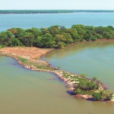
Chicamuxen Wildlife Management Area, Protected natural area near Potomac River in Maryland, United States.

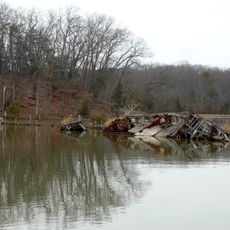
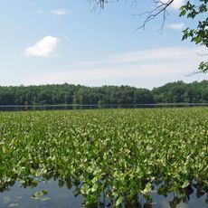
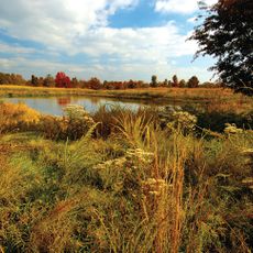
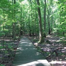
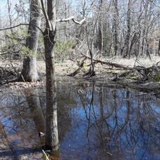
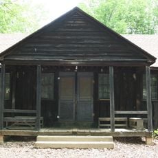
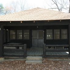
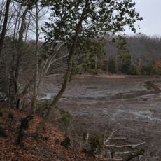
Chicamuxen Wildlife Management Area is a protected space made up of marshlands and forests along a creek in southern Maryland. The property includes multiple trails that wind through these different habitats, offering access to various parts of the landscape.

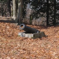
During the American Civil War, Union troops under General Joseph Hooker established a camp at this location. The site's military past eventually gave way to its current role as a protected wildlife area.

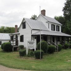
The land is managed by the Maryland Department of Natural Resources as a conservation area. Local visitors see it as a vital space where nature can thrive and be experienced without heavy development.

Visitors can explore the area on foot using marked trails designed for different activities and skill levels. It's best to prepare for changing weather and varying ground conditions that shift with the seasons.

Bald eagles hunt across the marshes and forests here, using the area as a key hunting ground. These large birds of prey are especially common during colder months and bring a sense of wildness to the landscape.

The community of curious travelers

AroundUs brings together thousands of curated places, local tips, and hidden gems, enriched daily by 60,000 contributors worldwide.

Start exploring
Location
GPS coordinates
38.54220,-77.22360
Latest update
December 14, 2025 17:41
Around this place
Mallows Bay
United States of America

Mallows Bay

8.7 km
National Museum of the Marine Corps
United States of America

National Museum of the Marine Corps

10.4 km
Weems–Botts Museum
United States of America

Weems–Botts Museum

9.7 km
Leesylvania State Park
United States of America

Leesylvania State Park

6 km
Quantico National Cemetery
United States of America

Quantico National Cemetery

12.3 km
Rippon Lodge
United States of America

Rippon Lodge

9.3 km
Occoquan Bay National Wildlife Refuge
United States of America

Occoquan Bay National Wildlife Refuge

11.4 km
Smallwood State Park
United States of America

Smallwood State Park

3.7 km
Elizabeth Hartwell Mason Neck National Wildlife Refuge
United States of America

Elizabeth Hartwell Mason Neck National Wildlife Refuge

12.6 km
Chopawamsic
United States of America

Chopawamsic

7.4 km
Araby
United States of America

Araby

10.3 km
Featherstone National Wildlife Refuge
United States of America

Featherstone National Wildlife Refuge

6.4 km
Waffle House
United States of America

Waffle House

9.9 km
Lexington
United States of America

Lexington

11.5 km
Chapman State Park
United States of America

Chapman State Park

12.7 km
Mount Aventine
United States of America

Mount Aventine

12.5 km
Commanding General's Quarters, Quantico Marine Base
United States of America

Commanding General's Quarters, Quantico Marine Base

6.8 km
Marine Corps Air-Ground Museum
United States of America

Marine Corps Air-Ground Museum

8.2 km
Freestone Point Confederate Battery
United States of America

Freestone Point Confederate Battery

6.1 km
Christ Church
United States of America

Christ Church

8 km
Henderson House
United States of America

Henderson House

9.6 km
Pleasant Historic District, Chopawamsic RDA Camp 4
United States of America

Pleasant Historic District, Chopawamsic RDA Camp 4

12.6 km
Cabin Branch Pyrite Mine Historic District
United States of America

Cabin Branch Pyrite Mine Historic District

11.7 km
Chopawamsic Recreational Demonstration Area Cabin Camp 1
United States of America

Chopawamsic Recreational Demonstration Area Cabin Camp 1

13 km
Taft Archeological Site No. 029-5411
United States of America

Taft Archeological Site No. 029-5411

12.1 km
Old Town Hall and School
United States of America

Old Town Hall and School

9.2 km
Orenda/SP-26 Historic District, Chopawamsic RDA Camp 3
United States of America

Orenda/SP-26 Historic District, Chopawamsic RDA Camp 3

12.2 km
Crusading for Right
United States of America

Crusading for Right

6.7 km
Show the full map
Reviews
Share your experience

No review yet

Discussions
Start a discussion...

No discussion yet

« Chicamuxen Wildlife Management Area - Protected natural area near Potomac River in Maryland, United States » is provided by Around Us (aroundus.com). Images and texts are derived from Wikimedia project under a Creative Commons license. You are allowed to copy, distribute, and modify copies of this page, under the conditions set by the license, as long as this note is clearly visible.

Discover hidden gems everywhere you go!

From secret cafés to breathtaking viewpoints, skip the crowded tourist spots and find places that match your style. Our app makes it easy with voice search, smart filtering, route optimization, and insider tips from travelers worldwide. Download now for the complete mobile experience.

Around Us App Screenshot

A unique approach to discovering new places

Le Figaro

All the places worth exploring

France Info

A tailor-made excursion in just a few clicks

20 Minutes

Around Us
Travel Guide & Maps
Download

Send to your phone

QR Code
1

Open the camera app on your mobile.

2

Point at the QR code with your camera. A notification will appear.

3

Tap the notification to open the link.