Enable Location

We need your location to show you interesting places around you

Discover nearby places

Find interesting locations and hidden gems around you

Precise directions

Get accurate directions and distances to places

Your location is never shared with other users. It's only used when you tap the location button.

Chesterfield Gorge

Log in to your account

Start exploring — it's free

Trusted by 61,919 travelers worldwide

Continue with Google
Continue with Apple
or

We will send you a code to connect

By continuing, you accept our Terms and Conditions and our Privacy Policy

Check your inbox

We've sent a pincode in your inbox. Please enter the code below.

Chesterfield Gorge

Chesterfield Gorge, Nature reserve in Chesterfield, Massachusetts, United States

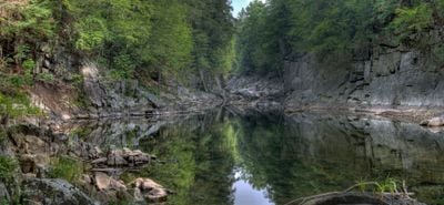
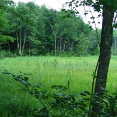
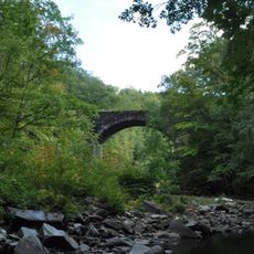
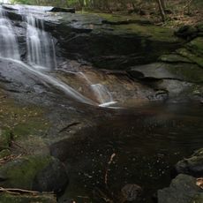
Chesterfield Gorge is a nature reserve in Massachusetts where the East Branch of the Westfield River flows through steep rocky cliffs rising over 30 feet high. The narrow passage cuts through forest and creates a dramatic landscape shaped by water erosion over time.

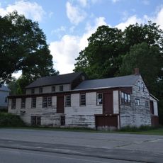
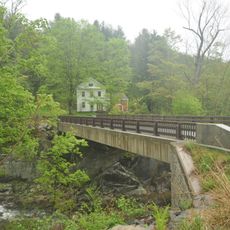
The gorge formed through water flow and geological processes over thousands of years. In 1835, severe flooding destroyed a bridge that crossed the gap and damaged nearby mills that relied on the river's power.

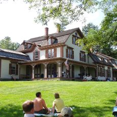
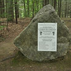
The Trustees of Reservations maintain this protected area since 1929, preserving both natural features and local environmental heritage.

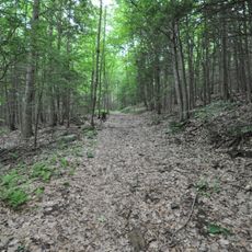
A half-mile trail with safety railings follows the cliff edge with multiple viewpoints along the way. The path is well-maintained but can be slippery when wet, so wearing proper footwear is important.

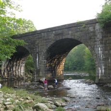
The gorge contains large boulder fields and stone bridge remnants from an old post road that once connected Boston to Albany. This historic route was a major transportation link between the coastal regions and inland areas during the 18th and 19th centuries.

The community of curious travelers

AroundUs brings together thousands of curated places, local tips, and hidden gems, enriched daily by 60,000 contributors worldwide.

Start exploring
Location
GPS coordinates
42.39310,-72.88000
Latest update
December 12, 2025 09:00
Around this place
William Cullen Bryant Homestead
United States of America

William Cullen Bryant Homestead

10 km
Look Park
United States of America

Look Park

16.6 km
Bear Swamp
United States of America

Bear Swamp

17.9 km
D.A.R. State Forest
United States of America

D.A.R. State Forest

9.8 km
C. M. Gardner State Park
United States of America

C. M. Gardner State Park

13.7 km
Petticoat Hill
United States of America

Petticoat Hill

11.2 km
Grove Hill Mansion
United States of America

Grove Hill Mansion

15.5 km
Chester Factory Village Historic District
United States of America

Chester Factory Village Historic District

15 km
Middlefield-Becket Stone Arch Railroad Bridge District
United States of America

Middlefield-Becket Stone Arch Railroad Bridge District

14.6 km
Bisbee Mill
United States of America

Bisbee Mill

5.3 km
Ross Farm
United States of America

Ross Farm

17.7 km
Mountain Rest
United States of America

Mountain Rest

8.2 km
Williamsburg Center Historic District
United States of America

Williamsburg Center Historic District

12.3 km
South Worthington Historic District
United States of America

South Worthington Historic District

5.3 km
Western Railroad Stone Arch Bridges and Chester Factory Village Depot
United States of America

Western Railroad Stone Arch Bridges and Chester Factory Village Depot

13 km
North Chester Historic District
United States of America

North Chester Historic District

8.5 km
West Chesterfield Historic District
United States of America

West Chesterfield Historic District

1.2 km
Chester Center Historic District
United States of America

Chester Center Historic District

12 km
Huntington Village Historic District
United States of America

Huntington Village Historic District

17.6 km
Ashfield Plain Historic District
United States of America

Ashfield Plain Historic District

16.7 km
Plainfield Center Historic District
United States of America

Plainfield Center Historic District

14 km
North Becket Village Historic District
United States of America

North Becket Village Historic District

18 km
Chesterfield Center Historic District
United States of America

Chesterfield Center Historic District

3.2 km
West Whately Historic District
United States of America

West Whately Historic District

17 km
Middlefield Center Historic District
United States of America

Middlefield Center Historic District

12.2 km
Goshen Town Hall
United States of America

Goshen Town Hall

8.5 km
Clark-Eames House
United States of America

Clark-Eames House

17 km
Chapel Brook Falls
United States of America

Chapel Brook Falls

14 km
Show the full map
« Chesterfield Gorge - Nature reserve in Chesterfield, Massachusetts, United States » is provided by Around Us (aroundus.com). Images and texts are derived from Wikimedia project under a Creative Commons license. You are allowed to copy, distribute, and modify copies of this page, under the conditions set by the license, as long as this note is clearly visible.

Discover hidden gems everywhere you go!

From secret cafés to breathtaking viewpoints, skip the crowded tourist spots and find places that match your style. Our app makes it easy with voice search, smart filtering, route optimization, and insider tips from travelers worldwide. Download now for the complete mobile experience.

Around Us App Screenshot

A unique approach to discovering new places

Le Figaro

All the places worth exploring

France Info

A tailor-made excursion in just a few clicks

20 Minutes

Around Us
Travel Guide & Maps
Download

Send to your phone

QR Code
1

Open the camera app on your mobile.

2

Point at the QR code with your camera. A notification will appear.

3

Tap the notification to open the link.