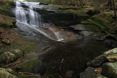
Chapel Brook Falls, Cascading waterfall in Ashfield, Massachusetts.
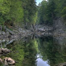
Chapel Brook Falls is a waterfall system in Ashfield, Massachusetts, featuring three connected drops with cascades, slides, and natural rock formations along the stream. The water flows over layers of stone and creates several pools of varying sizes where the stream slows.
The reservation was placed under public stewardship through a land donation in 1964. This gift made the falls and surrounding woodland accessible to visitors for recreation.
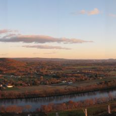
The reservation combines natural water features with outdoor recreation opportunities, including swimming areas and designated climbing zones at Pony Mountain.
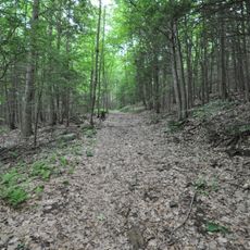
A marked trail leads to the falls and is walkable year-round, though conditions are best between April and November when water flow remains steady. The terrain is easier to navigate during these months without excessive water or ice.
The pools beneath the falls warm enough for swimming during summer months, offering a refreshing break while exploring the area. These natural bathing spots draw many visitors during the hotter season.
Location: Ashfield
GPS coordinates: 42.48251,-72.75984
Latest update: December 6, 2025 19:08
Massachusetts offers a range of locations beyond Boston and Cape Cod that receive fewer visitors. In the western part of the state, stone tower lookouts rise above forested hills, while waterfalls are located within state forests. Historic buildings from the 19th century stand in smaller communities, and gardens featuring native plant species are open to the public. The coastal region includes lighthouses on rocky points and beaches away from main travel routes. A museum houses a walk-through glass globe, geological formations show traces of past ice ages, and Victorian houses document different architectural styles. These places often require specific planning as they lie away from typical tourist routes.
Bridge of Flowers
13.6 km
Sugarloaf Mountain
13.8 km
Mount Sugarloaf State Reservation
13.8 km
Chesterfield Gorge
14 km
Bear Swamp
9.1 km
D.A.R. State Forest
4.3 km
Petticoat Hill
11.3 km
Shelburne Falls Trolley Museum
13.1 km
Bardwell's Ferry Bridge
10.5 km
Burkeville Covered Bridge
4.9 km
The Wilder Homestead
13.1 km
Bisbee Mill
12.8 km
Mountain Rest
7 km
Williamsburg Center Historic District
10.3 km
Robert Strong Woodward House and Studio
12.2 km
West Chesterfield Historic District
13 km
Odd Fellows' Hall
13.6 km
East Hawley Center Historic District
13.3 km
Ashfield Plain Historic District
5.5 km
Plainfield Center Historic District
13.2 km
Maj. Joseph Griswold House
12.2 km
Conway Center Historic District
5.9 km
Whately Center Historic District
11.3 km
Shelburne Free Public Library
13.2 km
Chesterfield Center Historic District
12.1 km
West Whately Historic District
8.1 km
Goshen Town Hall
5.6 km
North Hatfield Historic District
13.8 kmReviews
Visited this place? Tap the stars to rate it and share your experience / photos with the community! Try now! You can cancel it anytime.
Discover hidden gems everywhere you go!
From secret cafés to breathtaking viewpoints, skip the crowded tourist spots and find places that match your style. Our app makes it easy with voice search, smart filtering, route optimization, and insider tips from travelers worldwide. Download now for the complete mobile experience.
A unique approach to discovering new places❞
— Le Figaro
All the places worth exploring❞
— France Info
A tailor-made excursion in just a few clicks❞
— 20 Minutes