Enable Location

We need your location to show you interesting places around you

Discover nearby places

Find interesting locations and hidden gems around you

Precise directions

Get accurate directions and distances to places

Your location is never shared with other users. It's only used when you tap the location button.

D.A.R. State Forest

Log in to your account

Start exploring — it's free

Trusted by 63,154 travelers worldwide

Continue with Google
Continue with Apple
or

We will send you a code to connect

By continuing, you accept our Terms and Conditions and our Privacy Policy

Check your inbox

We've sent a pincode in your inbox. Please enter the code below.

D.A.R. State Forest
Discussion Reviews 1 Photos
2.9k Popularity

D.A.R. State Forest, State forest in Goshen, United States

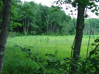
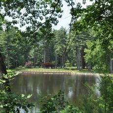
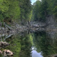
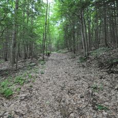
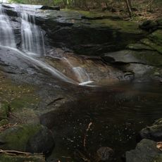
D.A.R. State Forest is a wooded area in Goshen and Ashfield centered around two lakes surrounded by mixed forest of hardwoods and conifers. The property includes campsites, trails, and day-use areas spread across its landscape.

The forest was established in 1929 when the Daughters of the American Revolution donated land to create a public recreation area. During the 1930s, the Civilian Conservation Corps contributed labor to construct dams, trails, and infrastructure.

The Civilian Conservation Corps contributed to the forest development in the 1930s by constructing dams, camping areas, roads, and bridges.

The area provides trails for hiking, mountain biking, and horseback riding at different skill levels. Parking is available, and campsites are available for overnight visitors.

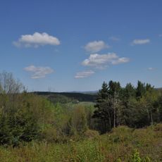
A fire tower offers sweeping views across the Connecticut River Valley and into neighboring states from its elevated location. This vantage point stands out as one of the most distinctive features in the forest.

The community of curious travelers

AroundUs brings together thousands of curated places, local tips, and hidden gems, enriched daily by 60,000 contributors worldwide.

Start exploring
Location
GPS coordinates
42.45690,-72.79860
Latest update
December 12, 2025 12:06
Around this place
William Cullen Bryant Homestead
United States of America

William Cullen Bryant Homestead

11.8 km
Look Park
United States of America

Look Park

15.4 km
Chesterfield Gorge
United States of America

Chesterfield Gorge

9.8 km
Bear Swamp
United States of America

Bear Swamp

10.4 km
Petticoat Hill
United States of America

Petticoat Hill

9.5 km
Shelburne Falls Trolley Museum
United States of America

Shelburne Falls Trolley Museum

16.6 km
Bardwell's Ferry Bridge
United States of America

Bardwell's Ferry Bridge

14.8 km
Grove Hill Mansion
United States of America

Grove Hill Mansion

14.1 km
Burkeville Covered Bridge
United States of America

Burkeville Covered Bridge

9.1 km
The Wilder Homestead
United States of America

The Wilder Homestead

16 km
West Hatfield Historic District
United States of America

West Hatfield Historic District

16.3 km
Bisbee Mill
United States of America

Bisbee Mill

9.1 km
Mountain Rest
United States of America

Mountain Rest

3.4 km
Williamsburg Center Historic District
United States of America

Williamsburg Center Historic District

9.1 km
South Worthington Historic District
United States of America

South Worthington Historic District

14.6 km
Robert Strong Woodward House and Studio
United States of America

Robert Strong Woodward House and Studio

14.7 km
West Chesterfield Historic District
United States of America

West Chesterfield Historic District

8.8 km
East Hawley Center Historic District
United States of America

East Hawley Center Historic District

13.5 km
Ashfield Plain Historic District
United States of America

Ashfield Plain Historic District

7.8 km
Plainfield Center Historic District
United States of America

Plainfield Center Historic District

11.5 km
Maj. Joseph Griswold House
United States of America

Maj. Joseph Griswold House

14.8 km
Conway Center Historic District
United States of America

Conway Center Historic District

10.1 km
Whately Center Historic District
United States of America

Whately Center Historic District

13.5 km
Chesterfield Center Historic District
United States of America

Chesterfield Center Historic District

8 km
West Whately Historic District
United States of America

West Whately Historic District

9.8 km
Goshen Town Hall
United States of America

Goshen Town Hall

1.7 km
North Hatfield Historic District
United States of America

North Hatfield Historic District

15.3 km
Chapel Brook Falls
United States of America

Chapel Brook Falls

4.3 km
Show the full map
Reviews
Share your experience

No review yet

Discussions
Start a discussion...

No discussion yet

« D.A.R. State Forest - State forest in Goshen, United States » is provided by Around Us (aroundus.com). Images and texts are derived from Wikimedia project under a Creative Commons license. You are allowed to copy, distribute, and modify copies of this page, under the conditions set by the license, as long as this note is clearly visible.

Discover hidden gems everywhere you go!

From secret cafés to breathtaking viewpoints, skip the crowded tourist spots and find places that match your style. Our app makes it easy with voice search, smart filtering, route optimization, and insider tips from travelers worldwide. Download now for the complete mobile experience.

Around Us App Screenshot

A unique approach to discovering new places

Le Figaro

All the places worth exploring

France Info

A tailor-made excursion in just a few clicks

20 Minutes

Around Us
Travel Guide & Maps
Download

Send to your phone

QR Code
1

Open the camera app on your mobile.

2

Point at the QR code with your camera. A notification will appear.

3

Tap the notification to open the link.