Clifty Wilderness, Protected wilderness in Daniel Boone National Forest, Kentucky, United States.
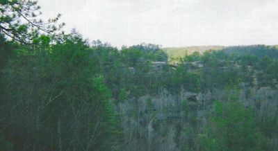
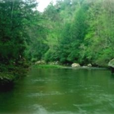
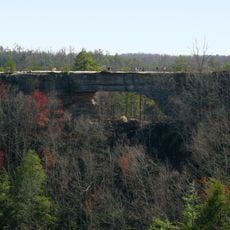
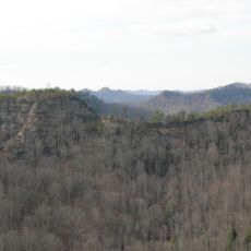
Clifty Wilderness is a protected forest area within Daniel Boone National Forest covering about 13,344 acres of rugged terrain. High sandstone cliffs, steep valleys, natural rock arches, and cave-like rock shelters define the landscape, with rocky streams running through the canyons.
The area was traveled and used by Native Americans and later by frontier explorers and settlers including Daniel Boone. Federal protection came in 1985 when this territory was formally designated as protected wilderness.
The red sandstone cliffs draw rock climbers and outdoor enthusiasts who engage with the landscape through various activities like hiking and nature exploration. Local communities view this area as an important natural landmark that connects them to the region's wild character.
Bring both digital and paper maps for navigation since the wilderness contains maintained trails alongside older unmarked forest paths. Spring and fall offer the best hiking conditions with comfortable temperatures and manageable water levels in the streams.
This wilderness hosts an unusual variety of plant life including around 750 flowering plant species and 170 different moss types found throughout the canyons and cliffs. Few visitors realize the area is equally rewarding for plant observation as it is for hiking and climbing.
The community of curious travelers
AroundUs brings together thousands of curated places, local tips, and hidden gems, enriched daily by 60,000 contributors worldwide.