Chest opened
+${chestReward.xp} XP
Explorer
NOUVEAU ×${chestReward.collectible.quantity}
tapez pour fermer
Chest locked

Open chests in the app

Around Us is built for your phone — chests unlock when you walk, explore and capture nearby places.

Enable Location

We need your location to show you interesting places around you

Discover nearby places

Find interesting locations and hidden gems around you

Precise directions

Get accurate directions and distances to places

Your location is never shared with other users. It's only used when you tap the location button.

Log in to your account

Start exploring — it's free

Trusted by 72,882 travelers worldwide

Continue with Google
Continue with Apple
or

We will send you a code to connect

By continuing, you accept our Terms and Conditions and our Privacy Policy

Check your inbox

We've sent a pincode in your inbox. Please enter the code below.

Discussion Reviews Photo
700+ Popularity

Davis County, Former county in Minnesota, United States

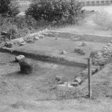
Davis County was an early administrative area in northern Minnesota that included several settlements and townships. It functioned as an organized county during the state's development phase in the 19th century.

The territory was created during Minnesota's territorial period in the mid-19th century as part of the transformation from tribal lands to organized counties. Its establishment reflected the expansion and settlement of the northern Midwest.

The territory contained both Dakota Sioux and European settler communities, reflecting the demographic changes occurring throughout Minnesota during the 19th century.

Visitors interested in early Minnesota history can contact local historical societies or archives to learn more about administration and life in this territory. Records and documents from this period are often available in regional museums and libraries.

Davis County's establishment coincided with Minnesota's shift from fur trading to lumber and grain industries, marking a period of economic transformation.

The community of curious travelers

AroundUs brings together thousands of curated places, local tips, and hidden gems, enriched daily by 60,000 contributors worldwide.

Start exploring
Shares border with
Stearns County
GPS coordinates
45.15000,-96.01670
Latest update
March 5, 2026 18:17
Around this place
Big Stone Lake
United States of America

Big Stone Lake

55.1 km
Andrew John Volstead House
United States of America

Andrew John Volstead House

53.4 km
Lac qui Parle State Park
United States of America

Lac qui Parle State Park

16.7 km
Big Stone Lake State Park
United States of America

Big Stone Lake State Park

46.7 km
Lac qui Parle Mission
United States of America

Lac qui Parle Mission

17.6 km
Camp Release State Monument
United States of America

Camp Release State Monument

32.1 km
Big Stone National Wildlife Refuge
United States of America

Big Stone National Wildlife Refuge

27.9 km
Church of St. Bridget-Catholic
United States of America

Church of St. Bridget-Catholic

44.7 km
First Congregational Church of Milbank
United States of America

First Congregational Church of Milbank

48.6 km
Swift County Courthouse
United States of America

Swift County Courthouse

37.5 km
Church of St. Francis Xavier
United States of America

Church of St. Francis Xavier

37.8 km
Gethsemane Episcopal Church
United States of America

Gethsemane Episcopal Church

5.6 km
Lund–Hoel House
United States of America

Lund–Hoel House

52.8 km
Big Stone County Courthouse
United States of America

Big Stone County Courthouse

37.6 km
Lewis H. Stanton House
United States of America

Lewis H. Stanton House

49.2 km
Morris Carnegie Library
United States of America

Morris Carnegie Library

49.1 km
Christ Episcopal Church
United States of America

Christ Episcopal Church

37.6 km
Appleton City Hall
United States of America

Appleton City Hall

5.5 km
Madison Carnegie Library
United States of America

Madison Carnegie Library

20.7 km
Alberta Teachers House
United States of America

Alberta Teachers House

47.5 km
Dawson Bank Museum
United States of America

Dawson Bank Museum

24.7 km
Sabin S. Murdock House
United States of America

Sabin S. Murdock House

49.8 km
Canby Commercial Historic District
United States of America

Canby Commercial Historic District

53.2 km
Grant County Courthouse
United States of America

Grant County Courthouse

49.1 km
First State Bank Building
United States of America

First State Bank Building

46 km
Milan Bridge
United States of America

Milan Bridge

6.5 km
Lac Qui Parle County Courthouse
United States of America

Lac Qui Parle County Courthouse

20.5 km
Lou T. Fisk
United States of America

Lou T. Fisk

21.2 km
Show the full map
Reviews
Share your experience

No review yet

Discussions
Start a discussion...

No discussion yet

« Davis County - Former county in Minnesota, United States » is provided by Around Us (aroundus.com). Images and texts are derived from Wikimedia project under a Creative Commons license. You are allowed to copy, distribute, and modify copies of this page, under the conditions set by the license, as long as this note is clearly visible.

Discover hidden gems everywhere you go!

From secret cafés to breathtaking viewpoints, skip the crowded tourist spots and find places that match your style. Our app makes it easy with voice search, smart filtering, route optimization, and insider tips from travelers worldwide. Download now for the complete mobile experience.

Around Us App Screenshot

A unique approach to discovering new places

Le Figaro

All the places worth exploring

France Info

A tailor-made excursion in just a few clicks

20 Minutes

Around Us
Travel Guide & Maps
Download

Send to your phone

QR Code
1

Open the camera app on your mobile.

2

Point at the QR code with your camera. A notification will appear.

3

Tap the notification to open the link.