Enable Location

We need your location to show you interesting places around you

Discover nearby places

Find interesting locations and hidden gems around you

Precise directions

Get accurate directions and distances to places

Your location is never shared with other users. It's only used when you tap the location button.

Douglaston Historic District

Log in to your account

Start exploring — it's free

Trusted by 61,550 travelers worldwide

Continue with Google
Continue with Apple
or

We will send you a code to connect

By continuing, you accept our Terms and Conditions and our Privacy Policy

Check your inbox

We've sent a pincode in your inbox. Please enter the code below.

Douglaston Historic District, Historic residential district in Queens, New York, United States.

Description

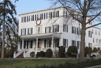
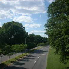
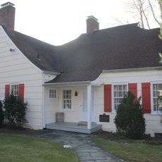
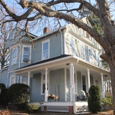
Douglaston Historic District is a residential area in Queens with about 631 homes arranged along winding streets on a peninsula extending into Little Neck Bay. The houses date from the early 20th century and display varied architectural features across the spacious lots.

History

The Rickert-Finlay Realty Company purchased land from the Douglas family in the early 1900s to establish the Douglas Manor Association. This planned development shaped the neighborhood's residential identity from its beginning.

Culture

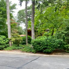
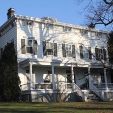
The neighborhood displays homes in different architectural styles such as Tudor, Mediterranean, and Colonial Revival that residents and visitors see while walking around. These varied designs shape the character of the streets and create visual interest at every turn.

Practical

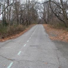
External changes and new construction in the district require approval from the Landmarks Preservation Commission, so major renovations are limited. The best way to explore is by walking the winding streets to see the different homes and their surroundings.

Did you know?

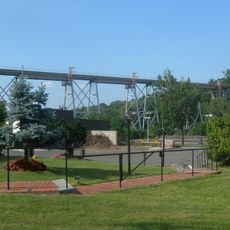
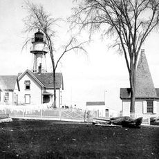
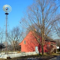
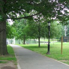
The area preserves old specimen trees and landscape features from the original 19th century estate grounds, including the Cornelius Van Wyck House from 1735. These historical plants and structures from earlier times remain visible within the modern neighborhood.

Location
GPS coordinates
40.77583,-73.75056
Latest update
December 13, 2025 12:41

AroundUs brings together thousands of curated places, local tips, and hidden gems, enriched daily by 60,000 contributors worldwide. Discover all places nearby (New York).

Around this place
Throgs Neck Bridge
United States of America

Throgs Neck Bridge

4.4 km
Fort Totten
United States of America

Fort Totten

2.8 km
Long Island Motor Parkway
United States of America

Long Island Motor Parkway

4.4 km
Alley Pond Park
United States of America

Alley Pond Park

2 km
Fort Schuyler
United States of America

Fort Schuyler

4.8 km
Creedmoor Rifle Range
United States of America

Creedmoor Rifle Range

4.2 km
Cunningham Park
United States of America

Cunningham Park

4.7 km
Queens County Farm Museum
United States of America

Queens County Farm Museum

3.9 km
Ben Rebhuhn House
United States of America

Ben Rebhuhn House

1.7 km
Douglaston Park
United States of America

Douglaston Park

3 km
Manhasset Viaduct
United States of America

Manhasset Viaduct

3.9 km
Cornelius Van Wyck House
United States of America

Cornelius Van Wyck House

328 m
Temple Beth-El
United States of America

Temple Beth-El

2.7 km
Douglaston Hill Historic District
United States of America

Douglaston Hill Historic District

1 km
Fort Totten Officers' Club
United States of America

Fort Totten Officers' Club

3 km
Throgs Neck Light
United States of America

Throgs Neck Light

4.6 km
Allen-Beville House
United States of America

Allen-Beville House

341 m
Lawrence Cemetery
United States of America

Lawrence Cemetery

2 km
Cornell Farmhouse
United States of America

Cornell Farmhouse

4 km
Church of St. Philip and St. James
United States of America

Church of St. Philip and St. James

4.5 km
Congregation Shaare Zion
United States of America

Congregation Shaare Zion

2.7 km
North Shore Towers
United States of America

North Shore Towers

3.6 km
Saddle Rock Grist Mill
United States of America

Saddle Rock Grist Mill

2.4 km
Congregation Kol Israel Achim
United States of America

Congregation Kol Israel Achim

2.8 km
Lake Success Jewish Center
United States of America

Lake Success Jewish Center

4.2 km
Douglaston/Little Neck Library
United States of America

Douglaston/Little Neck Library

1.4 km
Fresh Meadows Library
United States of America

Fresh Meadows Library

4.7 km
Broadway-Flushing Historic District
United States of America

Broadway-Flushing Historic District

4.7 km
Show the full map
« Douglaston Historic District - Historic residential district in Queens, New York, United States » is provided by Around Us (aroundus.com). Images and texts are derived from Wikimedia project under a Creative Commons license. You are allowed to copy, distribute, and modify copies of this page, under the conditions set by the license, as long as this note is clearly visible.

Discover hidden gems everywhere you go!

From secret cafés to breathtaking viewpoints, skip the crowded tourist spots and find places that match your style. Our app makes it easy with voice search, smart filtering, route optimization, and insider tips from travelers worldwide. Download now for the complete mobile experience.

Around Us App Screenshot

A unique approach to discovering new places

Le Figaro

All the places worth exploring

France Info

A tailor-made excursion in just a few clicks

20 Minutes

Around Us
Travel Guide & Maps
Download

Send to your phone

QR Code
1

Open the camera app on your mobile.

2

Point at the QR code with your camera. A notification will appear.

3

Tap the notification to open the link.