Enable Location

We need your location to show you interesting places around you

Discover nearby places

Find interesting locations and hidden gems around you

Precise directions

Get accurate directions and distances to places

Your location is never shared with other users. It's only used when you tap the location button.

Farmers' High School

Log in to your account

Start exploring — it's free

Trusted by 61,764 travelers worldwide

Continue with Google
Continue with Apple
or

We will send you a code to connect

By continuing, you accept our Terms and Conditions and our Privacy Policy

Check your inbox

We've sent a pincode in your inbox. Please enter the code below.

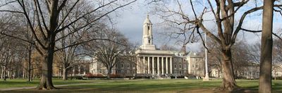
Farmers' High School, Historic district in State College, US.

Description

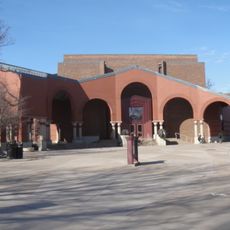
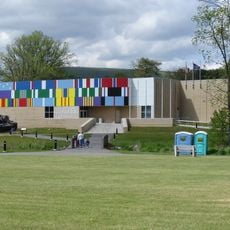
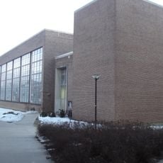
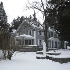
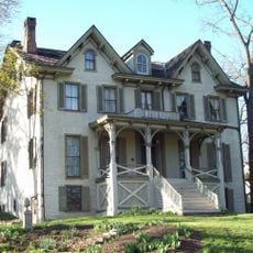
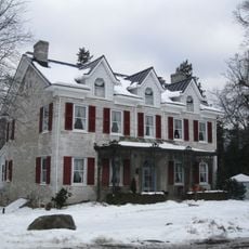
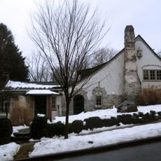
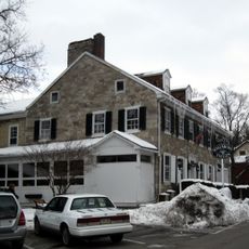
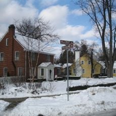
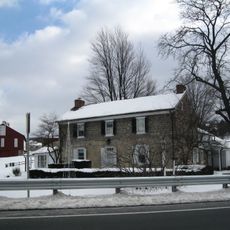
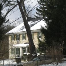
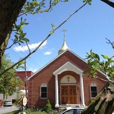
Farmers' High School is a historic educational complex near State College with multiple buildings arranged across the Pennsylvania grounds. The property includes classrooms, dormitories, and administrative structures that reflect how an agricultural institution expanded over time.

History

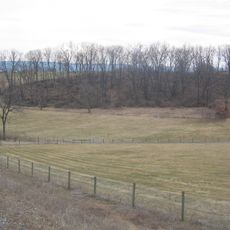
The school was founded in the 1850s to teach young people practical farming skills. Over the decades it became recognized as an important training center that introduced updated agricultural methods across the region.

Culture

The school has shaped how farming communities see themselves since its founding. You can see in the buildings and their use how deeply this place mattered to local identity and agricultural pride.

Practical

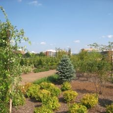
The school grounds are best explored on foot since buildings are spread across the property with connecting paths between them. Wear good walking shoes as the historic pathways can be uneven, especially after rain.

Did you know?

The buildings display construction styles from different decades, ranging from early wooden structures to later brick buildings, showing how school architecture adapted to new educational needs. This visual timeline of building styles tells the story of the institution's growth on its own.

Location
GPS coordinates
40.79417,-77.86528
Latest update
December 12, 2025 09:00

AroundUs brings together thousands of curated places, local tips, and hidden gems, enriched daily by 60,000 contributors worldwide. Discover all places nearby (State College).

Around this place
Beaver Stadium
United States of America

Beaver Stadium

2.2 km
Interstate 99
United States of America

Interstate 99

8.9 km
Nittany Lion Shrine
United States of America

Nittany Lion Shrine

435 m
Octacube
United States of America

Octacube

467 m
Palmer Museum of Art
United States of America

Palmer Museum of Art

706 m
The Arboretum at Penn State
United States of America

The Arboretum at Penn State

1.2 km
Pennsylvania Military Museum
United States of America

Pennsylvania Military Museum

6.1 km
Garfield Thomas Water Tunnel
United States of America

Garfield Thomas Water Tunnel

277 m
Boal Mansion
United States of America

Boal Mansion

5.7 km
Tudek Site
United States of America

Tudek Site

2.8 km
Houserville Site
United States of America

Houserville Site

3.2 km
Centre Furnace Mansion House
United States of America

Centre Furnace Mansion House

2.4 km
Oak Hall Historic District
United States of America

Oak Hall Historic District

5.1 km
Camelot
United States of America

Camelot

842 m
Frost Entomological Museum
United States of America

Frost Entomological Museum

1 km
Boalsburg Historic District
United States of America

Boalsburg Historic District

6.3 km
College Heights Historic District
United States of America

College Heights Historic District

951 m
Hill House
United States of America

Hill House

6.4 km
Lemont Historic District
United States of America

Lemont Historic District

4.3 km
Holmes-Foster-Highlands Historic District
United States of America

Holmes-Foster-Highlands Historic District

454 m
Gen. John Thompson House
United States of America

Gen. John Thompson House

2.8 km
Felix Dale Stone House
United States of America

Felix Dale Stone House

4.5 km
Церковь Святой Троицы
United States of America

Церковь Святой Троицы

640 m
Palmer Museum at the Arboretum
United States of America

Palmer Museum at the Arboretum

1.4 km
Discovery Space
United States of America

Discovery Space

1.7 km
Boal Mansion Museum
United States of America

Boal Mansion Museum

5.8 km
Carmike Cinema 6
United States of America

Carmike Cinema 6

6.6 km
Linden Hall Historic District
United States of America

Linden Hall Historic District

8.8 km
Show the full map
« Farmers' High School - Historic district in State College, US » is provided by Around Us (aroundus.com). Images and texts are derived from Wikimedia project under a Creative Commons license. You are allowed to copy, distribute, and modify copies of this page, under the conditions set by the license, as long as this note is clearly visible.

Discover hidden gems everywhere you go!

From secret cafés to breathtaking viewpoints, skip the crowded tourist spots and find places that match your style. Our app makes it easy with voice search, smart filtering, route optimization, and insider tips from travelers worldwide. Download now for the complete mobile experience.

Around Us App Screenshot

A unique approach to discovering new places

Le Figaro

All the places worth exploring

France Info

A tailor-made excursion in just a few clicks

20 Minutes

Around Us
Travel Guide & Maps
Download

Send to your phone

QR Code
1

Open the camera app on your mobile.

2

Point at the QR code with your camera. A notification will appear.

3

Tap the notification to open the link.