Enable Location

We need your location to show you interesting places around you

Discover nearby places

Find interesting locations and hidden gems around you

Precise directions

Get accurate directions and distances to places

Your location is never shared with other users. It's only used when you tap the location button.

Farmington Canal State Park Trail

Log in to your account

Start exploring — it's free

Trusted by 61,868 travelers worldwide

Continue with Google
Continue with Apple
or

We will send you a code to connect

By continuing, you accept our Terms and Conditions and our Privacy Policy

Check your inbox

We've sent a pincode in your inbox. Please enter the code below.

Farmington Canal State Park Trail

Farmington Canal State Park Trail, State park trail in New Haven County, Connecticut.

Description

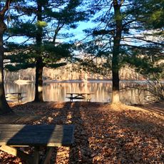
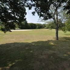
The Farmington Canal State Park Trail is an 84-mile paved pathway in Connecticut that runs through diverse landscapes and connects several communities. The route offers sections suitable for cycling, walking, and casual strolling for people of different abilities.

History

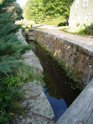
The pathway traces the original route of a canal system built in 1825 that connected New Haven with Farmington and reshaped regional commerce. When railroads expanded in the 1860s, the canal lost its purpose and was abandoned.

Culture

The trail preserves memories of the region's transportation past through its layout and visible remains of earlier routes. Visitors can explore the landscape while understanding how people once moved through this area.

Practical

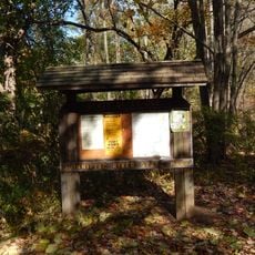
Multiple entry points with parking options are available along the entire route, including the Lock 12 lot in Cheshire and the Todd Street access in Hamden. The pathways are mostly flat and reliably paved, making them accessible for different ways of getting around.

Did you know?

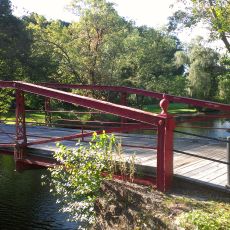
The trail features 28 restored locks that once managed water levels for boats and now serve as landmark points and architectural features. These structures demonstrate the technical skill of earlier transport methods and make them fascinating details for observant visitors to discover.

Location
GPS coordinates
41.47720,-72.92231
Latest update
December 14, 2025 11:03

AroundUs brings together thousands of curated places, local tips, and hidden gems, enriched daily by 60,000 contributors worldwide. Discover all places nearby (New Haven County).

Around this place
Sleeping Giant
United States of America

Sleeping Giant

5.8 km
Door Tree
United States of America

Door Tree

7.5 km
Nehemiah Royce House
United States of America

Nehemiah Royce House

9.2 km
Paul Mellon Arts Center
United States of America

Paul Mellon Arts Center

9.6 km
Roaring Brook Falls
United States of America

Roaring Brook Falls

1.8 km
Ireland’s Great Hunger Museum
United States of America

Ireland’s Great Hunger Museum

8.3 km
Wharton Brook State Park
United States of America

Wharton Brook State Park

9.3 km
Quinnipiac River State Park
United States of America

Quinnipiac River State Park

8.3 km
Mount Sanford
United States of America

Mount Sanford

2.8 km
Red Bridge
United States of America

Red Bridge

8.6 km
Waterbury Brass Company
United States of America

Waterbury Brass Company

10.6 km
Samuel Simpson House
United States of America

Samuel Simpson House

9 km
Levi B. Frost House
United States of America

Levi B. Frost House

10.1 km
Jonathan Dickerman II House
United States of America

Jonathan Dickerman II House

6.7 km
Hamden Memorial Town Hall
United States of America

Hamden Memorial Town Hall

10.5 km
Kohler Environmental Center
United States of America

Kohler Environmental Center

10.6 km
Franklin Johnson House
United States of America

Franklin Johnson House

8.9 km
Barnes-Frost House
United States of America

Barnes-Frost House

9.8 km
Samuel Parsons House
United States of America

Samuel Parsons House

9 km
Cheshire Historic District
United States of America

Cheshire Historic District

2.9 km
Prospect Green Historic District
United States of America

Prospect Green Historic District

5.4 km
David Hotchkiss House
United States of America

David Hotchkiss House

6.5 km
Elam Ives House
United States of America

Elam Ives House

8.5 km
Theophilus Jones House
United States of America

Theophilus Jones House

6.7 km
Wallingford Center Historic District
United States of America

Wallingford Center Historic District

8.9 km
Wheeler-Beecher House
United States of America

Wheeler-Beecher House

8.2 km
Orrin Todd House
United States of America

Orrin Todd House

6.9 km
Wallingford Center
United States of America

Wallingford Center

9.2 km
Show the full map
« Farmington Canal State Park Trail - State park trail in New Haven County, Connecticut » is provided by Around Us (aroundus.com). Images and texts are derived from Wikimedia project under a Creative Commons license. You are allowed to copy, distribute, and modify copies of this page, under the conditions set by the license, as long as this note is clearly visible.

Discover hidden gems everywhere you go!

From secret cafés to breathtaking viewpoints, skip the crowded tourist spots and find places that match your style. Our app makes it easy with voice search, smart filtering, route optimization, and insider tips from travelers worldwide. Download now for the complete mobile experience.

Around Us App Screenshot

A unique approach to discovering new places

Le Figaro

All the places worth exploring

France Info

A tailor-made excursion in just a few clicks

20 Minutes

Around Us
Travel Guide & Maps
Download

Send to your phone

QR Code
1

Open the camera app on your mobile.

2

Point at the QR code with your camera. A notification will appear.

3

Tap the notification to open the link.