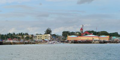
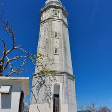
Talibon, municipality of the Philippines in the province of Bohol
Location: Bohol
Inception: 1830
Elevation above the sea: 7 m
Shares border with: Getafe, Bien Unido, Danao, Buenavista, Trinidad
Website: http://talibon-bohol.gov.ph
GPS coordinates: 10.11667,124.28333
Latest update: March 21, 2025 17:07
Chocolate Hills
25.7 km
Cebu–Cordova Link Expressway
45.4 km
Marcelo Fernan Bridge
41.8 km
Mactan-Mandaue Bridge
42.4 km
Bagacay Point Lighthouse
41.5 km
Rajah Sikatuna Protected Landscape
43.3 km
Mandaue Church
44.1 km
Talibon Cathedral
6.1 km
Magellan Monument
36.5 km
Muelle Osmeña Lighthouse
42.8 km
Upside Down World Cebu
44.9 km
Lapulapu historical marker
36.4 km
Nalusuan Island
32.1 km
Tubigon Church
39.7 km
Liberty Shrine
36.5 km
Inabanga Church
25.5 km
Bagacay Point Lighthouse
41.7 km
Sagbayan Peak Park
31.3 km
Carmen Church
33.8 km
Ferdinand Magellan’s Death historical marker
36.4 km
Lapulapu historical marker
36.5 km
Dagohoy Monument
20.6 km
Church of Tubigon historical marker
39.7 km
Mactan quincentennial historical marker
36.5 km
Lighthouse of Bagacay Point historical marker
41.5 km
In Memory of Francisco Dagohoy historical marker
20.6 km
Church of Carmen historical marker
33.8 km
Ferdinand Magellan historical marker
36.5 kmReviews
Visited this place? Tap the stars to rate it and share your experience / photos with the community! Try now! You can cancel it anytime.
Discover hidden gems everywhere you go!
From secret cafés to breathtaking viewpoints, skip the crowded tourist spots and find places that match your style. Our app makes it easy with voice search, smart filtering, route optimization, and insider tips from travelers worldwide. Download now for the complete mobile experience.
A unique approach to discovering new places❞
— Le Figaro
All the places worth exploring❞
— France Info
A tailor-made excursion in just a few clicks❞
— 20 Minutes