Chupa, Republic of Karelia

Log in to your account

AroundUs is a community-driven map of interesting places, built by curious explorers like you. It grows with every review, story, and photo you share.
Connect to save your favorite spots, contribute locations, and create personalized routes.
By continuing, you accept our Terms and Conditions and our Privacy Policy
Add to collection
Map
Suggest a change
Share

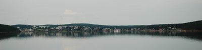
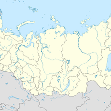
Chupa, Republic of Karelia, Urban settlement on White Sea coast, Republic of Karelia, Russia

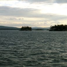
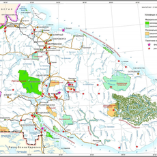
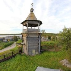
Chupa is an urban-type settlement on the White Sea coast in the Republic of Karelia, located approximately 629 kilometers north of Petrozavodsk. It stretches along the shoreline in the Loukhsky District and serves as the administrative center for the Chupinskoye urban settlement.

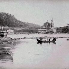
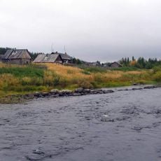
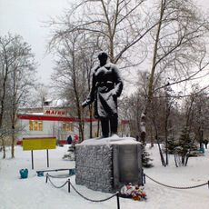
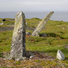
The settlement has records of continuous inhabitation since 1574 and received its urban-type settlement classification in 1943 during the Soviet period. This shift marked the transition from a trading post to an organized urban community.

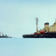
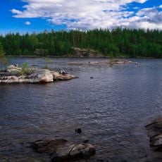
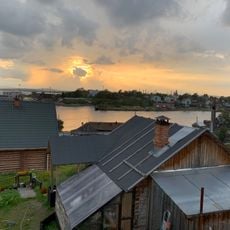
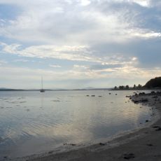
The name reflects the linguistic diversity of the region, appearing as Čuuppu in Karelian and Чупа in Russian. Local life is shaped by its position on the White Sea coast, where maritime traditions remain part of the community's character.

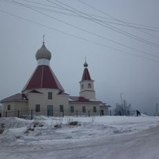
The settlement operates in the UTC+3 time zone and uses postal code 186670. Visitors should expect remote northern conditions with harsh winters and extended periods of darkness during colder months.

The region was historically a major hub for fur and sea product trading, a past that still influences local commerce today. These maritime roots continue to shape how the community functions and identifies itself.

Location: Chupinskoye urban settlement

Website: http://regionchupa.ru

GPS coordinates: 66.26667,33.03333

Latest update: December 8, 2025 13:41

Photos
Around this place
Show the full map
Kandalaksha Nature Reserve
Russian Federation

Kandalaksha Nature Reserve

92.9 km
Kanozero Petroglyphs
Russian Federation

Kanozero Petroglyphs

99.7 km
Nuorunen
Russian Federation

Nuorunen

126 km
Kumsk Reservoir
Russian Federation

Kumsk Reservoir

96.3 km
Kovdozero
Russian Federation

Kovdozero

73.5 km
Iovsk Reservoir
Russian Federation

Iovsk Reservoir

90.3 km
Kandalaksha Monastery
Russian Federation

Kandalaksha Monastery

102.8 km
Church of the Nativity of John the Baptist in Kandalaksha
Russian Federation

Church of the Nativity of John the Baptist in Kandalaksha

100.4 km
Saint Nicholas church
Russian Federation

Saint Nicholas church

48 km
Канозерский заказник
Russian Federation

Канозерский заказник

103.8 km
Kandalaksha
Russian Federation

Kandalaksha

100.7 km
Колвицкий заказник
Russian Federation

Колвицкий заказник

110.6 km
Muna
Russian Federation

Muna

111.7 km
Kovdaozero Reservoir
Russian Federation

Kovdaozero Reservoir

70.4 km
Bell tower of Saint Nicholas church (Kovda)
Russian Federation

Bell tower of Saint Nicholas church (Kovda)

48 km
Памятник Герою Советского Союза А. Спекову
Russian Federation

Памятник Герою Советского Союза А. Спекову

103.5 km
Место стоянки партизанского отряда
Russian Federation

Место стоянки партизанского отряда

93.9 km
Verman Rubezh
Russian Federation

Verman Rubezh

127.2 km
Братская могила жертв интервенции 1918-1920 годов
Russian Federation

Братская могила жертв интервенции 1918-1920 годов

72.7 km
Stone labyrinths in Kandalaksha
Russian Federation

Stone labyrinths in Kandalaksha

97.7 km
Братская могила четырех советских летчиков, погибших в воздушном бою 15 октября 1944 г. (Чупа)
Russian Federation

Братская могила четырех советских летчиков, погибших в воздушном бою 15 октября 1944 г. (Чупа)

1.5 km
Обелиск железнодорожникам, погибшим в годы Великой Отечественной войны
Russian Federation

Обелиск железнодорожникам, погибшим в годы Великой Отечественной войны

103.9 km
Palace of Culture "Metallurgist"
Russian Federation

Palace of Culture "Metallurgist"

105.1 km
Stamik Rogovoy
Russian Federation

Stamik Rogovoy

96.8 km
Святилище на горе Кивакка (Кестеньгское с.п.)
Russian Federation

Святилище на горе Кивакка (Кестеньгское с.п.)

111.5 km
Менгиры и хозяйственные ямы на острове Большой Робьяк (Куземское с.п.)
Russian Federation

Менгиры и хозяйственные ямы на острове Большой Робьяк (Куземское с.п.)

111.2 km
Нива 15 (поселение)
Russian Federation

Нива 15 (поселение)

100.1 km
Стоянка эпохи позднего неолита
Russian Federation

Стоянка эпохи позднего неолита

98 km
Show the full map
Reviews

Visited this place? Tap the stars to rate it and share your experience / photos with the community! Try now! You can cancel it anytime.

« Chupa, Republic of Karelia - Urban settlement on White Sea coast, Republic of Karelia, Russia » is provided by Around Us (aroundus.com). Images and texts are derived from Wikimedia project under a Creative Commons license. You are allowed to copy, distribute, and modify copies of this page, under the conditions set by the license, as long as this note is clearly visible.

Discover hidden gems everywhere you go!

From secret cafés to breathtaking viewpoints, skip the crowded tourist spots and find places that match your style. Our app makes it easy with voice search, smart filtering, route optimization, and insider tips from travelers worldwide. Download now for the complete mobile experience.

Around Us App Screenshot

A unique approach to discovering new places

Le Figaro

All the places worth exploring

France Info

A tailor-made excursion in just a few clicks

20 Minutes