Chest opened
+${chestReward.xp} XP
Explorer
NOUVEAU ×${chestReward.collectible.quantity}
tapez pour fermer
Chest locked

Open chests in the app

Around Us is built for your phone — chests unlock when you walk, explore and capture nearby places.

Enable Location

We need your location to show you interesting places around you

Discover nearby places

Find interesting locations and hidden gems around you

Precise directions

Get accurate directions and distances to places

Your location is never shared with other users. It's only used when you tap the location button.

Log in to your account

Start exploring — it's free

Trusted by 72,879 travelers worldwide

Continue with Google
Continue with Apple
or

We will send you a code to connect

By continuing, you accept our Terms and Conditions and our Privacy Policy

Check your inbox

We've sent a pincode in your inbox. Please enter the code below.

Romashkino Field
Discussion Reviews Photo
23.7k Popularity

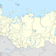
Romashkino Field, Oil field in Leninogorsky District, Tatarstan, Russia

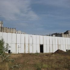
Romashkino Field is a large oil deposit in the Tatarstan region with reserves located deep underground in distinct geological formations. The field is operated by a major oil company and has numerous extraction facilities spread across the territory.

Oil deposits were discovered here in 1948 and made the region a major petroleum source for Russia. This discovery played a significant role in reshaping the country's economic structure in the postwar era.

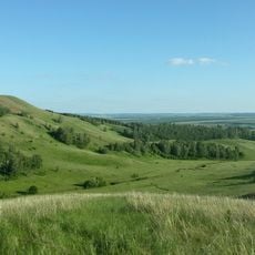
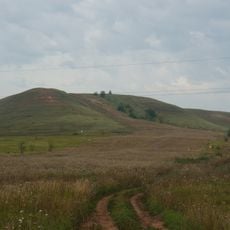
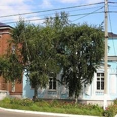
The development of this oil field shaped Tatarstan into a major industrial region and left a lasting mark on how people use the land. You can see the traces of this economic transformation everywhere in the landscape and local infrastructure.

The site is large and controlled by an oil company, so visitor access is limited or not possible. The best way to get a sense of the field is to travel through the region or visit nearby towns where the effects of oil production are visible.

This field has an unusual characteristic: oil quantities continue to grow despite decades of intensive extraction. Scientists explain this through underground flows of hydrocarbons that feed the field from outside and keep replenishing it.

The community of curious travelers

AroundUs brings together thousands of curated places, local tips, and hidden gems, enriched daily by 60,000 contributors worldwide.

Start exploring
Location
GPS coordinates
54.57278,52.37056
Latest update
December 20, 2025 13:47
Around this place
Tataria Nuclear Power Station
Russian Federation

Tataria Nuclear Power Station

120.4 km
Çatır taw
Russian Federation

Çatır taw

63.7 km
Aktashsky Proval Lake
Russian Federation

Aktashsky Proval Lake

40.7 km
Nizhne Kam Mosque
Russian Federation

Nizhne Kam Mosque

123.8 km
Бугульминский Казанско-Богородицкий монастырь
Russian Federation

Бугульминский Казанско-Богородицкий монастырь

27 km
Russian Federation

Regional Historical Museum Naberezhnye Chelny

124 km
Almetyevsk Tatar State Dramatic Theatre
Russian Federation

Almetyevsk Tatar State Dramatic Theatre

36.8 km
Shumilovsky waterfall
Russian Federation

Shumilovsky waterfall

84.7 km
Bugulminsky Alexandro-Nevsky monastery
Russian Federation

Bugulminsky Alexandro-Nevsky monastery

38.5 km
Stroitel Stadium
Russian Federation

Stroitel Stadium

123.3 km
Dolphinarium in Naberezhnye Chelny
Russian Federation

Dolphinarium in Naberezhnye Chelny

122.8 km
Jaroslav Hašek museum, Bugulma
Russian Federation

Jaroslav Hašek museum, Bugulma

27.8 km
Saint Michael the Archangel Church
Russian Federation

Saint Michael the Archangel Church

125.4 km
Бугурусланский Покровский монастырь
Russian Federation

Бугурусланский Покровский монастырь

102.8 km
Sernovodny Hill
Russian Federation

Sernovodny Hill

102.4 km
Russian Federation

С. Н. Ғимаев исемендәге боҙло комплекс

85.1 km
Russian Federation

Совхоза Татарстан

117.5 km
Tuymazy State Tatar Drama Theatre
Russian Federation

Tuymazy State Tatar Drama Theatre

85.4 km
Храм Святой Троицы города Бугуруслана
Russian Federation

Храм Святой Троицы города Бугуруслана

106.6 km
Бугульминский краеведческий музей
Russian Federation

Бугульминский краеведческий музей

28 km
Маклауш (разъезд)
Russian Federation

Маклауш (разъезд)

33 km
Russian Federation

Чувикс

120.1 km
Розовка Уйăрăшĕ
Russian Federation

Розовка Уйăрăшĕ

119.2 km
Гиндукуш
Russian Federation

Гиндукуш

109.3 km
Palace of Culture Energetik
Russian Federation

Palace of Culture Energetik

123.6 km
Our Lady of Kazan cathedral in Almetyevsk
Russian Federation

Our Lady of Kazan cathedral in Almetyevsk

37 km
Габдулла Тукай исемендәге үзәк китапханә
Russian Federation

Габдулла Тукай исемендәге үзәк китапханә

122.8 km
Yaxşıbay Mosque
Russian Federation

Yaxşıbay Mosque

66.6 km
Show the full map
Reviews
Share your experience

No review yet

Discussions
Start a discussion...

No discussion yet

« Romashkino Field - Oil field in Leninogorsky District, Tatarstan, Russia » is provided by Around Us (aroundus.com). Images and texts are derived from Wikimedia project under a Creative Commons license. You are allowed to copy, distribute, and modify copies of this page, under the conditions set by the license, as long as this note is clearly visible.

Discover hidden gems everywhere you go!

From secret cafés to breathtaking viewpoints, skip the crowded tourist spots and find places that match your style. Our app makes it easy with voice search, smart filtering, route optimization, and insider tips from travelers worldwide. Download now for the complete mobile experience.

Around Us App Screenshot

A unique approach to discovering new places

Le Figaro

All the places worth exploring

France Info

A tailor-made excursion in just a few clicks

20 Minutes

Around Us
Travel Guide & Maps
Download

Send to your phone

QR Code
1

Open the camera app on your mobile.

2

Point at the QR code with your camera. A notification will appear.

3

Tap the notification to open the link.