Enable Location

We need your location to show you interesting places around you

Discover nearby places

Find interesting locations and hidden gems around you

Precise directions

Get accurate directions and distances to places

Your location is never shared with other users. It's only used when you tap the location button.

Yazvenka

Log in to your account

Start exploring — it's free

Trusted by 62,933 travelers worldwide

Continue with Google
Continue with Apple
or

We will send you a code to connect

By continuing, you accept our Terms and Conditions and our Privacy Policy

Check your inbox

We've sent a pincode in your inbox. Please enter the code below.

Discussion Reviews 1 Photos
1.8k Popularity

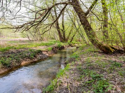
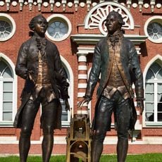
Yazvenka, Protected natural area and river in eastern Moscow, Russia.

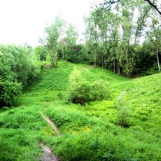
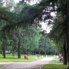
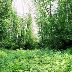
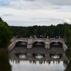
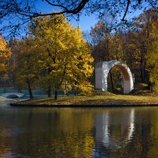
Yazvenka is a river in Moscow Oblast that flows through the eastern part of the metropolis, creating a green corridor with dense vegetation lining its banks. The water channel winds past residential areas while maintaining a natural landscape distinct from the surrounding urban development.

The river served as a natural pathway for communities settling in the growing city during its early development. Over time it remained an important feature of the local landscape while the metropolis expanded around it.

The river and its protected area serve as a space where Moscow residents observe nature and spend time outdoors in different seasons.

The area can be accessed from several points on the eastern side of the city with nearby parking available. Visitors should wear sturdy shoes and be prepared for uneven ground, especially during wet weather.

The protected corridor functions as a buffer between expanding development and allows wildlife to move through natural pathways across the urban area. This function for local animals often goes unnoticed but is vital to the city's natural balance.

The community of curious travelers

AroundUs brings together thousands of curated places, local tips, and hidden gems, enriched daily by 60,000 contributors worldwide.

Start exploring
Location
Location
GPS coordinates
55.60800,37.68597
Latest update
December 14, 2025 11:42
Around this place
Tsaritsyno Park + palace
Russian Federation

Tsaritsyno Park + palace

1 km
Tsaritsyno museum
Russian Federation

Tsaritsyno museum

862 m
Tsaritsyno Palace Building
Russian Federation

Tsaritsyno Palace Building

866 m
Biryulyovskiy Arboretum
Russian Federation

Biryulyovskiy Arboretum

1.3 km
Orekhovo-Borisovo Metochion
Russian Federation

Orekhovo-Borisovo Metochion

2.7 km
Church of the Theotokos Life Giving Spring in Tsaritsyno
Russian Federation

Church of the Theotokos Life Giving Spring in Tsaritsyno

1 km
Tsaritsino
Russian Federation

Tsaritsino

261 m
Arshinovskiy park
Russian Federation

Arshinovskiy park

2.4 km
Middle Tsaritsyno Palace
Russian Federation

Middle Tsaritsyno Palace

801 m
Кавалерские корпуса
Russian Federation

Кавалерские корпуса

924 m
Fountains in Tsaritsyno
Russian Federation

Fountains in Tsaritsyno

1.2 km
Monument to Vasili Bazhenov and Matvey Kazakov
Russian Federation

Monument to Vasili Bazhenov and Matvey Kazakov

909 m
Бирюлёвский лесопарк
Russian Federation

Бирюлёвский лесопарк

1.5 km
Храм-часовня иконы Божией Матери «Троеручица» в Орехове-Борисове
Russian Federation

Храм-часовня иконы Божией Матери «Троеручица» в Орехове-Борисове

2.2 km
Big Bridge over the Gully
Russian Federation

Big Bridge over the Gully

1.2 km
Small Tsaritsyno Palace
Russian Federation

Small Tsaritsyno Palace

887 m
Kitchen House in Tsaritsyno
Russian Federation

Kitchen House in Tsaritsyno

895 m
Pavilion of Milovid
Russian Federation

Pavilion of Milovid

562 m
The Ruin Tower (Tsaritsyno)
Russian Federation

The Ruin Tower (Tsaritsyno)

398 m
Third Chevalier House
Russian Federation

Third Chevalier House

1.1 km
Wineyard Gate (Tsaritsyno)
Russian Federation

Wineyard Gate (Tsaritsyno)

968 m
Second Chevalier House
Russian Federation

Second Chevalier House

1 km
First Chevalier House
Russian Federation

First Chevalier House

968 m
Upper Tsaritsyno Pond dam
Russian Federation

Upper Tsaritsyno Pond dam

1 km
Mermaid Gates
Russian Federation

Mermaid Gates

968 m
Pavilion Nerostankino
Russian Federation

Pavilion Nerostankino

353 m
Figurny Bridge
Russian Federation

Figurny Bridge

989 m
Водонапорная башня станции Бирюлёво-Товарная
Russian Federation

Водонапорная башня станции Бирюлёво-Товарная

2.6 km
Show the full map
Reviews
Share your experience

No review yet

Discussions
Start a discussion...

No discussion yet

« Yazvenka - Protected natural area and river in eastern Moscow, Russia » is provided by Around Us (aroundus.com). Images and texts are derived from Wikimedia project under a Creative Commons license. You are allowed to copy, distribute, and modify copies of this page, under the conditions set by the license, as long as this note is clearly visible.

Discover hidden gems everywhere you go!

From secret cafés to breathtaking viewpoints, skip the crowded tourist spots and find places that match your style. Our app makes it easy with voice search, smart filtering, route optimization, and insider tips from travelers worldwide. Download now for the complete mobile experience.

Around Us App Screenshot

A unique approach to discovering new places

Le Figaro

All the places worth exploring

France Info

A tailor-made excursion in just a few clicks

20 Minutes

Around Us
Travel Guide & Maps
Download

Send to your phone

QR Code
1

Open the camera app on your mobile.

2

Point at the QR code with your camera. A notification will appear.

3

Tap the notification to open the link.