See the monuments around you in AROpen chests in the app
Around Us is built for your phone — point your camera at the streets and discover the monuments and places around you in augmented reality.Around Us is built for your phone — chests unlock when you walk, explore and capture nearby places.
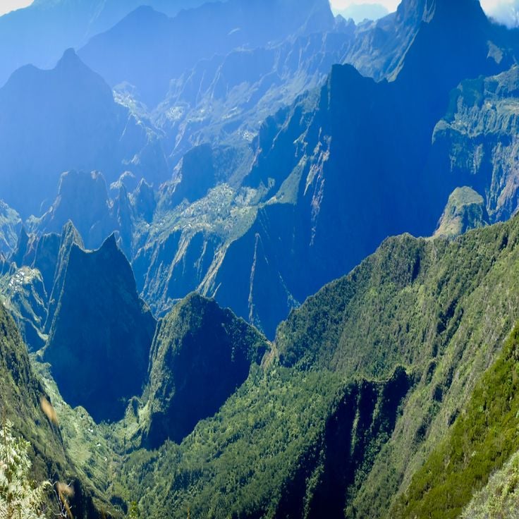
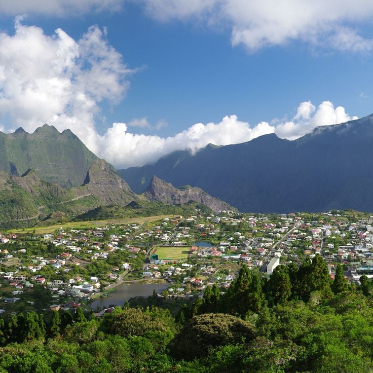
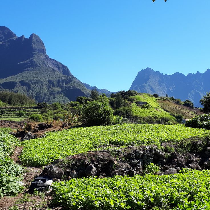
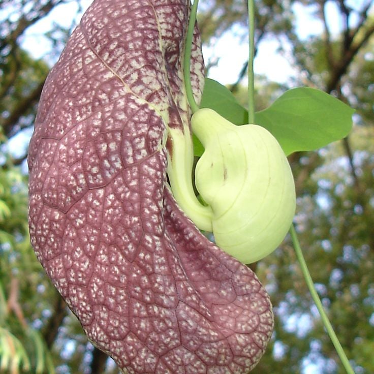
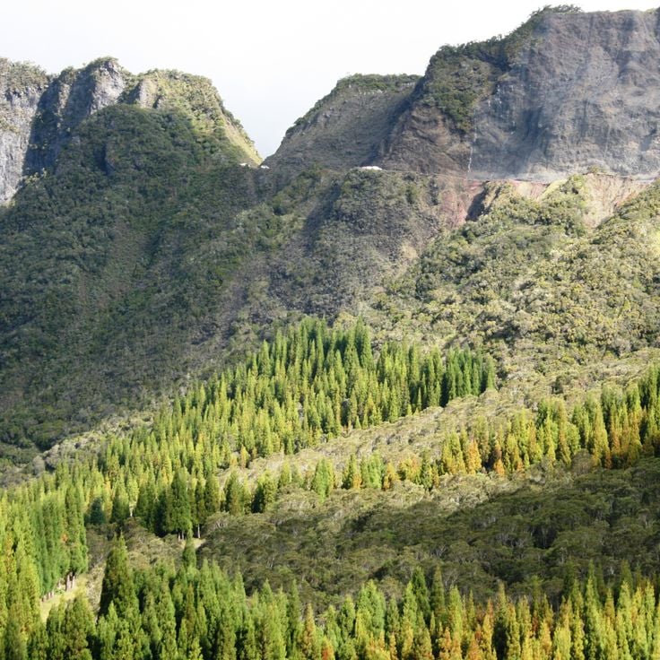
La Réunion is an island shaped by dramatic natural forces. Volcanoes, waterfalls, and mountains define the landscape. The Piton des Neiges rises to 3070 meters and dominates the island. Deep canyons cut through the terrain, crater lakes mirror the sky, and botanical gardens showcase the variety of plants found here.
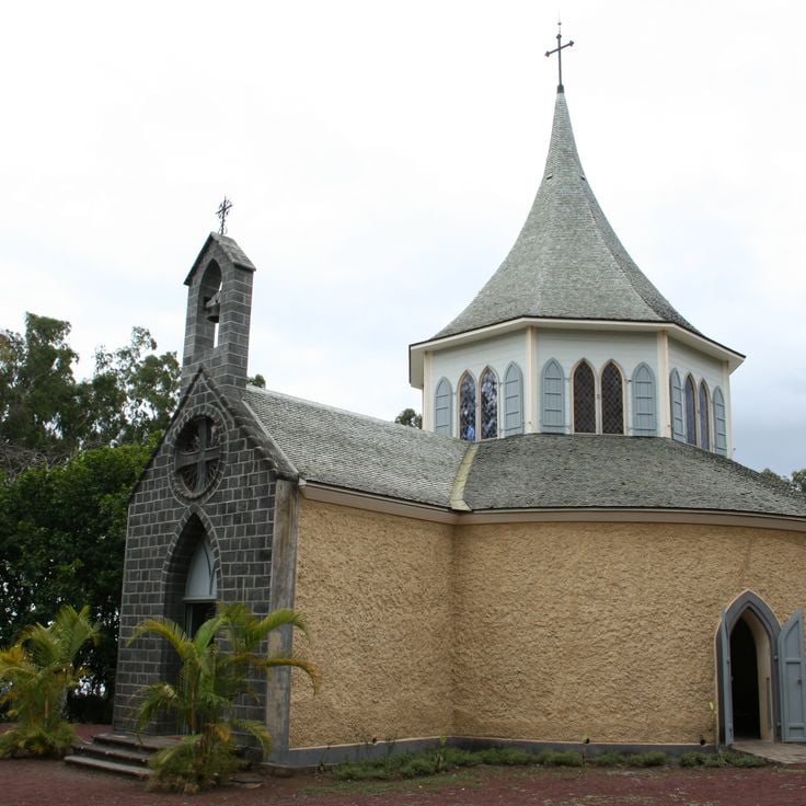
The island's history lives in its places. The Chapelle Pointue and the cemetery of Saint-Paul speak to the colonial period. Viewpoints like the Belvédère du Maïdo offer far-reaching perspectives across the land. Coastal sites like Anse des Cascades connect beach and nature. Some locations are shaped by volcanic forces, such as Cap Méchant and Pas de Bellecombe, where the ground tells stories of eruptions and change.
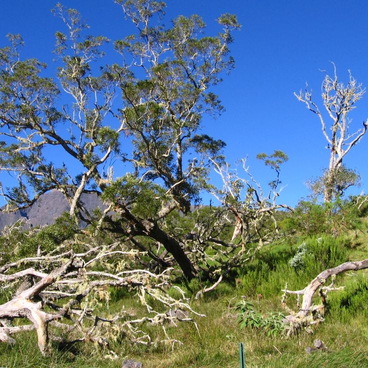
Visitors discover many ways to experience this island. Hikers follow steep trails to waterfalls like Cascade de Trou Noir. Others seek out quiet lakes such as Grand Étang or walk through forests like Forêt de Bébour. Each place has its own character and rewards those who take time to explore.
La Réunion is an island shaped by dramatic natural forces. Volcanoes, waterfalls, and mountains define the landscape. The Piton des Neiges rises to 3070 meters and dominates the island. Deep canyons cut through the terrain, crater lakes mirror the sky, and botanical gardens showcase the variety of plants found here.
The island's history lives in its places. The Chapelle Pointue and the cemetery of Saint-Paul speak to the colonial period. Viewpoints like the Belvédère du Maïdo offer far-reaching perspectives across the land. Coastal sites like Anse des Cascades connect beach and nature. Some locations are shaped by volcanic forces, such as Cap Méchant and Pas de Bellecombe, where the ground tells stories of eruptions and change.
Visitors discover many ways to experience this island. Hikers follow steep trails to waterfalls like Cascade de Trou Noir. Others seek out quiet lakes such as Grand Étang or walk through forests like Forêt de Bébour. Each place has its own character and rewards those who take time to explore.
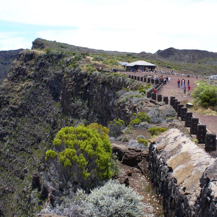
The Belvédère du Maïdo is an observation point at 2200 meters elevation that fits into La Réunion's natural and cultural places. From here, you look out 180 degrees over the Mafate valley and the Indian Ocean. On clear days, you watch clouds move below you and the landscape spreads out in all directions.
Anse des Cascades belongs to this collection of natural sites and cultural places on La Réunion, an island known for its volcanoes, waterfalls and mountains. At this location, multiple waterfalls flow into a cove where coconut trees grow, a small fishing port operates and views of the Indian Ocean extend to the horizon.
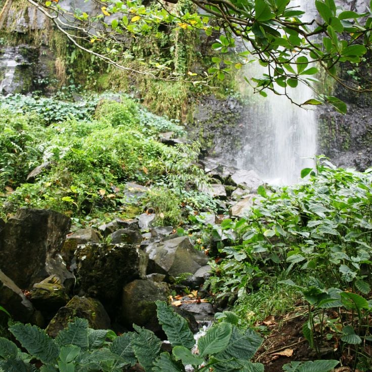
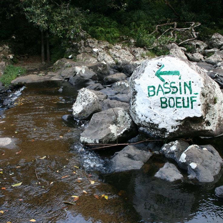
Bassin Boeuf is a natural water basin in the Sainte-Suzanne valley on La Réunion. This site fits among the island's natural attractions, which include volcanoes, waterfalls, and mountains. A waterfall drops about 10 meters into the basin, which is surrounded by bamboo and tropical plants. The pool invites you to swim and explore the surrounding forest.
La Roche Merveilleuse is an observation point at 1300 meters elevation in Cilaos. From here, you can see the Cilaos village, the valley and Piton des Neiges. This location fits perfectly into La Réunion's natural sites, which feature volcanoes, waterfalls and mountains, including the 3070 meter Piton des Neiges.
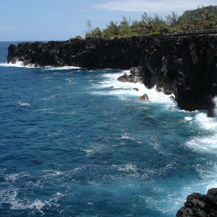
Cap Méchant is a natural site in Saint-Philippe that showcases La Réunion's raw power. The basalt cliffs rise 30 meters above the Indian Ocean, where large waves crash against the rocks. This place documents the volcanic origins of the island and the force of the sea that shapes the land.
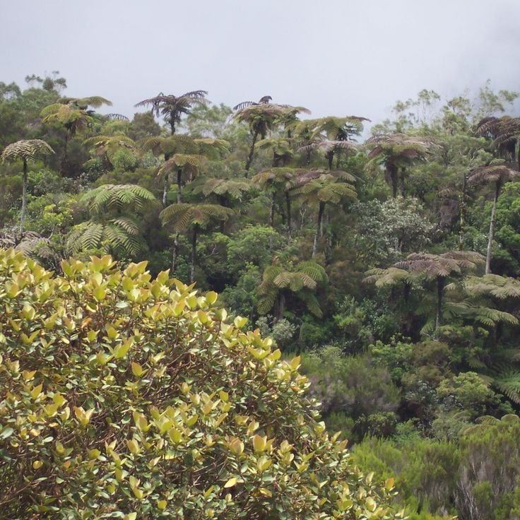
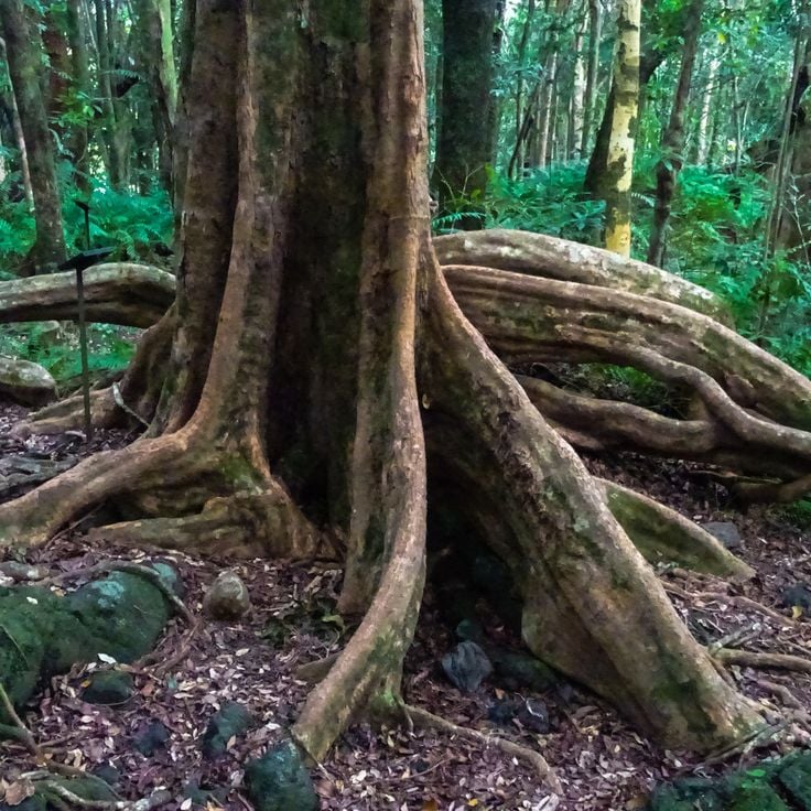
The Forêt de Bébour is a humid primary forest within La Réunion's diverse landscape of volcanoes, waterfalls and mountains. Located at altitudes between 1300 and 1800 meters, this forest is home to rare ferns, orchids and plants found nowhere else. Walking through its dense vegetation reveals the island's natural richness.
The viewpoint Belvédère de Bois Court sits at 1300 meters altitude and offers views across the island's landscapes and the Grand Bassin region. This location fits into the natural diversity of La Réunion, where volcanoes, waterfalls, and mountains shape the terrain. From here, visitors can take in the scale of Piton des Neiges and see the deep canyons and crater lakes that define the island.
Cascade de Trou Noir in Salazie is part of La Réunion's natural landscape, where waterfalls, volcanoes and mountains shape the island. The waterfall drops 30 meters between tropical plants and forms a natural pool at its base.
Pointe de la Table is a wild cape on La Réunion known for its peculiar rock formations by the ocean. This site fits within the island's diverse landscape, which features volcanoes, waterfalls and mountains. The cape shows the rugged character of the coastline and contributes to the natural richness that defines La Réunion.
The Piton de Sucre is a peak located in Sainte-Rose on La Réunion, offering a demanding hike with expansive views across the island. The climb takes you through varied landscapes and is visited by hikers who come to experience the natural beauty and distant vistas this place provides.
Mare à Poule d'Eau is a calm pond set within the highland forests. This site fits into the natural variety of La Réunion, which offers volcanoes, waterfalls and mountains. The Piton des Neiges rises to 3070 meters. The island has deep canyons, crater lakes and botanical gardens, showing the geological character of the island.
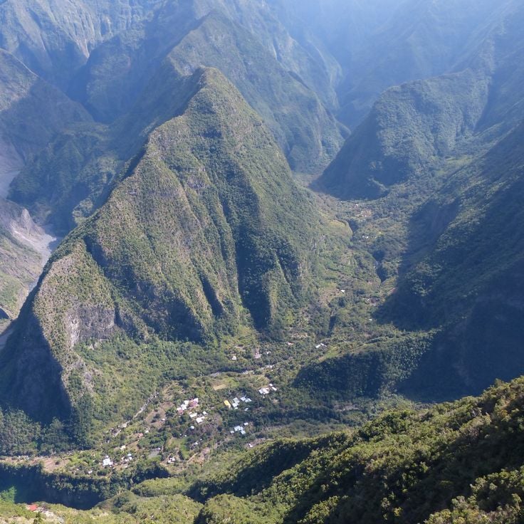
Ilet à Cordes is a remote village set among the mountains of La Réunion, reached by scenic pathways. The village shows how people live and work in this volcanic region. The surrounding canyons and peaks reflect the natural landscape that shapes life on the island.
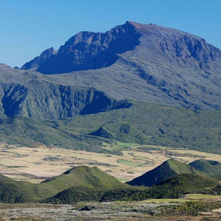
Piton des Neiges is an inactive volcano that rises 3070 meters and shapes the central landscape of La Réunion. With steep flanks and deep valleys, this mountain stands as the island's heart, revealing the volcanic history that formed this region. Visitors experience the raw beauty of high altitude terrain and discover how the island's natural character was built by ancient eruptions.
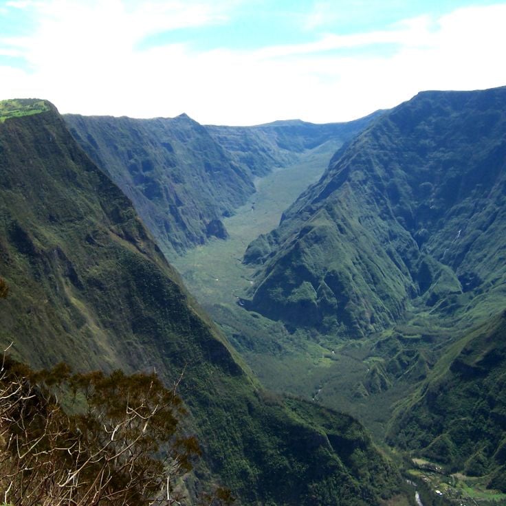
The Rivière des Remparts is a river in Saint-Joseph that has carved through volcanic rock over millions of years, creating a 1000-meter deep canyon and revealing geological formations. These layers of stone tell the story of La Réunion's volcanic origins and fit naturally among the island's other remarkable natural sites, from waterfalls to mountains.
Pas de Bellecombe is an observation platform at about 2311 meters elevation in Sainte-Rose. From this vantage point, you look out over the volcanic landscape of Piton de la Fournaise. The site shows you how volcanoes have shaped La Réunion's terrain. The view helps you understand why this region is known for its geological features, from deep canyons to crater lakes and the towering Piton des Neiges.
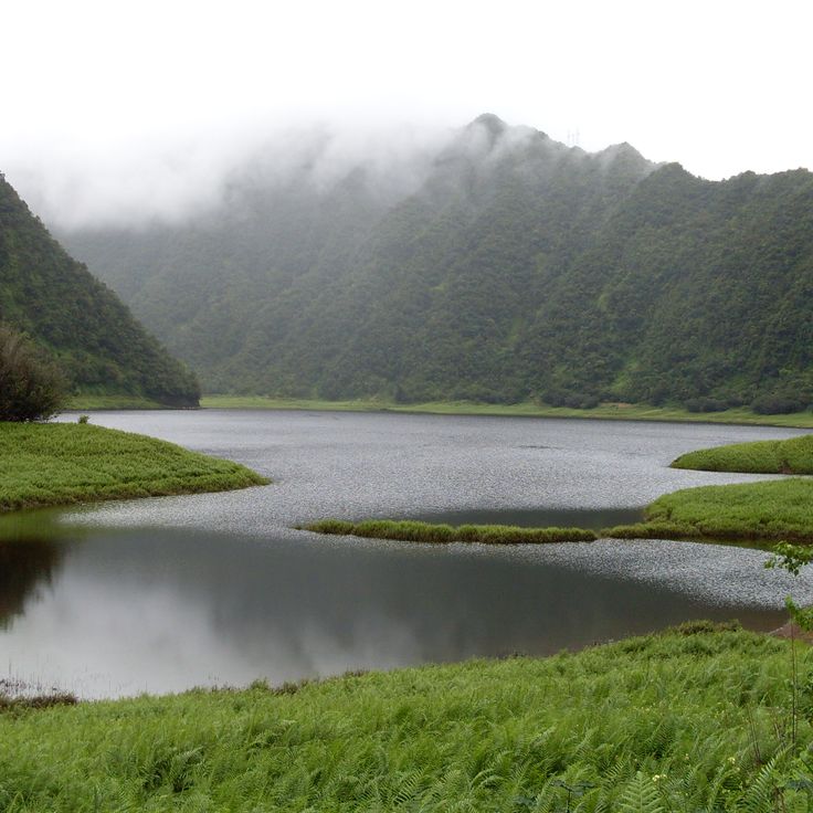
Grand Étang is a natural lake nestled within a volcanic crater in Saint-Benoît, representing the geological wonders found across La Réunion. The lake spans 3 hectares and receives water from multiple waterfalls that tumble down the crater walls, surrounded by dense bamboo forest. This site showcases the island's volcanic landscape, which also features mountains, deep canyons, crater lakes, and botanical gardens alongside its historical colonial sites.
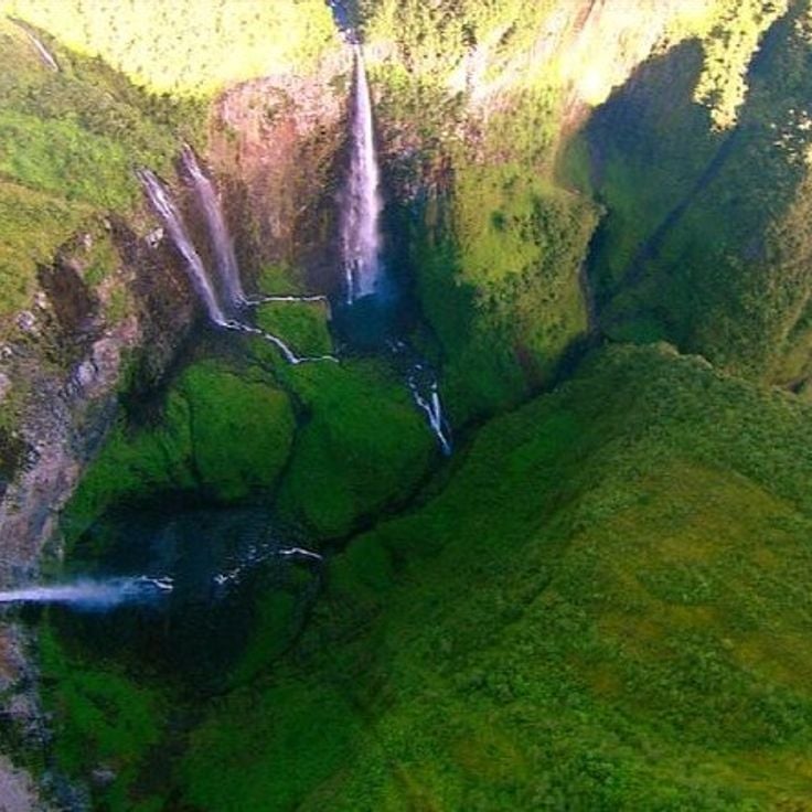
Trou de Fer is a canyon set within the Salazie cirque on the island of La Réunion. Seven waterfalls cascade down the sheer rock walls, which drop over 300 meters vertically. This location sits within La Réunion's landscape of volcanoes, mountains and crater lakes. The canyon shows the powerful geological forces that shaped the island.
The Mare Longue Forest is a lowland forest in Saint-Philippe and forms part of La Réunion's natural sites, where volcanoes, waterfalls and mountains shape the landscape. This forest sits between 150 and 300 meters above sea level and contains 150 plant species found nowhere else. It showcases the varied vegetation that La Réunion offers alongside its famous peaks like Piton des Neiges at 3070 meters, deep canyons and crater lakes.
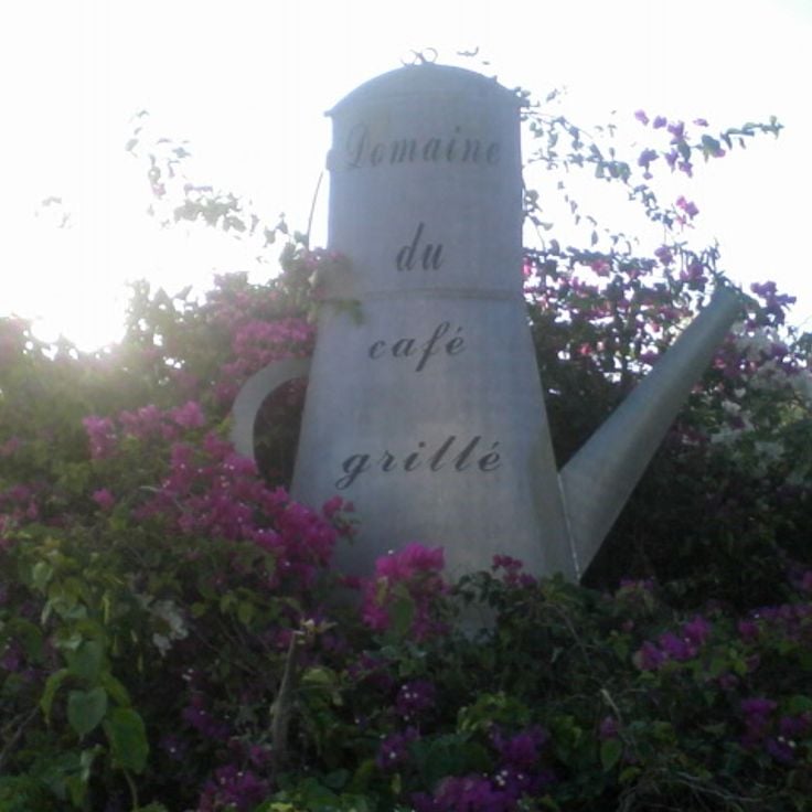
The Roasted Coffee Estate showcases coffee cultivation and processing on a 4-hectare property in Pierrefonds. Visitors can see how coffee grows on the land and follows the journey from plant to roasted bean. This working estate fits into Réunion's story of culture and nature, where waterfalls, mountains, and historical sites reveal how people have lived on the island.
The Egret Basin is a natural pool set between basalt rocks on an island known for its volcanoes, waterfalls, and mountains. Several freshwater springs feed this water basin, creating a refreshing spot within Réunion's varied landscape.
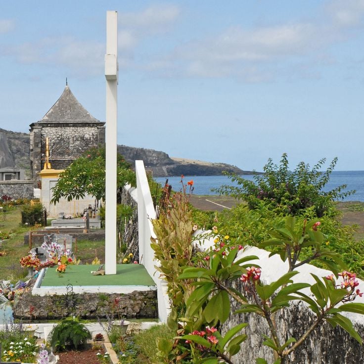
The Marin Cemetery of Saint-Paul is a historical cemetery by the sea that documents the island's maritime history and colonial period through its gravestones. It reveals the past of La Réunion and stands among the important places that tell the story of the island with its volcanoes, waterfalls and mountains.
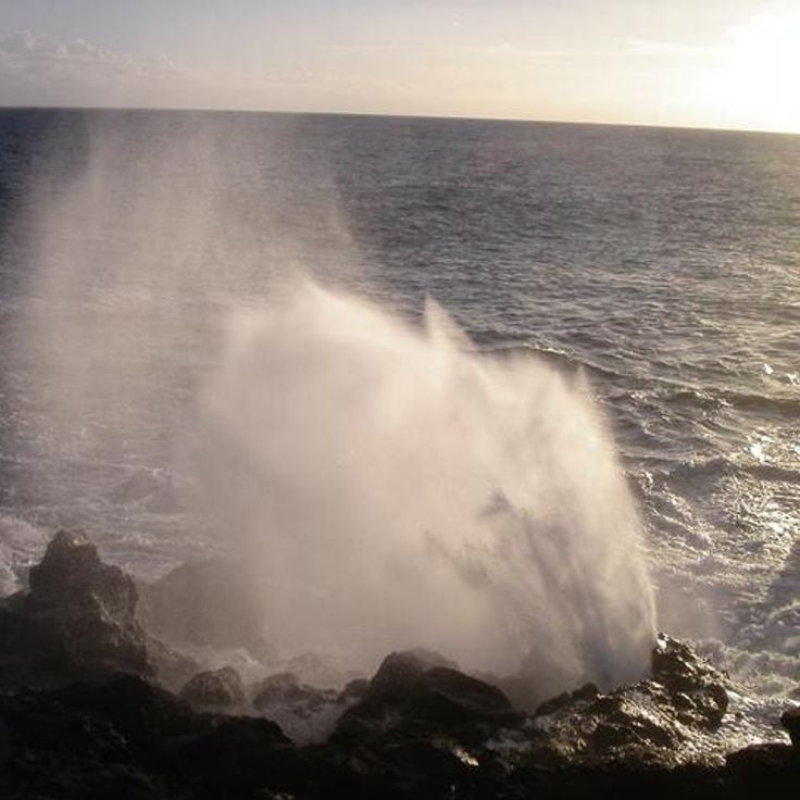
Le Souffleur in Saint-Leu is among the natural features of La Réunion, an island shaped by volcanoes, waterfalls, and mountains. This geological formation occurs when seawater shoots upward through volcanic tubes under high pressure. Le Souffleur demonstrates the raw power of the volcanic landscape that defines La Réunion. Visitors can watch as water erupts from the ground like a fountain, a display of nature's force.
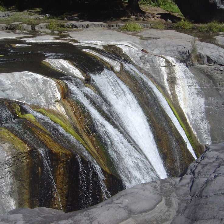
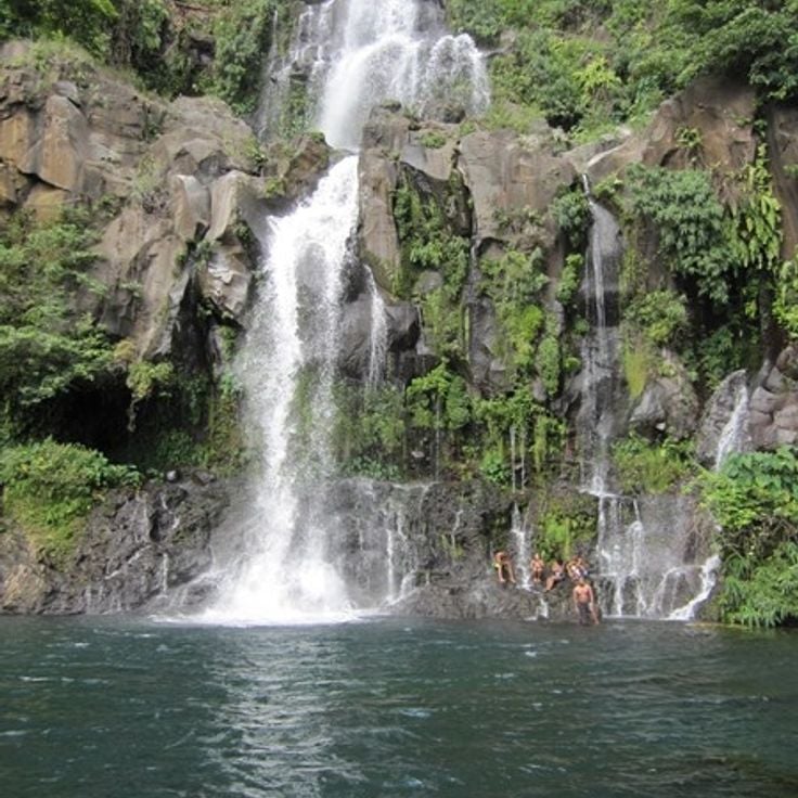
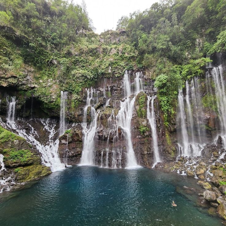
Cascade de Grand Galet is located in southern La Réunion, an island known for its volcanoes, waterfalls and mountains. This waterfall of the Langevin River drops 25 meters and forms several natural pools. The site is part of the island's varied landscapes, where history and nature come together.
The Jardin des Parfums et des Epices in Saint-Philippe showcases over 1500 tropical plants and fits perfectly into La Réunion's diverse natural landscape with volcanoes, waterfalls, and botanical gardens. This garden features spice plants including vanilla, cinnamon, and cloves, allowing visitors to discover the aromatic treasures that have shaped the island's history.
Chapelle Pointue is a religious building that stands on a rock formation between two 50-meter coastal cliffs on the southern shore of La Réunion. This chapel is part of the island's historical record from the colonial period. La Réunion itself features volcanoes, waterfalls, mountains, and deep canyons that shape its dramatic landscape.
Col des Bœufs is a mountain pass in the National Park of La Réunion, situated at 2011 meters altitude. It connects the districts of Salazie and Mafate through a walking path. This pass is part of the island's varied mountain landscape, which includes volcanoes, waterfalls, deep canyons, and crater lakes.
Plaine des Tamarins is located in the heart of the National Park of La Réunion, an island known for its volcanoes, waterfalls, and mountains. This forest area is home to hundred-year-old tamarind trees at 1800 meters elevation. It is part of a landscape featuring deep canyons, crater lakes, and botanical gardens that display the natural diversity of the region.
Les Trois Roches is a natural formation of three granite blocks in Mafate, part of La Réunion's diverse landscape. These rocks divide the river into multiple streams and create small water basins between them. The formation reflects the geological variety of the island, where volcanoes, waterfalls and mountains combine with fascinating rock structures.
The Belvédère du Maïdo is an observation point at 2200 meters elevation that fits into La Réunion's natural and cultural places. From here, you look out 180 degrees over the Mafate valley and the Indian Ocean. On clear days, you watch clouds move below you and the landscape spreads out in all directions.
Anse des Cascades belongs to this collection of natural sites and cultural places on La Réunion, an island known for its volcanoes, waterfalls and mountains. At this location, multiple waterfalls flow into a cove where coconut trees grow, a small fishing port operates and views of the Indian Ocean extend to the horizon.
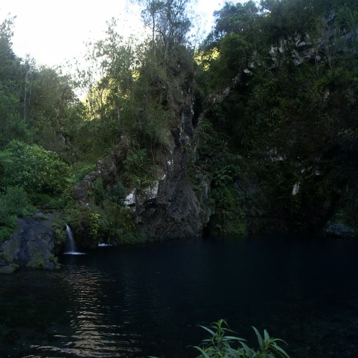
Bassin Boeuf is a natural water basin in the Sainte-Suzanne valley on La Réunion. This site fits among the island's natural attractions, which include volcanoes, waterfalls, and mountains. A waterfall drops about 10 meters into the basin, which is surrounded by bamboo and tropical plants. The pool invites you to swim and explore the surrounding forest.
La Roche Merveilleuse is an observation point at 1300 meters elevation in Cilaos. From here, you can see the Cilaos village, the valley and Piton des Neiges. This location fits perfectly into La Réunion's natural sites, which feature volcanoes, waterfalls and mountains, including the 3070 meter Piton des Neiges.
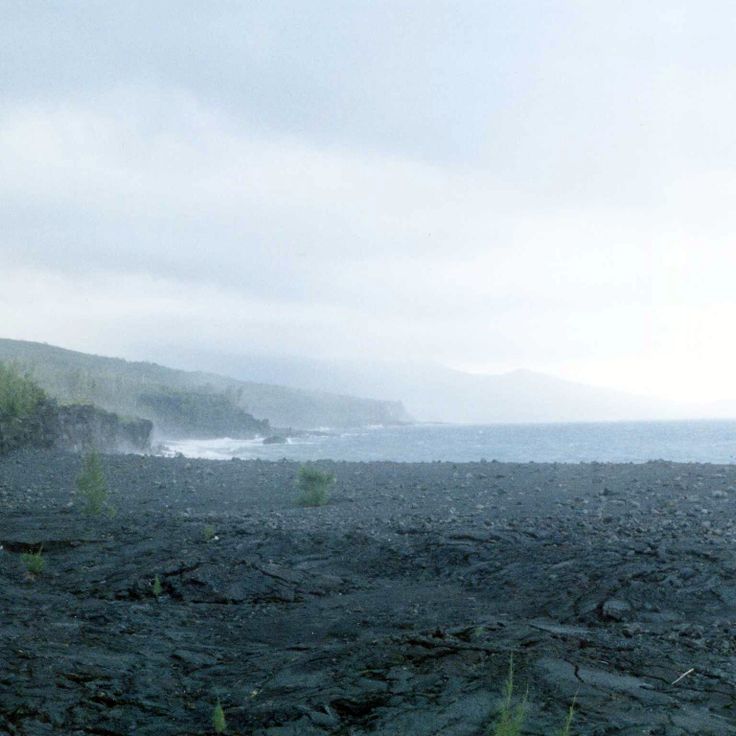
Cap Méchant is a natural site in Saint-Philippe that showcases La Réunion's raw power. The basalt cliffs rise 30 meters above the Indian Ocean, where large waves crash against the rocks. This place documents the volcanic origins of the island and the force of the sea that shapes the land.
The Forêt de Bébour is a humid primary forest within La Réunion's diverse landscape of volcanoes, waterfalls and mountains. Located at altitudes between 1300 and 1800 meters, this forest is home to rare ferns, orchids and plants found nowhere else. Walking through its dense vegetation reveals the island's natural richness.
The viewpoint Belvédère de Bois Court sits at 1300 meters altitude and offers views across the island's landscapes and the Grand Bassin region. This location fits into the natural diversity of La Réunion, where volcanoes, waterfalls, and mountains shape the terrain. From here, visitors can take in the scale of Piton des Neiges and see the deep canyons and crater lakes that define the island.
Cascade de Trou Noir in Salazie is part of La Réunion's natural landscape, where waterfalls, volcanoes and mountains shape the island. The waterfall drops 30 meters between tropical plants and forms a natural pool at its base.
Pointe de la Table is a wild cape on La Réunion known for its peculiar rock formations by the ocean. This site fits within the island's diverse landscape, which features volcanoes, waterfalls and mountains. The cape shows the rugged character of the coastline and contributes to the natural richness that defines La Réunion.
The Piton de Sucre is a peak located in Sainte-Rose on La Réunion, offering a demanding hike with expansive views across the island. The climb takes you through varied landscapes and is visited by hikers who come to experience the natural beauty and distant vistas this place provides.
Mare à Poule d'Eau is a calm pond set within the highland forests. This site fits into the natural variety of La Réunion, which offers volcanoes, waterfalls and mountains. The Piton des Neiges rises to 3070 meters. The island has deep canyons, crater lakes and botanical gardens, showing the geological character of the island.
Ilet à Cordes is a remote village set among the mountains of La Réunion, reached by scenic pathways. The village shows how people live and work in this volcanic region. The surrounding canyons and peaks reflect the natural landscape that shapes life on the island.
Piton des Neiges is an inactive volcano that rises 3070 meters and shapes the central landscape of La Réunion. With steep flanks and deep valleys, this mountain stands as the island's heart, revealing the volcanic history that formed this region. Visitors experience the raw beauty of high altitude terrain and discover how the island's natural character was built by ancient eruptions.
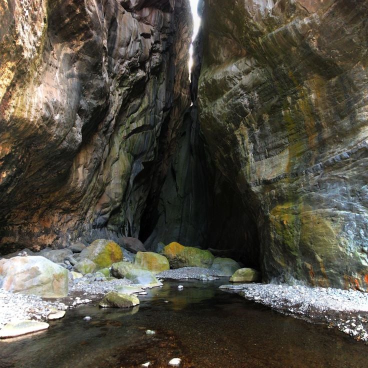
The Rivière des Remparts is a river in Saint-Joseph that has carved through volcanic rock over millions of years, creating a 1000-meter deep canyon and revealing geological formations. These layers of stone tell the story of La Réunion's volcanic origins and fit naturally among the island's other remarkable natural sites, from waterfalls to mountains.
Pas de Bellecombe is an observation platform at about 2311 meters elevation in Sainte-Rose. From this vantage point, you look out over the volcanic landscape of Piton de la Fournaise. The site shows you how volcanoes have shaped La Réunion's terrain. The view helps you understand why this region is known for its geological features, from deep canyons to crater lakes and the towering Piton des Neiges.
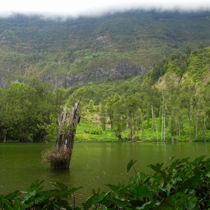
Grand Étang is a natural lake nestled within a volcanic crater in Saint-Benoît, representing the geological wonders found across La Réunion. The lake spans 3 hectares and receives water from multiple waterfalls that tumble down the crater walls, surrounded by dense bamboo forest. This site showcases the island's volcanic landscape, which also features mountains, deep canyons, crater lakes, and botanical gardens alongside its historical colonial sites.
Trou de Fer is a canyon set within the Salazie cirque on the island of La Réunion. Seven waterfalls cascade down the sheer rock walls, which drop over 300 meters vertically. This location sits within La Réunion's landscape of volcanoes, mountains and crater lakes. The canyon shows the powerful geological forces that shaped the island.
The Mare Longue Forest is a lowland forest in Saint-Philippe and forms part of La Réunion's natural sites, where volcanoes, waterfalls and mountains shape the landscape. This forest sits between 150 and 300 meters above sea level and contains 150 plant species found nowhere else. It showcases the varied vegetation that La Réunion offers alongside its famous peaks like Piton des Neiges at 3070 meters, deep canyons and crater lakes.
The Roasted Coffee Estate showcases coffee cultivation and processing on a 4-hectare property in Pierrefonds. Visitors can see how coffee grows on the land and follows the journey from plant to roasted bean. This working estate fits into Réunion's story of culture and nature, where waterfalls, mountains, and historical sites reveal how people have lived on the island.
The Egret Basin is a natural pool set between basalt rocks on an island known for its volcanoes, waterfalls, and mountains. Several freshwater springs feed this water basin, creating a refreshing spot within Réunion's varied landscape.
The Marin Cemetery of Saint-Paul is a historical cemetery by the sea that documents the island's maritime history and colonial period through its gravestones. It reveals the past of La Réunion and stands among the important places that tell the story of the island with its volcanoes, waterfalls and mountains.
Le Souffleur in Saint-Leu is among the natural features of La Réunion, an island shaped by volcanoes, waterfalls, and mountains. This geological formation occurs when seawater shoots upward through volcanic tubes under high pressure. Le Souffleur demonstrates the raw power of the volcanic landscape that defines La Réunion. Visitors can watch as water erupts from the ground like a fountain, a display of nature's force.
Cascade de Grand Galet is located in southern La Réunion, an island known for its volcanoes, waterfalls and mountains. This waterfall of the Langevin River drops 25 meters and forms several natural pools. The site is part of the island's varied landscapes, where history and nature come together.
The Jardin des Parfums et des Epices in Saint-Philippe showcases over 1500 tropical plants and fits perfectly into La Réunion's diverse natural landscape with volcanoes, waterfalls, and botanical gardens. This garden features spice plants including vanilla, cinnamon, and cloves, allowing visitors to discover the aromatic treasures that have shaped the island's history.
Chapelle Pointue is a religious building that stands on a rock formation between two 50-meter coastal cliffs on the southern shore of La Réunion. This chapel is part of the island's historical record from the colonial period. La Réunion itself features volcanoes, waterfalls, mountains, and deep canyons that shape its dramatic landscape.
Col des Bœufs is a mountain pass in the National Park of La Réunion, situated at 2011 meters altitude. It connects the districts of Salazie and Mafate through a walking path. This pass is part of the island's varied mountain landscape, which includes volcanoes, waterfalls, deep canyons, and crater lakes.
Plaine des Tamarins is located in the heart of the National Park of La Réunion, an island known for its volcanoes, waterfalls, and mountains. This forest area is home to hundred-year-old tamarind trees at 1800 meters elevation. It is part of a landscape featuring deep canyons, crater lakes, and botanical gardens that display the natural diversity of the region.
Les Trois Roches is a natural formation of three granite blocks in Mafate, part of La Réunion's diverse landscape. These rocks divide the river into multiple streams and create small water basins between them. The formation reflects the geological variety of the island, where volcanoes, waterfalls and mountains combine with fascinating rock structures.
The Belvédère du Maïdo is an observation point at 2200 meters elevation that fits into La Réunion's natural and cultural places. From here, you look out 180 degrees over the Mafate valley and the Indian Ocean. On clear days, you watch clouds move below you and the landscape spreads out in all directions.
Anse des Cascades belongs to this collection of natural sites and cultural places on La Réunion, an island known for its volcanoes, waterfalls and mountains. At this location, multiple waterfalls flow into a cove where coconut trees grow, a small fishing port operates and views of the Indian Ocean extend to the horizon.
Bassin Boeuf is a natural water basin in the Sainte-Suzanne valley on La Réunion. This site fits among the island's natural attractions, which include volcanoes, waterfalls, and mountains. A waterfall drops about 10 meters into the basin, which is surrounded by bamboo and tropical plants. The pool invites you to swim and explore the surrounding forest.
La Roche Merveilleuse is an observation point at 1300 meters elevation in Cilaos. From here, you can see the Cilaos village, the valley and Piton des Neiges. This location fits perfectly into La Réunion's natural sites, which feature volcanoes, waterfalls and mountains, including the 3070 meter Piton des Neiges.
Cap Méchant is a natural site in Saint-Philippe that showcases La Réunion's raw power. The basalt cliffs rise 30 meters above the Indian Ocean, where large waves crash against the rocks. This place documents the volcanic origins of the island and the force of the sea that shapes the land.
The Forêt de Bébour is a humid primary forest within La Réunion's diverse landscape of volcanoes, waterfalls and mountains. Located at altitudes between 1300 and 1800 meters, this forest is home to rare ferns, orchids and plants found nowhere else. Walking through its dense vegetation reveals the island's natural richness.
The viewpoint Belvédère de Bois Court sits at 1300 meters altitude and offers views across the island's landscapes and the Grand Bassin region. This location fits into the natural diversity of La Réunion, where volcanoes, waterfalls, and mountains shape the terrain. From here, visitors can take in the scale of Piton des Neiges and see the deep canyons and crater lakes that define the island.
Cascade de Trou Noir in Salazie is part of La Réunion's natural landscape, where waterfalls, volcanoes and mountains shape the island. The waterfall drops 30 meters between tropical plants and forms a natural pool at its base.
Pointe de la Table is a wild cape on La Réunion known for its peculiar rock formations by the ocean. This site fits within the island's diverse landscape, which features volcanoes, waterfalls and mountains. The cape shows the rugged character of the coastline and contributes to the natural richness that defines La Réunion.
The Piton de Sucre is a peak located in Sainte-Rose on La Réunion, offering a demanding hike with expansive views across the island. The climb takes you through varied landscapes and is visited by hikers who come to experience the natural beauty and distant vistas this place provides.
Mare à Poule d'Eau is a calm pond set within the highland forests. This site fits into the natural variety of La Réunion, which offers volcanoes, waterfalls and mountains. The Piton des Neiges rises to 3070 meters. The island has deep canyons, crater lakes and botanical gardens, showing the geological character of the island.
Ilet à Cordes is a remote village set among the mountains of La Réunion, reached by scenic pathways. The village shows how people live and work in this volcanic region. The surrounding canyons and peaks reflect the natural landscape that shapes life on the island.
Piton des Neiges is an inactive volcano that rises 3070 meters and shapes the central landscape of La Réunion. With steep flanks and deep valleys, this mountain stands as the island's heart, revealing the volcanic history that formed this region. Visitors experience the raw beauty of high altitude terrain and discover how the island's natural character was built by ancient eruptions.
The Rivière des Remparts is a river in Saint-Joseph that has carved through volcanic rock over millions of years, creating a 1000-meter deep canyon and revealing geological formations. These layers of stone tell the story of La Réunion's volcanic origins and fit naturally among the island's other remarkable natural sites, from waterfalls to mountains.
Pas de Bellecombe is an observation platform at about 2311 meters elevation in Sainte-Rose. From this vantage point, you look out over the volcanic landscape of Piton de la Fournaise. The site shows you how volcanoes have shaped La Réunion's terrain. The view helps you understand why this region is known for its geological features, from deep canyons to crater lakes and the towering Piton des Neiges.
Grand Étang is a natural lake nestled within a volcanic crater in Saint-Benoît, representing the geological wonders found across La Réunion. The lake spans 3 hectares and receives water from multiple waterfalls that tumble down the crater walls, surrounded by dense bamboo forest. This site showcases the island's volcanic landscape, which also features mountains, deep canyons, crater lakes, and botanical gardens alongside its historical colonial sites.
Trou de Fer is a canyon set within the Salazie cirque on the island of La Réunion. Seven waterfalls cascade down the sheer rock walls, which drop over 300 meters vertically. This location sits within La Réunion's landscape of volcanoes, mountains and crater lakes. The canyon shows the powerful geological forces that shaped the island.
The Mare Longue Forest is a lowland forest in Saint-Philippe and forms part of La Réunion's natural sites, where volcanoes, waterfalls and mountains shape the landscape. This forest sits between 150 and 300 meters above sea level and contains 150 plant species found nowhere else. It showcases the varied vegetation that La Réunion offers alongside its famous peaks like Piton des Neiges at 3070 meters, deep canyons and crater lakes.
The Roasted Coffee Estate showcases coffee cultivation and processing on a 4-hectare property in Pierrefonds. Visitors can see how coffee grows on the land and follows the journey from plant to roasted bean. This working estate fits into Réunion's story of culture and nature, where waterfalls, mountains, and historical sites reveal how people have lived on the island.
The Egret Basin is a natural pool set between basalt rocks on an island known for its volcanoes, waterfalls, and mountains. Several freshwater springs feed this water basin, creating a refreshing spot within Réunion's varied landscape.
The Marin Cemetery of Saint-Paul is a historical cemetery by the sea that documents the island's maritime history and colonial period through its gravestones. It reveals the past of La Réunion and stands among the important places that tell the story of the island with its volcanoes, waterfalls and mountains.
Le Souffleur in Saint-Leu is among the natural features of La Réunion, an island shaped by volcanoes, waterfalls, and mountains. This geological formation occurs when seawater shoots upward through volcanic tubes under high pressure. Le Souffleur demonstrates the raw power of the volcanic landscape that defines La Réunion. Visitors can watch as water erupts from the ground like a fountain, a display of nature's force.
Cascade de Grand Galet is located in southern La Réunion, an island known for its volcanoes, waterfalls and mountains. This waterfall of the Langevin River drops 25 meters and forms several natural pools. The site is part of the island's varied landscapes, where history and nature come together.
The Jardin des Parfums et des Epices in Saint-Philippe showcases over 1500 tropical plants and fits perfectly into La Réunion's diverse natural landscape with volcanoes, waterfalls, and botanical gardens. This garden features spice plants including vanilla, cinnamon, and cloves, allowing visitors to discover the aromatic treasures that have shaped the island's history.
Chapelle Pointue is a religious building that stands on a rock formation between two 50-meter coastal cliffs on the southern shore of La Réunion. This chapel is part of the island's historical record from the colonial period. La Réunion itself features volcanoes, waterfalls, mountains, and deep canyons that shape its dramatic landscape.
Col des Bœufs is a mountain pass in the National Park of La Réunion, situated at 2011 meters altitude. It connects the districts of Salazie and Mafate through a walking path. This pass is part of the island's varied mountain landscape, which includes volcanoes, waterfalls, deep canyons, and crater lakes.
Plaine des Tamarins is located in the heart of the National Park of La Réunion, an island known for its volcanoes, waterfalls, and mountains. This forest area is home to hundred-year-old tamarind trees at 1800 meters elevation. It is part of a landscape featuring deep canyons, crater lakes, and botanical gardens that display the natural diversity of the region.
Les Trois Roches is a natural formation of three granite blocks in Mafate, part of La Réunion's diverse landscape. These rocks divide the river into multiple streams and create small water basins between them. The formation reflects the geological variety of the island, where volcanoes, waterfalls and mountains combine with fascinating rock structures.