Crayford

Log in to your account

AroundUs is a community-driven map of interesting places, built by curious explorers like you. It grows with every review, story, and photo you share.
Connect to save your favorite spots, contribute locations, and create personalized routes.
By continuing, you accept our Terms and Conditions and our Privacy Policy
Add to collection
Map
Suggest a change
Share

Crayford, Administrative district in London Borough of Bexley, England

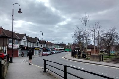
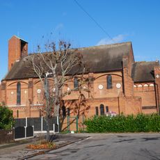
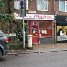
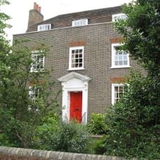
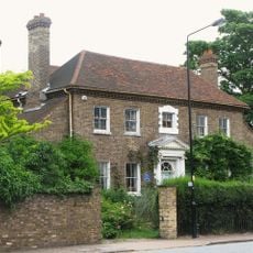
Crayford is an area in the London Borough of Bexley that spreads along the River Cray, with residential neighborhoods, shops, and green spaces throughout. The district connects these different zones through local streets, creating a mixed community with homes, commerce, and outdoor areas.

The area appears in the Domesday Book of 1086, documenting 27 households, three mills, and a church controlled by Christ Church Canterbury. This early record shows that the settlement was already organized and economically active nearly a thousand years ago.

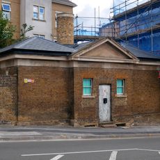
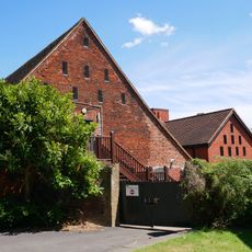
The town carries traces of its industrial past through buildings that once housed textile and weapons manufacturing from the 1800s. These structures still shape the character of local streets today, showing how work and production once defined daily life here.

The area has good train connections from Crayford station to central London, with regular services throughout the day and multiple bus routes linking to nearby neighborhoods. Getting around requires using a combination of these public transport options depending on your destination.

According to the Anglo-Saxon Chronicle, the Battle of Crecganford occurred here in 457, marking the beginning of Saxon control over Kent. This early conflict reveals how strategically important the area was for controlling southeastern England at that time.

Location: London Borough of Bexley

GPS coordinates: 51.44910,0.18120

Latest update: December 7, 2025 10:06

Photos
Around this place
Hall Place and Gardens
United Kingdom

Hall Place and Gardens

1.5 km
The Mick Jagger Centre
United Kingdom

The Mick Jagger Centre

1.8 km
One Bell
United Kingdom

One Bell

654 m
Bexley Civic Offices
United Kingdom

Bexley Civic Offices

2 km
Braeburn Park
United Kingdom

Braeburn Park

754 m
Wansunt Pit
United Kingdom

Wansunt Pit

926 m
Crayford Town Hall
United Kingdom

Crayford Town Hall

127 m
Church of St Paulinus, Crayford
United Kingdom

Church of St Paulinus, Crayford

787 m
Parish Church of St Mary the Virgin
United Kingdom

Parish Church of St Mary the Virgin

2.1 km
Christ Church
United Kingdom

Christ Church

1.5 km
Coal Duty Boundary Marker (In The Fence To The Back Of The Garden Of Number 57 Baldwyn's Park) And Adjacent Iron Bollard
United Kingdom

Coal Duty Boundary Marker (In The Fence To The Back Of The Garden Of Number 57 Baldwyn's Park) And Adjacent Iron Bollard

2.2 km
Former West Hill Police Station
United Kingdom

Former West Hill Police Station

2 km
Coal Duty Boundary Marker (On The South Side Of Number 1)
United Kingdom

Coal Duty Boundary Marker (On The South Side Of Number 1)

1.9 km
Crayford War Memorial
United Kingdom

Crayford War Memorial

1.2 km
The Long Shed (Part Of David Evans Limited Factory At Number 71)
United Kingdom

The Long Shed (Part Of David Evans Limited Factory At Number 71)

630 m
Barn At Hall Place
United Kingdom

Barn At Hall Place

1.5 km
Cray House
United Kingdom

Cray House

2.2 km
High Street House
United Kingdom

High Street House

2.2 km
Milestone Opposite Nos 179 And 179A
United Kingdom

Milestone Opposite Nos 179 And 179A

977 m
16, North Cray Road
United Kingdom

16, North Cray Road

2.2 km
Lychgate to South West of Parish Church of St Mary the Virgin
United Kingdom

Lychgate to South West of Parish Church of St Mary the Virgin

2.2 km
Granary Approximately 25 Metres South South East Of Hall Place
United Kingdom

Granary Approximately 25 Metres South South East Of Hall Place

1.5 km
Lychgate to West of Parish Church of St Paulinus
United Kingdom

Lychgate to West of Parish Church of St Paulinus

808 m
Crayford Manor House
United Kingdom

Crayford Manor House

1.2 km
Garden Wall, Gatepiers And Gates To North Amd West Of Hall Place
United Kingdom

Garden Wall, Gatepiers And Gates To North Amd West Of Hall Place

1.5 km
The Oakwood
United Kingdom

The Oakwood

1 km
Milestone, Old Bexley Lane, 40m E of Kent Boundary post
United Kingdom

Milestone, Old Bexley Lane, 40m E of Kent Boundary post

1.9 km
Milestone, The Broadway, Bexley Heath, opp Zizzi restaurant and by Civic Centre
United Kingdom

Milestone, The Broadway, Bexley Heath, opp Zizzi restaurant and by Civic Centre

2.3 km
Show the full map
Reviews

Visited this place? Tap the stars to rate it and share your experience / photos with the community! Try now! You can cancel it anytime.

« Crayford - Administrative district in London Borough of Bexley, England » is provided by Around Us (aroundus.com). Images and texts are derived from Wikimedia project under a Creative Commons license. You are allowed to copy, distribute, and modify copies of this page, under the conditions set by the license, as long as this note is clearly visible.

Discover hidden gems everywhere you go!

From secret cafés to breathtaking viewpoints, skip the crowded tourist spots and find places that match your style. Our app makes it easy with voice search, smart filtering, route optimization, and insider tips from travelers worldwide. Download now for the complete mobile experience.

Around Us App Screenshot

A unique approach to discovering new places

Le Figaro

All the places worth exploring

France Info

A tailor-made excursion in just a few clicks

20 Minutes