Enable Location

We need your location to show you interesting places around you

Discover nearby places

Find interesting locations and hidden gems around you

Precise directions

Get accurate directions and distances to places

Your location is never shared with other users. It's only used when you tap the location button.

Clinton County

Log in to your account

Join the adventure

Create your free account and start exploring (like 60k+ others)

We will send you a code to connect

or
Continue with Google
Continue with Apple
By continuing, you accept our Terms and Conditions and our Privacy Policy

Check your inbox

We've sent a pincode in your inbox. Please enter the code below.

Clinton County, Administrative division in northeastern New York, United States

Description

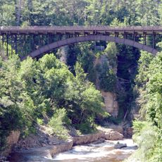
Clinton County is an administrative division spanning wooded terrain in northeastern New York with mountains, lakeshores, and river valleys. The region combines elevated terrain with water systems that shape the landscape and local communities.

History

This area was established in 1788 and named after George Clinton, the first Governor of New York. Clinton later held national office, reflecting the political importance of the founding period.

Culture

The State University of New York at Plattsburgh and Clinton Community College contribute to the educational landscape of Clinton County through their academic programs.

Practical

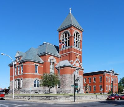
The county seat of Plattsburgh provides access to services, healthcare facilities, and transportation links for visitors and residents. The area can be reached by major highways and regional airports.

Did you know?

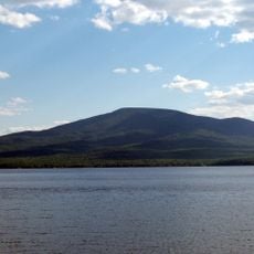
Lyon Mountain in the town of Dannemora rises to about 3,830 feet (1,170 m), making it the highest point in the area. The peak offers views across the surrounding forests and valleys.

Location
Inception
1788
Capital city
Plattsburgh
Shares border with
Chittenden County, Grand Isle County, Franklin County, Les Jardins-de-Napierville, Le Haut-Richelieu, Le Haut-Saint-Laurent, Essex County
GPS coordinates
44.74000,-73.68000
Latest update
December 17, 2025 09:09

AroundUs brings together thousands of curated places, local tips, and hidden gems, enriched daily by 60,000 contributors worldwide. Discover all places nearby (New York).

Around this place
Fort Montgomery
United States of America

Fort Montgomery

39.4 km
Ausable Chasm
United States of America

Ausable Chasm

29.2 km
Chazy Fossil Reef
United States of America

Chazy Fossil Reef

29.6 km
Point Au Roche State Park
United States of America

Point Au Roche State Park

23.3 km
Rouses Point–Lacolle 223 Border Crossing
Canada

Rouses Point–Lacolle 223 Border Crossing

38.7 km
Lyon Mountain
United States of America

Lyon Mountain

15.2 km
Fort Sainte Anne
Canada

Fort Sainte Anne

31.7 km
Old Stone Barracks
United States of America

Old Stone Barracks

19.7 km
United States of America

Cumberland Bay State Park

20.4 km
Rouses Point Bridge
United States of America

Rouses Point Bridge

38.9 km
Bluff Point Light
United States of America

Bluff Point Light

23.5 km
AuSable Chasm Bridge
United States of America

AuSable Chasm Bridge

29.5 km
Mooers–Hemmingford Border Crossing
Canada

Mooers–Hemmingford Border Crossing

30.1 km
Cumberland Head Light
United States of America

Cumberland Head Light

23.9 km
Hawkins Hall
United States of America

Hawkins Hall

17.4 km
Double-Span Metal Pratt Truss Bridge
United States of America

Double-Span Metal Pratt Truss Bridge

30.8 km
Strand Theate
United States of America

Strand Theate

18.5 km
St. John the Baptist Roman Catholic Church
United States of America

St. John the Baptist Roman Catholic Church

18.5 km
Swing Bridge
United States of America

Swing Bridge

30.6 km
Point Aux Roches Light
United States of America

Point Aux Roches Light

26.1 km
United States of America

Windmill Point Light

37.9 km
Plattsburgh Bay
United States of America

Plattsburgh Bay

24.6 km
United States of America

Fort Brown Site

19.1 km
Elkanah Watson House
United States of America

Elkanah Watson House

32.3 km
United States of America

Delaware and Hudson Railroad Bridge

28.3 km
Clinton County Courthouse Complex
United States of America

Clinton County Courthouse Complex

18.5 km
Kent-Delord House
United States of America

Kent-Delord House

18.5 km
Isle La Motte Light
United States of America

Isle La Motte Light

32.4 km
Show the full map
Administrative divisions
« Clinton County - Administrative division in northeastern New York, United States » is provided by Around Us (aroundus.com). Images and texts are derived from Wikimedia project under a Creative Commons license. You are allowed to copy, distribute, and modify copies of this page, under the conditions set by the license, as long as this note is clearly visible.

Discover hidden gems everywhere you go!

From secret cafés to breathtaking viewpoints, skip the crowded tourist spots and find places that match your style. Our app makes it easy with voice search, smart filtering, route optimization, and insider tips from travelers worldwide. Download now for the complete mobile experience.

Around Us App Screenshot

A unique approach to discovering new places

Le Figaro

All the places worth exploring

France Info

A tailor-made excursion in just a few clicks

20 Minutes

Around Us
Travel Guide & Maps
Download

Send to your phone

QR Code
1

Open the camera app on your mobile.

2

Point at the QR code with your camera. A notification will appear.

3

Tap the notification to open the link.