Enable Location

We need your location to show you interesting places around you

Discover nearby places

Find interesting locations and hidden gems around you

Precise directions

Get accurate directions and distances to places

Your location is never shared with other users. It's only used when you tap the location button.

Tuscola County

Log in to your account

Start exploring — it's free

Trusted by 62,033 travelers worldwide

Continue with Google
Continue with Apple
or

We will send you a code to connect

By continuing, you accept our Terms and Conditions and our Privacy Policy

Check your inbox

We've sent a pincode in your inbox. Please enter the code below.

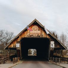
Tuscola County, Administrative county in Thumb region, Michigan.

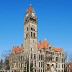
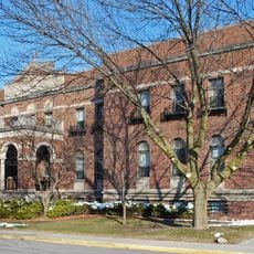
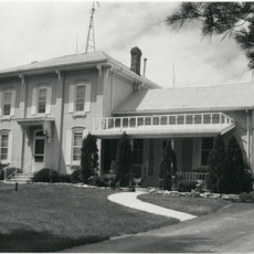
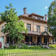
Tuscola County is an administrative division in the Thumb region of Michigan, encompassing several small towns and rural areas. The county operates from Caro, where the main government offices and courthouses are located.

The county was established in 1840, marking the start of organized government in this part of Michigan. Over the following decades, the region developed into an agricultural center with growing communities.

The county maintains multiple courts, including Circuit, District, and Probate courts, serving the legal needs of more than 50,000 residents.

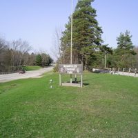
Visitors will find all main administrative facilities and public services concentrated in Caro for easy access. Most attractions and services are best reached by car, as the area is connected by good roads.

The Pioneer Power Antique Tractor Show in Caro displays the region's farm machinery heritage through working exhibits and demonstrations. This annual event draws visitors interested in agricultural history and old farming equipment.

The community of curious travelers

AroundUs brings together thousands of curated places, local tips, and hidden gems, enriched daily by 60,000 contributors worldwide.

Start exploring
Location
Inception
April 1, 1840
Capital city
Caro
Shares border with
Huron County, Lapeer County, Sanilac County, Genesee County, Saginaw County, Bay County
GPS coordinates
43.46667,-83.45000
Latest update
December 7, 2025 19:28
Around this place
Zilwaukee Bridge
United States of America

Zilwaukee Bridge

37.4 km
USS Edson
United States of America

USS Edson

37.6 km
Sanilac Petroglyphs Historic State Park
United States of America

Sanilac Petroglyphs Historic State Park

40.8 km
Zehnder’s Splash Village Water Park
United States of America

Zehnder’s Splash Village Water Park

28.7 km
Richard C. Burtis House
United States of America

Richard C. Burtis House

6.2 km
Saginaw River Rear Range Light
United States of America

Saginaw River Rear Range Light

37.4 km
City Hall
United States of America

City Hall

38.1 km
Randall House
United States of America

Randall House

17.5 km
Bay City Downtown Historic District
United States of America

Bay City Downtown Historic District

38.4 km
Mercy Hospital and Elizabeth McDowell Bialy Memorial House
United States of America

Mercy Hospital and Elizabeth McDowell Bialy Memorial House

38.1 km
Indian Mission
United States of America

Indian Mission

28.9 km
Bay City Masonic Temple
United States of America

Bay City Masonic Temple

37.9 km
Trinity Episcopal Church
United States of America

Trinity Episcopal Church

4.9 km
Townsend North House
United States of America

Townsend North House

14.4 km
Odd Fellows Valley Lodge No. 189 Building
United States of America

Odd Fellows Valley Lodge No. 189 Building

37.6 km
Gugel Bridge
United States of America

Gugel Bridge

30.5 km
State Street Bridge
United States of America

State Street Bridge

37 km
Bay County Building
United States of America

Bay County Building

38 km
Tuscola County Courthouse
United States of America

Tuscola County Courthouse

5.3 km
First Presbyterian Church
United States of America

First Presbyterian Church

26.9 km
Harry C. Tinker House
United States of America

Harry C. Tinker House

37 km
McKinley School
United States of America

McKinley School

15 km
Millington Bank Building
United States of America

Millington Bank Building

21.7 km
Alexander McClew Farm House
United States of America

Alexander McClew Farm House

32 km
Green Acres Golf Course
United States of America

Green Acres Golf Course

33.9 km
Independence Bridge
United States of America

Independence Bridge

37.8 km
William Peter Mansion
United States of America

William Peter Mansion

34.7 km
Zehnder's Covered Bridge
United States of America

Zehnder's Covered Bridge

28.2 km
Show the full map
Administrative divisions
« Tuscola County - Administrative county in Thumb region, Michigan » is provided by Around Us (aroundus.com). Images and texts are derived from Wikimedia project under a Creative Commons license. You are allowed to copy, distribute, and modify copies of this page, under the conditions set by the license, as long as this note is clearly visible.

Discover hidden gems everywhere you go!

From secret cafés to breathtaking viewpoints, skip the crowded tourist spots and find places that match your style. Our app makes it easy with voice search, smart filtering, route optimization, and insider tips from travelers worldwide. Download now for the complete mobile experience.

Around Us App Screenshot

A unique approach to discovering new places

Le Figaro

All the places worth exploring

France Info

A tailor-made excursion in just a few clicks

20 Minutes

Around Us
Travel Guide & Maps
Download

Send to your phone

QR Code
1

Open the camera app on your mobile.

2

Point at the QR code with your camera. A notification will appear.

3

Tap the notification to open the link.