Enable Location

We need your location to show you interesting places around you

Discover nearby places

Find interesting locations and hidden gems around you

Precise directions

Get accurate directions and distances to places

Your location is never shared with other users. It's only used when you tap the location button.

Interstate 88

Log in to your account

Start exploring — it's free

Trusted by 62,818 travelers worldwide

Continue with Google
Continue with Apple
or

We will send you a code to connect

By continuing, you accept our Terms and Conditions and our Privacy Policy

Check your inbox

We've sent a pincode in your inbox. Please enter the code below.

Interstate 88

Interstate 88, Major interstate highway in northern Illinois, United States

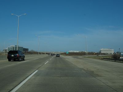
Interstate 88 is a major highway in northern Illinois extending roughly 140 kilometers from Silvis and Moline near the Iowa border to Hillside. The route connects the Quad Cities area with the Chicago metropolitan region and serves as an important corridor for both passenger and freight traffic.

The highway received its Interstate designation in July 1987, converting from Illinois Route 5. This reclassification allowed speed limit increases to 65 miles per hour on certain sections.

The tollway section was named in honor of former President Ronald Reagan, a native of Illinois, following his death in 2004. This naming reflects the state's connection to this historical figure.

Speed limits vary between 100 and 110 kilometers per hour depending on the section. Drivers should watch for signs since limits change, especially in transition zones and near urban areas.

The road functions as part of the Chicago-Kansas City Expressway system and offers truck drivers an alternative to Interstate 80 for freight movement. This role makes it an important secondary corridor in the regional cargo network.

The community of curious travelers

AroundUs brings together thousands of curated places, local tips, and hidden gems, enriched daily by 60,000 contributors worldwide.

Start exploring
Location
Inception
July 1987
GPS coordinates
41.79640,-88.31652
Latest update
December 20, 2025 00:45
Around this place
Fabyan Villa
United States of America

Fabyan Villa

8.3 km
Riverbank Laboratories
United States of America

Riverbank Laboratories

8.3 km
Two Brothers Roundhouse
United States of America

Two Brothers Roundhouse

4 km
Paramount Theatre
United States of America

Paramount Theatre

4.3 km
Fabyan Windmill
United States of America

Fabyan Windmill

8.4 km
Leland Tower
United States of America

Leland Tower

4.3 km
Stolp Island
United States of America

Stolp Island

4.3 km
Mrs. A. W. Gridley House
United States of America

Mrs. A. W. Gridley House

7.1 km
Old Second National Bank
United States of America

Old Second National Bank

4.3 km
Sam and Ruth VanSickle Ford House
United States of America

Sam and Ruth VanSickle Ford House

6 km
Grand Army of the Republic Hall
United States of America

Grand Army of the Republic Hall

4.4 km
Elizabeth Place
United States of America

Elizabeth Place

9.3 km
Col. Ira C. Copley Mansion
United States of America

Col. Ira C. Copley Mansion

4.2 km
Keystone Building
United States of America

Keystone Building

4.4 km
Aurora Public Library
United States of America

Aurora Public Library

4.5 km
Graham Building
United States of America

Graham Building

4.4 km
Aurora Historical Museum
United States of America

Aurora Historical Museum

3.7 km
Stolp Woolen Mill Store
United States of America

Stolp Woolen Mill Store

4.4 km
West Side Historic District
United States of America

West Side Historic District

4.9 km
Healy Chapel
United States of America

Healy Chapel

4.2 km
First Methodist Church of Batavia
United States of America

First Methodist Church of Batavia

5.8 km
Ephraim Smith House
United States of America

Ephraim Smith House

9.7 km
Big Woods School
United States of America

Big Woods School

7.3 km
Stearns–Wadsworth House
United States of America

Stearns–Wadsworth House

9.2 km
Middle Avenue Historic District
United States of America

Middle Avenue Historic District

4.6 km
Masonic Temple
United States of America

Masonic Temple

4.8 km
LaSalle Street Auto Row Historic District
United States of America

LaSalle Street Auto Row Historic District

4.6 km
Judge Isaac Wilson House
United States of America

Judge Isaac Wilson House

6.1 km
Show the full map
« Interstate 88 - Major interstate highway in northern Illinois, United States » is provided by Around Us (aroundus.com). Images and texts are derived from Wikimedia project under a Creative Commons license. You are allowed to copy, distribute, and modify copies of this page, under the conditions set by the license, as long as this note is clearly visible.

Discover hidden gems everywhere you go!

From secret cafés to breathtaking viewpoints, skip the crowded tourist spots and find places that match your style. Our app makes it easy with voice search, smart filtering, route optimization, and insider tips from travelers worldwide. Download now for the complete mobile experience.

Around Us App Screenshot

A unique approach to discovering new places

Le Figaro

All the places worth exploring

France Info

A tailor-made excursion in just a few clicks

20 Minutes

Around Us
Travel Guide & Maps
Download

Send to your phone

QR Code
1

Open the camera app on your mobile.

2

Point at the QR code with your camera. A notification will appear.

3

Tap the notification to open the link.