Clare County

Log in to your account

AroundUs is a community-driven map of interesting places, built by curious explorers like you. It grows with every review, story, and photo you share.
Connect to save your favorite spots, contribute locations, and create personalized routes.
By continuing, you accept our Terms and Conditions and our Privacy Policy
Add to collection
Map
Suggest a change
Share

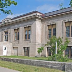
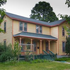
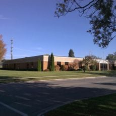
Clare County, County administration center in Central Michigan, US
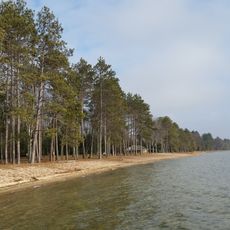
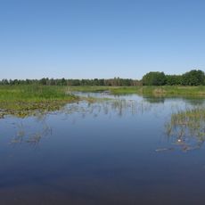
Clare County extends across 575 square miles of land in Michigan, containing a mix of agricultural fields, forests, and numerous lakes throughout its territory.

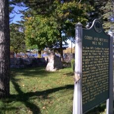
The Michigan Legislature established the county in 1840 as Kaykakee County, named after a Sauk Indian Chief, before renaming it to Clare County in 1843.

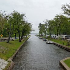
The county maintains multiple public parks, recreation areas, and trail systems where residents participate in outdoor activities throughout all four seasons.

The county connects major transportation routes through US Highway 10, US Highway 127, M-61, and M-18, facilitating travel across the central Michigan region.

The Clare-Gladwin Regional Education Service District operates specialized education programs serving both counties with technical and vocational training opportunities.

Location: Michigan

Inception: 1840

Capital city: Harrison

Shares border with: Roscommon County, Isabella County, Gladwin County, Midland County, Mecosta County, Osceola County, Missaukee County

Website: http://clareco.net

GPS coordinates: 43.99000,-84.84000

Latest update: March 6, 2025 15:11

Around this place
Show the full map
Soaring Eagle Waterpark
United States of America

Soaring Eagle Waterpark

42.9 km
South Higgins Lake State Park
United States of America

South Higgins Lake State Park

50.4 km
Au Sable State Forest
United States of America

Au Sable State Forest

55 km
North Higgins Lake State Park
United States of America

North Higgins Lake State Park

58.7 km
Mitchell State Park
United States of America

Mitchell State Park

56.2 km
Dead Stream Flooding State Wildlife Management Area
United States of America

Dead Stream Flooding State Wildlife Management Area

43.4 km
Mount Pleasant Downtown Historic District
United States of America

Mount Pleasant Downtown Historic District

43.2 km
Cadillac-Soo Lumber Company 3
United States of America

Cadillac-Soo Lumber Company 3

52.9 km
Charles T. Mitchell House
United States of America

Charles T. Mitchell House

53.3 km
Houghton Lake Flats Flooding State Wildlife Management Area
United States of America

Houghton Lake Flats Flooding State Wildlife Management Area

42.6 km
Cadillac Public Library
United States of America

Cadillac Public Library

53.3 km
Michigan Condensed Milk Factory
United States of America

Michigan Condensed Milk Factory

43.1 km
Frank J. Cobbs House
United States of America

Frank J. Cobbs House

52.9 km
Eggleston School
United States of America

Eggleston School

36.9 km
George and Martha Hitchcock House
United States of America

George and Martha Hitchcock House

17.2 km
Elks Temple Building
United States of America

Elks Temple Building

53.2 km
Cobbs and Mitchell Building
United States of America

Cobbs and Mitchell Building

53 km
Masonic Temple Building
United States of America

Masonic Temple Building

53.4 km
Clare Downtown Historic District
United States of America

Clare Downtown Historic District

19.9 km
Sherman City Union Church
United States of America

Sherman City Union Church

34.9 km
Doughty House
United States of America

Doughty House

43.1 km
The Sweeney House
United States of America

The Sweeney House

43.4 km
Ball Road-Little Salt Creek Bridge
United States of America

Ball Road-Little Salt Creek Bridge

57.4 km
Kelly/Shorts Stadium
United States of America

Kelly/Shorts Stadium

46.3 km
Cobbs and Mitchell Mill No 1 Historical Marker
United States of America

Cobbs and Mitchell Mill No 1 Historical Marker

52.9 km
Cadillac Wexford Public Library
United States of America

Cadillac Wexford Public Library

53.1 km
Missaukee County Historical Society Museum
United States of America

Missaukee County Historical Society Museum

49.4 km
Missaukee County Veterans Memorial Park
United States of America

Missaukee County Veterans Memorial Park

48.5 km
Show the full map

Reviews

Visited this place? Tap the stars to rate it and share your experience / photos with the community! Try now! You can cancel it anytime.

Administrative divisions
« Clare County: County administration center in Central Michigan, US » is provided by Around Us (aroundus.com). Images and texts are derived from Wikimedia project under a Creative Commons license. You are allowed to copy, distribute, and modify copies of this page, under the conditions set by the license, as long as this note is clearly visible.

Discover hidden gems everywhere you go!

From secret cafés to breathtaking viewpoints, skip the crowded tourist spots and find places that match your style. Our app makes it easy with voice search, smart filtering, route optimization, and insider tips from travelers worldwide. Download now for the complete mobile experience.

Around Us App Screenshot

A unique approach to discovering new places

Le Figaro

All the places worth exploring

France Info

A tailor-made excursion in just a few clicks

20 Minutes