Enable Location

We need your location to show you interesting places around you

Discover nearby places

Find interesting locations and hidden gems around you

Precise directions

Get accurate directions and distances to places

Your location is never shared with other users. It's only used when you tap the location button.

Yankton County

Log in to your account

Start exploring — it's free

Trusted by 62,844 travelers worldwide

Continue with Google
Continue with Apple
or

We will send you a code to connect

By continuing, you accept our Terms and Conditions and our Privacy Policy

Check your inbox

We've sent a pincode in your inbox. Please enter the code below.

Yankton County, County in South Dakota, United States.

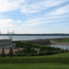
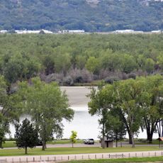
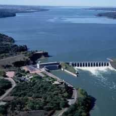
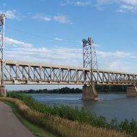
Yankton County is an administrative division in South Dakota stretching along the Missouri River. The area includes several cities and towns, and features the Gavins Point Dam that creates Lewis and Clark Lake.

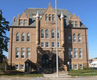
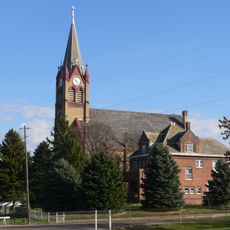
The area was established in 1862 and named after the Yankton Sioux people who lived here long before. The city of Yankton became the administrative and economic center of this county.

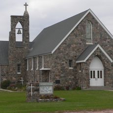
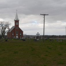
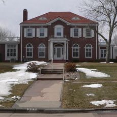
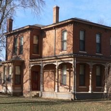
The name comes from the Yankton Sioux, an indigenous nation with deep roots in this area. Visitors can still see cultural marks and places connected to this heritage throughout the region.

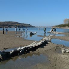
The region is accessible via several major highways that connect all the towns and communities throughout. The Missouri River and the lake offer good access points for visitors interested in water activities and outdoor exploration.

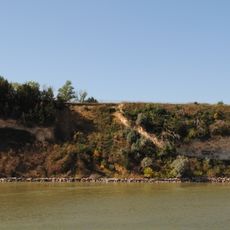
The Gavins Point Dam creates a striking contrast between the river landscape upstream and downstream, shaping the region in obvious ways. This structure has been central to how the land and communities here developed over time.

The community of curious travelers

AroundUs brings together thousands of curated places, local tips, and hidden gems, enriched daily by 60,000 contributors worldwide.

Start exploring
Location
Inception
1862
Capital city
Yankton
Shares border with
Bon Homme County, Cedar County, Clay County, Hutchinson County, Knox County, Turner County
GPS coordinates
43.01000,-97.39000
Latest update
December 10, 2025 15:58
Around this place
Lewis and Clark Lake
United States of America

Lewis and Clark Lake

18.4 km
Missouri National Recreational River
United States of America

Missouri National Recreational River

16.4 km
Human Services Center
United States of America

Human Services Center

11.1 km
Discovery Bridge
United States of America

Discovery Bridge

16.1 km
United States of America

Lewis and Clark State Recreation Area

24.7 km
Our Savior's Lutheran Church
United States of America

Our Savior's Lutheran Church

22 km
Calumet Bluff
United States of America

Calumet Bluff

18.2 km
Immaculate Conception Catholic Church and Rectory
United States of America

Immaculate Conception Catholic Church and Rectory

25.2 km
Gavins Point National Fish Hatchery
United States of America

Gavins Point National Fish Hatchery

17.7 km
Governor John L. Pennington House
United States of America

Governor John L. Pennington House

15.6 km
Training Dike Recreation Area
United States of America

Training Dike Recreation Area

18.8 km
St. Agnes Church
United States of America

St. Agnes Church

4.1 km
United Church of Christ
United States of America

United Church of Christ

13.2 km
Cottonwood Recreation Area
United States of America

Cottonwood Recreation Area

18.2 km
Vangen Church
United States of America

Vangen Church

13.8 km
Ohlman-Shannon House
United States of America

Ohlman-Shannon House

15.6 km
Aggergaard Manor
United States of America

Aggergaard Manor

20.4 km
Yankton Carnegie Library
United States of America

Yankton Carnegie Library

15.4 km
Martin's Evangelical Church
United States of America

Martin's Evangelical Church

5.1 km
Van Osdel House
United States of America

Van Osdel House

13.4 km
William J. Fantle House
United States of America

William J. Fantle House

14.2 km
Harold A. Doyle House
United States of America

Harold A. Doyle House

15.6 km
Burns House
United States of America

Burns House

14.8 km
Dr. John Trierweiler House
United States of America

Dr. John Trierweiler House

15.6 km
Bishop Marty Rectory
United States of America

Bishop Marty Rectory

15.5 km
Dr. B.M. Banton House
United States of America

Dr. B.M. Banton House

15.2 km
Bruce-Donaldson House
United States of America

Bruce-Donaldson House

15.5 km
Mathias Merkwan Rubblestone Barn
United States of America

Mathias Merkwan Rubblestone Barn

20.8 km
Show the full map
Administrative divisions
« Yankton County - County in South Dakota, United States » is provided by Around Us (aroundus.com). Images and texts are derived from Wikimedia project under a Creative Commons license. You are allowed to copy, distribute, and modify copies of this page, under the conditions set by the license, as long as this note is clearly visible.

Discover hidden gems everywhere you go!

From secret cafés to breathtaking viewpoints, skip the crowded tourist spots and find places that match your style. Our app makes it easy with voice search, smart filtering, route optimization, and insider tips from travelers worldwide. Download now for the complete mobile experience.

Around Us App Screenshot

A unique approach to discovering new places

Le Figaro

All the places worth exploring

France Info

A tailor-made excursion in just a few clicks

20 Minutes

Around Us
Travel Guide & Maps
Download

Send to your phone

QR Code
1

Open the camera app on your mobile.

2

Point at the QR code with your camera. A notification will appear.

3

Tap the notification to open the link.