Enable Location

We need your location to show you interesting places around you

Discover nearby places

Find interesting locations and hidden gems around you

Precise directions

Get accurate directions and distances to places

Your location is never shared with other users. It's only used when you tap the location button.

Custer County

Log in to your account

Start exploring — it's free

Trusted by 61,814 travelers worldwide

Continue with Google
Continue with Apple
or

We will send you a code to connect

By continuing, you accept our Terms and Conditions and our Privacy Policy

Check your inbox

We've sent a pincode in your inbox. Please enter the code below.

Custer County, Administrative county in central Nebraska, US.

Description

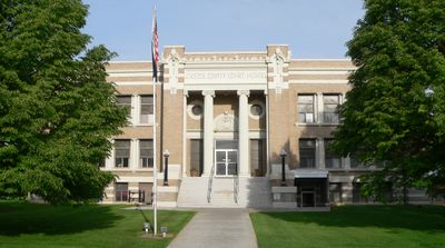
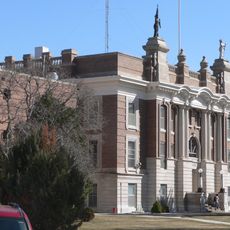
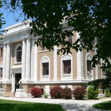
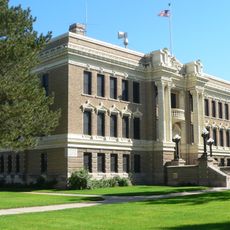
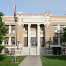
Custer County is an administrative division in central Nebraska covering approximately 2,576 square miles, making it the second largest county in the state. The county seat is Broken Bow, where the main courthouse stands at 431 South 10th Street.

History

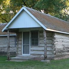
The county was established in 1877 and named after General George Armstrong Custer, who died at the Battle of Little Bighorn in 1876. Its creation was part of the broader settlement and administrative organization of western Nebraska during that era.

Culture

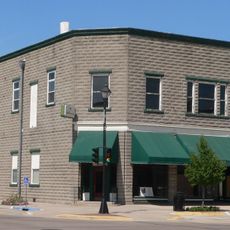
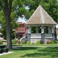
The courthouse in Broken Bow brings the community together for official matters and everyday civic interactions. You will see people coming and going to handle local business and gather for public events.

Practical

The courthouse in Broken Bow provides access to county services and is straightforward to locate in town. Main offices are open on weekdays during standard business hours for your convenience.

Did you know?

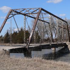
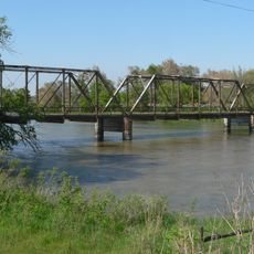
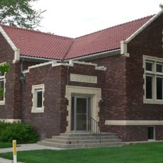
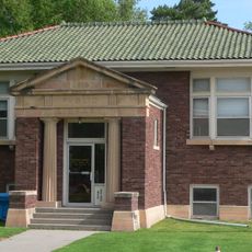
The Burlington Railroad arrived in the 1880s and connected isolated settlements throughout the region. This rail line enabled new towns to develop along its route and reshaped the local economy.

Location
Inception
1877
Capital city
Broken Bow
Shares border with
Valley County, Dawson County, Loup County, Garfield County, Sherman County, Buffalo County, Lincoln County, Logan County, Blaine County
GPS coordinates
41.39000,-99.73000
Latest update
December 7, 2025 20:47

AroundUs brings together thousands of curated places, local tips, and hidden gems, enriched daily by 60,000 contributors worldwide. Discover all places nearby (Nebraska).

Around this place
Dowse Sod House
United States of America

Dowse Sod House

41.4 km
Fort McPherson
United States of America

Fort McPherson

78 km
Fort McPherson National Cemetery
United States of America

Fort McPherson National Cemetery

78.1 km
Heartland Museum of Military Vehicles
United States of America

Heartland Museum of Military Vehicles

72 km
Fort Hartsuff State Historical Park
United States of America

Fort Hartsuff State Historical Park

69.6 km
St. Anselm's Catholic Church, Rectory and Parish Hall
United States of America

St. Anselm's Catholic Church, Rectory and Parish Hall

27.6 km
Rad Slavin cis. 112 Z.C.B.J. Hall
United States of America

Rad Slavin cis. 112 Z.C.B.J. Hall

53.8 km
Sargent Bridge
United States of America

Sargent Bridge

39.9 km
Dawson County Courthouse
United States of America

Dawson County Courthouse

67.9 km
Garfield County Frontier Fairgrounds
United States of America

Garfield County Frontier Fairgrounds

66.3 km
Loup City Township Carnegie Library
United States of America

Loup City Township Carnegie Library

65.1 km
North Loup Bridge
United States of America

North Loup Bridge

82.7 km
Burwell Carnegie Library
United States of America

Burwell Carnegie Library

66.2 km
People's Unitarian Church
United States of America

People's Unitarian Church

70.7 km
Sherman County Courthouse
United States of America

Sherman County Courthouse

65.1 km
Allen's Opera House
United States of America

Allen's Opera House

62.8 km
Ernest A. Calling House
United States of America

Ernest A. Calling House

62.3 km
Valley County Courthouse
United States of America

Valley County Courthouse

70.9 km
Ira Webster Olive House
United States of America

Ira Webster Olive House

67.1 km
Custer County Courthouse
United States of America

Custer County Courthouse

19.4 km
Gothenburg Carnegie Library
United States of America

Gothenburg Carnegie Library

62.7 km
Custer County Courthouse
United States of America

Custer County Courthouse

7.5 km
Brenizer Library
United States of America

Brenizer Library

10.8 km
Broken Bow Carnegie Library
United States of America

Broken Bow Carnegie Library

7.5 km
Tiffany Theater
United States of America

Tiffany Theater

7.5 km
Tobin Indian Raid Historical Marker
United States of America

Tobin Indian Raid Historical Marker

75.3 km
Sweetwater Mill Bridge
United States of America

Sweetwater Mill Bridge

71.9 km
Harry V. Temple House
United States of America

Harry V. Temple House

67.2 km
Show the full map
Administrative divisions
« Custer County - Administrative county in central Nebraska, US » is provided by Around Us (aroundus.com). Images and texts are derived from Wikimedia project under a Creative Commons license. You are allowed to copy, distribute, and modify copies of this page, under the conditions set by the license, as long as this note is clearly visible.

Discover hidden gems everywhere you go!

From secret cafés to breathtaking viewpoints, skip the crowded tourist spots and find places that match your style. Our app makes it easy with voice search, smart filtering, route optimization, and insider tips from travelers worldwide. Download now for the complete mobile experience.

Around Us App Screenshot

A unique approach to discovering new places

Le Figaro

All the places worth exploring

France Info

A tailor-made excursion in just a few clicks

20 Minutes

Around Us
Travel Guide & Maps
Download

Send to your phone

QR Code
1

Open the camera app on your mobile.

2

Point at the QR code with your camera. A notification will appear.

3

Tap the notification to open the link.