Mashpee

Log in to your account

AroundUs is a community-driven map of interesting places, built by curious explorers like you. It grows with every review, story, and photo you share.
Connect to save your favorite spots, contribute locations, and create personalized routes.
Continue with Google
Continue with Apple
Continue with X
Continue with Facebook
Continue with email
By continuing, you accept our Terms and Conditions and our Privacy Policy
Create an account
Add to collection
Map
Suggest a change
Share

Mashpee, New England town in Barnstable County, Massachusetts

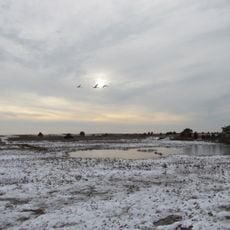
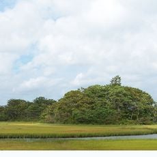
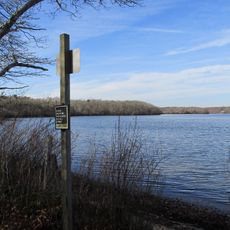
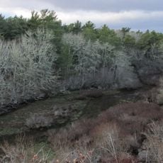
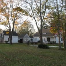
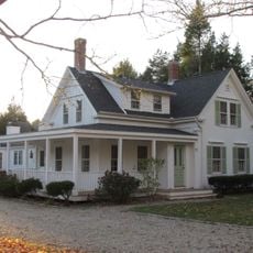
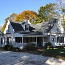
Mashpee is a town in Barnstable County located on Cape Cod, Massachusetts, with lakes, wetlands, and coastal areas that shape its landscape. The town contains several villages and neighborhoods connected by roads and waterways that define its geography.

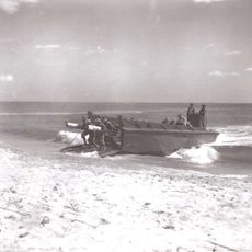
The region was home to the Wampanoag people for many generations before European settlers arrived in the 1600s. In 1763, the British Crown designated the area as a plantation, marking a significant shift in how the land was controlled and organized.

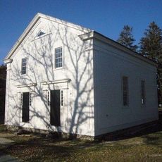
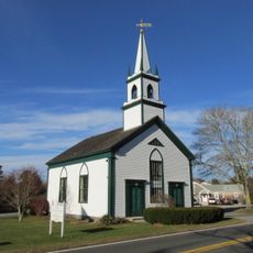
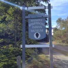
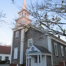
The Old Indian Meeting House from 1684 reflects the deep roots of the Wampanoag people in this region and their spiritual traditions that continue today. Visitors can observe how this early structure stands as a symbol of Native American resilience and community life over centuries.

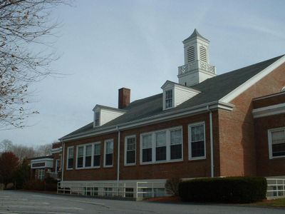
The area is accessible from several main roads and offers access to public services including schools, health centers, and administrative offices. The best time to explore is between May and October when the weather is milder and most facilities operate at full capacity.

The name comes from the Wampanoag language, where "mass" means great and "nippe" refers to water, originally describing the expansive cove at the area's heart. This linguistic connection reveals how the native people understood and named their landscape based on its most defining features.

Location: Barnstable County

Inception: 1660

Elevation above the sea: 17 m

Shares border with: Falmouth

Website: http://ci.mashpee.ma.us

GPS coordinates: 41.64833,-70.48167

Latest update: December 20, 2025 14:41

Photos
Around this place
Old Indian Meeting House
United States of America

Old Indian Meeting House

2.7 km
South Cape Beach State Park
United States of America

South Cape Beach State Park

10.2 km
Mashpee National Wildlife Refuge
United States of America

Mashpee National Wildlife Refuge

4.7 km
Lowell Park
United States of America

Lowell Park

4.7 km
Lowell Holly Reservation
United States of America

Lowell Holly Reservation

2.2 km
Mashpee River Reservation
United States of America

Mashpee River Reservation

2.8 km
United States of America

Cahoon Museum of American Art

2.8 km
Camp Washburn
United States of America

Camp Washburn

11.7 km
Waquoit Historic District
United States of America

Waquoit Historic District

7.7 km
Santuit Historic District
United States of America

Santuit Historic District

2.8 km
Mashpee Wampanoag Indian Museum
United States of America

Mashpee Wampanoag Indian Museum

430 m
Goodspeed House
United States of America

Goodspeed House

5.3 km
Col. Charles Codman Estate
United States of America

Col. Charles Codman Estate

5.8 km
William Marston House
United States of America

William Marston House

5.6 km
Gideon Hawley House
United States of America

Gideon Hawley House

2.6 km
Avant House
United States of America

Avant House

426 m
Sampson's Folly
United States of America

Sampson's Folly

3.4 km
Cotuit Historic District
United States of America

Cotuit Historic District

5.2 km
United States of America

Attaquin Beach

2.2 km
Gifford Farm
United States of America

Gifford Farm

5.9 km
Ebenezer Crocker Jr. House
United States of America

Ebenezer Crocker Jr. House

5 km
Merrill Estate
United States of America

Merrill Estate

6.5 km
Nelson Rhodehouse House
United States of America

Nelson Rhodehouse House

3.1 km
Harlow Homestead
United States of America

Harlow Homestead

3.9 km
Charles L. Baxter House
United States of America

Charles L. Baxter House

3 km
United States of America

Sampsons Island Wildlife Sanctuary

6.4 km
United States of America

Ashumet Holly Wildlife Sanctuary

5.7 km
Marstons Mills Hearse House and Cemetery
United States of America

Marstons Mills Hearse House and Cemetery

6.3 km
Show the full map
Reviews

Visited this place? Tap the stars to rate it and share your experience / photos with the community! Try now! You can cancel it anytime.

« Mashpee - New England town in Barnstable County, Massachusetts » is provided by Around Us (aroundus.com). Images and texts are derived from Wikimedia project under a Creative Commons license. You are allowed to copy, distribute, and modify copies of this page, under the conditions set by the license, as long as this note is clearly visible.

Discover hidden gems everywhere you go!

From secret cafés to breathtaking viewpoints, skip the crowded tourist spots and find places that match your style. Our app makes it easy with voice search, smart filtering, route optimization, and insider tips from travelers worldwide. Download now for the complete mobile experience.

Around Us App Screenshot

A unique approach to discovering new places

Le Figaro

All the places worth exploring

France Info

A tailor-made excursion in just a few clicks

20 Minutes