Enable Location

We need your location to show you interesting places around you

Discover nearby places

Find interesting locations and hidden gems around you

Precise directions

Get accurate directions and distances to places

Your location is never shared with other users. It's only used when you tap the location button.

Fleming County

Log in to your account

Start exploring — it's free

Trusted by 61,908 travelers worldwide

Continue with Google
Continue with Apple
or

We will send you a code to connect

By continuing, you accept our Terms and Conditions and our Privacy Policy

Check your inbox

We've sent a pincode in your inbox. Please enter the code below.

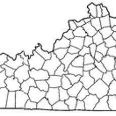
Fleming County, Administrative county in northern Kentucky, United States

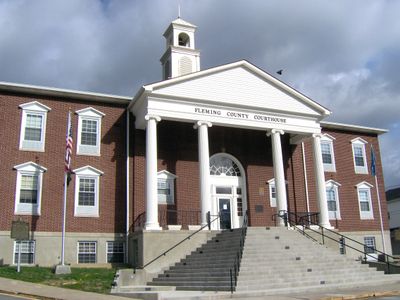
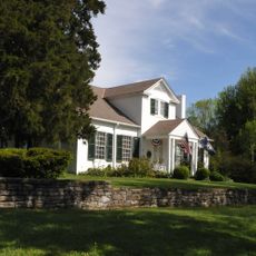
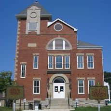
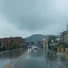
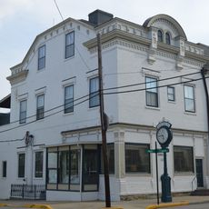
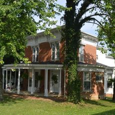
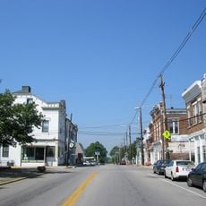
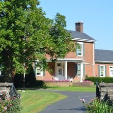
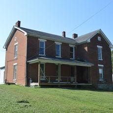
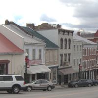
Fleming County is an administrative region in northern Kentucky covering roughly 351 square miles. The area contains several smaller communities and the city of Flemingsburg, which serves as its main administrative center.

The county was established in 1798 and named after Colonel John Fleming, an early settler and military figure. This naming reflects his role in the region's early settlement and development.

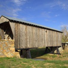
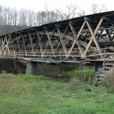
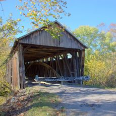
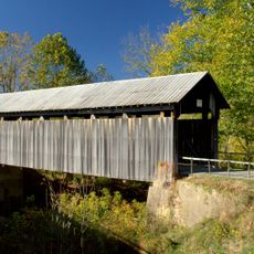
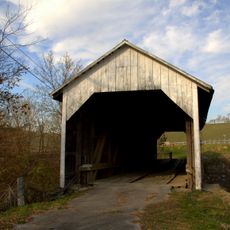
Covered bridges define how locals and visitors experience the landscape, serving as landmarks that connect communities and anchor memories. These structures remain central to how people understand and describe the region.

Visitors should be aware that alcoholic beverage sales are restricted throughout the area. This regulation affects the availability of bars and restaurants that serve alcohol across the entire region.

The region is known for its historic covered bridges that display various nineteenth-century construction techniques. Each structure represents different building methods that were passed down through generations of local craftspeople.

The community of curious travelers

AroundUs brings together thousands of curated places, local tips, and hidden gems, enriched daily by 60,000 contributors worldwide.

Start exploring
Location
Inception
February 10, 1798
Capital city
Flemingsburg
Shares border with
Lewis County, Rowan County, Bath County, Nicholas County, Robertson County, Mason County
GPS coordinates
38.37000,-83.69000
Latest update
December 7, 2025 20:45
Around this place
Blue Licks Battlefield State Park
United States of America

Blue Licks Battlefield State Park

27.4 km
Jayne Stadium
United States of America

Jayne Stadium

30.5 km
Kentucky Folk Art Center
United States of America

Kentucky Folk Art Center

30.7 km
Goddard Covered Bridge
United States of America

Goddard Covered Bridge

6.6 km
Johnson Creek Covered Bridge
United States of America

Johnson Creek Covered Bridge

27.9 km
Washington Historic District
United States of America

Washington Historic District

29 km
Cabin Creek Covered Bridge
United States of America

Cabin Creek Covered Bridge

27.3 km
Forest Retreat
United States of America

Forest Retreat

32.6 km
Ringos Mill Covered Bridge
United States of America

Ringos Mill Covered Bridge

13.3 km
First Presbyterian Church
United States of America

First Presbyterian Church

7.3 km
Hillsboro Covered Bridge
United States of America

Hillsboro Covered Bridge

13.2 km
Confederate Monument in Owingsville
United States of America

Confederate Monument in Owingsville

26.1 km
Rowan County Courthouse
United States of America

Rowan County Courthouse

30.5 km
Downtown Morehead Historic District
United States of America

Downtown Morehead Historic District

30.6 km
Elizaville Presbyterian Church
United States of America

Elizaville Presbyterian Church

12.9 km
Raccoon John Smith House
United States of America

Raccoon John Smith House

26.1 km
Thomas Deye Owings House
United States of America

Thomas Deye Owings House

26 km
Poague House
United States of America

Poague House

20.4 km
May's Lick Negro School
United States of America

May's Lick Negro School

20.9 km
Stone Barn on Brushy Creek
United States of America

Stone Barn on Brushy Creek

33.3 km
J.J. Nesbitt House
United States of America

J.J. Nesbitt House

26 km
Owingsville Commercial District and Courthouse Square
United States of America

Owingsville Commercial District and Courthouse Square

25.9 km
William Mathers House
United States of America

William Mathers House

31.5 km
Erasmus Riggs House
United States of America

Erasmus Riggs House

33.9 km
Thomas A. Dorsey Farmhouse
United States of America

Thomas A. Dorsey Farmhouse

29.8 km
United States of America

Brushy Voting House No. 6

22.7 km
Sheltowee Falls Splash Pad
United States of America

Sheltowee Falls Splash Pad

30.9 km
Morehead State University
United States of America

Morehead State University

30.3 km
Show the full map
Administrative divisions
« Fleming County - Administrative county in northern Kentucky, United States » is provided by Around Us (aroundus.com). Images and texts are derived from Wikimedia project under a Creative Commons license. You are allowed to copy, distribute, and modify copies of this page, under the conditions set by the license, as long as this note is clearly visible.

Discover hidden gems everywhere you go!

From secret cafés to breathtaking viewpoints, skip the crowded tourist spots and find places that match your style. Our app makes it easy with voice search, smart filtering, route optimization, and insider tips from travelers worldwide. Download now for the complete mobile experience.

Around Us App Screenshot

A unique approach to discovering new places

Le Figaro

All the places worth exploring

France Info

A tailor-made excursion in just a few clicks

20 Minutes

Around Us
Travel Guide & Maps
Download

Send to your phone

QR Code
1

Open the camera app on your mobile.

2

Point at the QR code with your camera. A notification will appear.

3

Tap the notification to open the link.