Enable Location

We need your location to show you interesting places around you

Discover nearby places

Find interesting locations and hidden gems around you

Precise directions

Get accurate directions and distances to places

Your location is never shared with other users. It's only used when you tap the location button.

Kewaunee County

Log in to your account

Start exploring — it's free

Trusted by 61,994 travelers worldwide

Continue with Google
Continue with Apple
or

We will send you a code to connect

By continuing, you accept our Terms and Conditions and our Privacy Policy

Check your inbox

We've sent a pincode in your inbox. Please enter the code below.

Kewaunee County, Administrative division in Wisconsin, US.

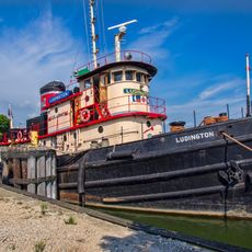
Kewaunee County is an administrative division in eastern Wisconsin that stretches along the western shore of Lake Michigan. The territory combines agricultural areas with waterfront geography and benefits from abundant fish populations in the lake.

The territory was established as an administrative division in 1852 following the acquisition of the region from the Menominee Nation through the 1831 Treaty of Washington. This founding marked the formal organization of an area with a long history of habitation.

The county's agricultural heritage shapes daily life, with dairy and vegetable farming defining the landscape and local economy. Farm stands and seasonal markets reflect how residents connect with the land and growing seasons throughout the year.

The division is managed through local administrative offices that provide public services. Visitors can find key information online or by visiting the county's administrative buildings.

The waters of the region were home to Wisconsin's state record rainbow trout, caught in 1997. The area remains a significant site for salmon fishing across the state.

The community of curious travelers

AroundUs brings together thousands of curated places, local tips, and hidden gems, enriched daily by 60,000 contributors worldwide.

Start exploring
GPS coordinates
44.52128,-87.63011
Latest update
December 7, 2025 20:43
Around this place
SS Lakeland
United States of America

SS Lakeland

45.9 km
Two Creeks Buried Forest State Natural Area
United States of America

Two Creeks Buried Forest State Natural Area

22.9 km
Sturgeon Bay Bridge
United States of America

Sturgeon Bay Bridge

39.8 km
Tug Ludington
United States of America

Tug Ludington

12.3 km
St. Lawrence Catholic Church
United States of America

St. Lawrence Catholic Church

14.2 km
Sturgeon Bay Canal North Pierhead Light
United States of America

Sturgeon Bay Canal North Pierhead Light

39.4 km
Rawley Point Light
United States of America

Rawley Point Light

35.9 km
Sturgeon Bay Canal Light
United States of America

Sturgeon Bay Canal Light

39.5 km
Door County Maritime Museum
United States of America

Door County Maritime Museum

39.6 km
Kewaunee Pierhead Lighthouse
United States of America

Kewaunee Pierhead Lighthouse

13 km
Algoma Pierhead Light
United States of America

Algoma Pierhead Light

18.5 km
Coast Guard Station Sturgeon Bay
United States of America

Coast Guard Station Sturgeon Bay

39.4 km
Kewaunee Marshland Walk
United States of America

Kewaunee Marshland Walk

11.7 km
Pilgrim Family Farmstead
United States of America

Pilgrim Family Farmstead

6.5 km
St Agnes-by-the-Lake Episcopal Church
United States of America

St Agnes-by-the-Lake Episcopal Church

17.9 km
Point Beach Ridges
United States of America

Point Beach Ridges

35.4 km
Ahnapee Brewery
United States of America

Ahnapee Brewery

18.3 km
L. A. Larson & Co. Store
United States of America

L. A. Larson & Co. Store

40.1 km
Carnegie Free Library
United States of America

Carnegie Free Library

40.3 km
Teweles and Brandeis Grain Elevator
United States of America

Teweles and Brandeis Grain Elevator

39.4 km
George Halada Farmstead
United States of America

George Halada Farmstead

9.8 km
Melvin W. and Mary Perry House
United States of America

Melvin W. and Mary Perry House

18.1 km
Art Dettman Fishing Shanty
United States of America

Art Dettman Fishing Shanty

18.4 km
J.B. Bouche House
United States of America

J.B. Bouche House

23.7 km
Louis Vangindertahlen House
United States of America

Louis Vangindertahlen House

25.1 km
Joseph Monfils Farmstead
United States of America

Joseph Monfils Farmstead

24.8 km
Marquette Historic District
United States of America

Marquette Historic District

12.6 km
Joachine J. Falque House
United States of America

Joachine J. Falque House

22.3 km
Show the full map
« Kewaunee County - Administrative division in Wisconsin, US » is provided by Around Us (aroundus.com). Images and texts are derived from Wikimedia project under a Creative Commons license. You are allowed to copy, distribute, and modify copies of this page, under the conditions set by the license, as long as this note is clearly visible.

Discover hidden gems everywhere you go!

From secret cafés to breathtaking viewpoints, skip the crowded tourist spots and find places that match your style. Our app makes it easy with voice search, smart filtering, route optimization, and insider tips from travelers worldwide. Download now for the complete mobile experience.

Around Us App Screenshot

A unique approach to discovering new places

Le Figaro

All the places worth exploring

France Info

A tailor-made excursion in just a few clicks

20 Minutes

Around Us
Travel Guide & Maps
Download

Send to your phone

QR Code
1

Open the camera app on your mobile.

2

Point at the QR code with your camera. A notification will appear.

3

Tap the notification to open the link.